 My GeoNetwork catalogue
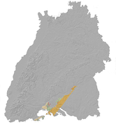
LGRB-BW SPK MOL: Speicherkomplex Buntsandstein
Im Rahmen des Projekts "Speicher-Kataster" unter Federführung der Bundesanstalt für Geowissenschaften und Rohstoffe wurden vom LGRB auf Grundlage vorliegender geologischer Daten und einheitlicher Bewertungskriterien Potenzialkarten von Speicher- und Barrieregesteinen im baden-württembergischen Anteil des Molassebeckens erstellt. Die Karte zeigt das Speicherpotential des Buntsandsteins auf Basis der Tiefenlage und Mächtigkeit der Gesteine, sowie Belegpunkte und Störungen ( https://media.lgrb-bw.de/link/spk/spk_skmol_10.pdf ). Weitere Informationen: https://lgrb-bw.de/hydrogeologie/projekte/speicherkataster
INSPIRE
Identification
- File identifier
- ab0bcb10-9238-424d-8c3b-0663f2a4b34f XML
- Hierarchy level
- Dataset
Online resource
Resource identifier
- Metadata language
- Deutsch
Encoding
- Format
-
ESRI Shapefile
- Version
-
n/a (default)
- Format
-
GeoPackage
- Version
-
n/a (default)
- Specification
Projection
- code
-
EPSG:25832
- code
-
EPSG:31467
- code
-
EPSG:4326
- code
-
EPSG:3857
- code
-
EPSG:4258
Classification of data and services
Coupled resource
Coupled resource
Classification of data and services
Coupled resource
Coupled resource
Keywords
-
GDI-BW-Schlüsselwortliste nach dem mehrsprachigen Umwelt-Thesaurus GEMET
-
-
Energie
-
Geologie
-
Other keywords
- Keywords
-
-
Gesteine
-
- Keywords
-
-
Geodaten
-
Geographic coverage
))
Temporal reference
Temporal extent
Temporal extent
- Date (Revision)
- 2010-12-31
Quality and validity
- Lineage
-
Fehn, Ch., Wirsing, G. (2012): Speicherpotenziale im tieferen Untergrund Baden-Württembergs - SDGG, Heft 74 Speicher-Kataster Deutschland, Teil Baden-Württemberg
Conformity
Conformity
Conformity
Conformity
Conformity
Conformity
Restrictions on access and use
- Access constraints
-
Daten nicht im Vertrieb, Verfügbarkeit/Preis auf Anfrage
Responsible organization (s)
Contact for the resource
- Organisation name
-
Regierungspräsidium Freiburg - Abteilung 9 Landesamt für Geologie, Rohstoffe und Bergbau, Ref. 94 Landeshydrogeologie und -geothermie
Responsible organization (s)
Contact for the resource
- Organisation name
-
Regierungspräsidium Freiburg - Abteilung 9 Landesamt für Geologie, Rohstoffe und Bergbau, Ref. 94 Landeshydrogeologie und -geothermie
Metadata information
Contact for the metadata
- Organisation name
-
Regierungspräsidium Freiburg - Abteilung 9 Landesamt für Geologie, Rohstoffe und Bergbau, Referat 91 Geowissenschaftliches Landeservicezentrum
- Date stamp
- 2025-12-19T08:15:13
- Metadata language
- Deutsch
- Character set
- UTF8
SDS
Conformance class 1: invocable
Access Point URL
Endpoint URL
Technical specification
Conformance class 2: interoperable
Access constraints
Limitation
Use constraints
Limitation
Responsible custodian
Contact for the resource
Overviews
Spatial extent
Provided by
