 My GeoNetwork catalogue
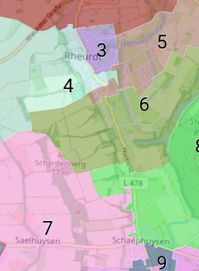
Ratswahlbezirke Rheurdt
Die Ratswahlbezirke werden räumlich anhand der durchschnittlichen Anzahl der Wahlberechtigten mit einer Abweichung von +/- 15% vom Durchschnitt innerhalb von Rheurdt vom Wahlausschuss festgesetzt.
Die Daten umfassen die aktuellen Wahlbezirksgeometrien. Sie werden vor jeder Wahl neu festgelegt bzw. beschlossen.
- Identification
- Distribution
- Quality
- Spatial rep.
- Ref. system
- Content
- Portrayal
- Metadata
- Md. constraints
- Md. maintenance
- Schema info
Identification
Data identification
Citation
- Date (Publication)
- 2024-11-19T00:00:00.000+01:00
- Citation identifier
- https://registry.gdi-de.org/id/de.nw/5c5c638d-9c2c-49e0-bb2a-85dc64db1313
Maintenance information
- Maintenance and update frequency
- As needed
- Update scope
- Dataset
- Keywords
-
-
Ratswahlbezirke
-
Stimmbezirke
-
Wahlen
-
Wahl
-
Wahlkreis
-
Wahlbezirk
-
Kommunalwahl
-
KW
-
Kreis Kleve
-
ARS
-
Rheurdt
-
05154048
-
opendata
-
- Theme
-
-
SOCI
-
-
UMTHES Thesaurus
Legal constraints
- Use constraints
- Other restrictions
- Other constraints
-
Datenlizenz Deutschland – Zero – Version 2.0
- Other constraints
-
{"id":"dl-zero-de/2.0","name":"Datenlizenz Deutschland – Zero – Version 2.0","url":" https://www.govdata.de/dl-de/zero-2-0","quelle":""}
Legal constraints
- Access constraints
- Other restrictions
- Other constraints
- Es gelten keine Zugriffsbeschränkungen
- Language
- Deutsch
- Topic category
-
- Society
- Boundaries
Extent
))
Bounding Polygon
- Extent type code
- Yes

Geographic description
- Extent type code
- Yes
- Geographic identifier
- Rheurdt, Gemeinde (051540048048)
- Code
- 051540048048
Distribution
Distribution
- Distribution format
-
- OnLine resource
- Wahlbezirke Kreis Kleve
- OnLine resource
- WMS Wahlbezirke Kreis Kleve
Quality
Data quality
- Hierarchy level
- Dataset
Lineage
- Statement
-
Kommunalwahlgesetz (KWahlG NRW)
- Description
-
räumliches Zusammenfügen der Wahlberechtigten zu Bezirken
Ref. system
- Unique resource identifier
- EPSG 25832: ETRS89 / UTM Zone 32N
Metadata
Metadata
- File identifier
- aef56eed-394e-418a-9add-27996e2bb828 XML
- Metadata language
- Deutsch
- Character set
- UTF8
- Parent identifier
-
Ratswahlbezirke Kreis Kleve
a6bb811e-ab7c-4f6d-8664-c99f53a990fb
- Hierarchy level
- Dataset
- Date stamp
- 2025-12-08
- Metadata standard name
-
ISO19115
- Metadata standard version
-
2003/Cor.1:2006
Overviews
Spatial extent

Provided by
