 My GeoNetwork catalogue
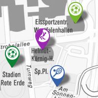
Stadt Dortmund: WMS - Sportanlagen
Sportanlagen in Dortmund
INSPIRE
Identification
- File identifier
- b53ccadf2ae133a54e2b38d502fb63ff566682ff XML
- Hierarchy level
- Service
Online resource
- Protocol
-
OGC:WMS-http-get-map
- Protocol
-
OGC:WMS-http-get-map
- Protocol
-
OGC:WMS-http-get-map
- Protocol
-
OGC:WMS-http-get-map
- Protocol
-
OGC:WMS-http-get-map
- Protocol
-
OGC:WMS-http-get-map
- Protocol
-
OGC:WMS-http-get-map
- Protocol
-
OGC:WMS-http-get-map
- Protocol
-
OGC:WMS-http-get-map
Resource identifier
Encoding
- Format
-
WMS
- Version
-
1.3.0
Projection
Classification of data and services
- Service Type
- OGC:WMS
- Coupling Type
- Tight
Coupled resource
Coupled resource
Classification of data and services
- Service Type
- OGC:WMS
- Coupling Type
- Tight
Coupled resource
Coupled resource
Keywords
-
Anwendungen
-
-
map.apps
-
-
theme.govdata
-
-
Kultur, Freizeit, Sport und Tourismus
-
Bevölkerung
-
Other keywords
- Theme
-
-
infoMapAccessService
-
- Theme
-
-
Dortmund
-
Geographic coverage
))
Temporal reference
Temporal extent
Temporal extent
- Date (Revision)
- 2017-09-27T14:58:49
Quality and validity
- Lineage
-
Erfassung durch das Vermessungs- und Katasteramt
Conformity
Conformity
Conformity
Conformity
Conformity
Conformity
Restrictions on access and use
- Access constraints
-
Datenlizenz Deutschland – Namensnennung – Version 2.0
Responsible organization (s)
Contact for the resource
- Organisation name
-
Stadt Dortmund
Responsible organization (s)
Contact for the resource
- Organisation name
-
Stadt Dortmund
Metadata information
Contact for the metadata
- Organisation name
-
Stadt Dortmund
- Date stamp
- 2017-09-28T13:06:24
- Metadata language
- Deutsch
SDS
Conformance class 1: invocable
Access Point URL
Endpoint URL
Technical specification
Conformance class 2: interoperable
Access constraints
Limitation
- string
-
Datenlizenz Deutschland – Namensnennung – Version 2.0
Use constraints
Limitation
Responsible custodian
Contact for the resource
Conformance class 3: harmonized
Contains Operations
- Operation Name
-
GetCapabilities
- Distributed Computing Platforms
- HTTP-GET
- Connect Point
-
Format : text/xml
(
text/xml
)
Format :
text/xml
Contains Operations
- Operation Name
-
GetMap
- Distributed Computing Platforms
- HTTP-GET
- Connect Point
-
Format : image/jpeg
(
image/jpeg
)
Format :
image/jpeg
- Connect Point
-
Format : image/png
(
image/png
)
Format :
image/png
- Connect Point
-
Format : image/png; mode=16bit
(
image/png; mode=16bit
)
Format :
image/png; mode=16bit
- Connect Point
-
Format : image/png; mode=8bit
(
image/png; mode=8bit
)
Format :
image/png; mode=8bit
- Connect Point
-
Format : image/png; mode=1bit
(
image/png; mode=1bit
)
Format :
image/png; mode=1bit
- Connect Point
-
Format : application/dxf
(
application/dxf
)
Format :
application/dxf
Contains Operations
- Operation Name
-
GetFeatureInfo
- Distributed Computing Platforms
- HTTP-GET
- Connect Point
-
Format : text/plain
(
text/plain
)
Format :
text/plain
- Connect Point
-
Format : text/html
(
text/html
)
Format :
text/html
- Connect Point
-
Format : text/xml
(
text/xml
)
Format :
text/xml
- Connect Point
-
Format : application/vnd.ogc.gml
(
application/vnd.ogc.gml
)
Format :
application/vnd.ogc.gml
- Connect Point
-
Format : application/vnd.ogc.gml/3.1.1
(
application/vnd.ogc.gml/3.1.1
)
Format :
application/vnd.ogc.gml/3.1.1
Contains Operations
- Operation Name
-
sld:GetLegendGraphic
- Distributed Computing Platforms
- HTTP-GET
- Connect Point
-
Format : image/jpeg
(
image/jpeg
)
Format :
image/jpeg
- Connect Point
-
Format : image/png
(
image/png
)
Format :
image/png
Contains Operations
- Operation Name
-
sld:DescribeLayer
- Distributed Computing Platforms
- HTTP-GET
- Connect Point
-
Format : text/xml
(
text/xml
)
Format :
text/xml
Contains Operations
- Operation Name
-
qgs:GetStyles
- Distributed Computing Platforms
- HTTP-GET
- Connect Point
-
Format : text/xml
(
text/xml
)
Format :
text/xml
Overviews
Spatial extent
Provided by
