 My GeoNetwork catalogue
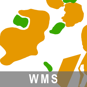
WMS Karte der oberflächennahen Rohstoffe 1: 50 000 BB (WMS-KOR50)
Der Darstellungsdienst (WMS) Karte der oberflächennahen Rohstoffe 1: 50 000 Brandenburg stellt Daten zur Karte der oberflächennahen Rohstoffe 1: 50 000 (KOR50) bereit.
Die Karte der oberflächennahen Rohstoffe 1: 50 000 Brandenburg gehören thematisch zu der Rohstoff- und Tiefengeologie. Diesem Thema sind zwei weitere Dienstethemen zugeorndet:
- WMS/WFS Strukturgeologische Übersicht BB,
- WMS/WFS Reflexionsseismische Horizonte 2D BB.
Der WMS beinhaltet die folgenden Layer:
- Karte der oberflächennahen Rohstoffe 1 : 50 000 [kor50].
- Identification
- Distribution
- Quality
- Spatial rep.
- Ref. system
- Content
- Portrayal
- Metadata
- Md. constraints
- Md. maintenance
- Schema info
Identification
Identification info
Service Identification (19119)
Citation
- Alternate title
-
WMS-KOR50
- Date (Publication)
- 2023-03-23T00:00:00
- Date (Revision)
- 2026-04-10T00:00:00
- Date (Creation)
- 2023-03-22T00:00:00
- Citation identifier
- https://registry.gdi-de.org/id/de.bb.metadata/c1a09810-0b2f-4cb0-b8f9-e59ef9f65d18
+49-331-8844-16-123
- Keywords
-
-
opendata
-
- Theme
-
-
Gestein
-
WMS
-
Sediment
-
Sedimentation [geologisch]
-
Geologie
-
Sedimentologie
-
Bodenkunde
-
sgd_Rohstoffe
-
-
BE/BB Schlagwortliste, Version 1.0
-
-
Boden
-
Legal constraints
- Use constraints
- Other restrictions
- Other constraints
-
Die Daten können gemäß der „Datenlizenz Deutschland - Namensnennung - Version 2.0“ ( https://www.govdata.de/dl-de/by-2-0 ) genutzt werden. Namensnennung: "Landesamt für Bergbau, Geologie und Rohstoffe Brandenburg (LBGR)", Beispiel: „© Landesamt für Bergbau, Geologie und Rohstoffe Brandenburg (LBGR), dl-de/by-2-0, (Daten geändert)“, (Klammer = optional)
- Other constraints
-
{
"id": "dl-by-de/2.0",
"name": "Datenlizenz Deutschland - Namensnennung - Version 2.0",
"url": " https://www.govdata.de/dl-de/by-2-0 ",
"quelle": "Quelle: © Landesamt für Bergbau, Geologie und Rohstoffe Brandenburg (LBGR), dl-de/by-2-0"
}
Legal constraints
- Access constraints
- Other restrictions
- Other constraints
- Es gelten keine Zugriffsbeschränkungen
- Service Type
- view
- Service Version
-
OGC:WMS 1.1.0, WMS 1.1.1, WMS 1.3.0
Extent
- Description
-
Land Brandenburg
))
- Coupling Type
- Tight
Contains Operations
- Operation Name
-
GetFeatureInfo
- Distributed Computing Platforms
- Web services
- Connect Point
- https://inspire.brandenburg.de/services/kor50_wms?
Contains Operations
- Operation Name
-
GetCapabilities
- Distributed Computing Platforms
- Web services
- Connect Point
- https://inspire.brandenburg.de/services/kor50_wms?
Contains Operations
- Operation Name
-
GetMap
- Distributed Computing Platforms
- Web services
- Connect Point
- https://inspire.brandenburg.de/services/kor50_wms?
Contains Operations
- Operation Name
-
GetLegendGraphic
- Distributed Computing Platforms
- Web services
- Connect Point
- https://inspire.brandenburg.de/services/kor50_wms?
Distribution
Distribution
+49-331-8844-16-123
Digital transfer options
- OnLine resource
- Produktinformation ( Web Address (URL) )
- OnLine resource
- View-Service ( OGC Web Map Service )
Ref. system
- Unique resource identifier
- EPSG:25833
- Unique resource identifier
- EPSG:25832
- Unique resource identifier
- EPSG:4326
- Unique resource identifier
- EPSG:4258
- Unique resource identifier
- EPSG:3034
- Unique resource identifier
- EPSG:3035
- Unique resource identifier
- EPSG:3044
- Unique resource identifier
- EPSG:3045
- Unique resource identifier
- EPSG:3857
- Unique resource identifier
- EPSG:4839
Metadata
Metadata
- File identifier
- c1a09810-0b2f-4cb0-b8f9-e59ef9f65d18 XML
- Metadata language
- Deutsch
- Character set
- UTF8
- Hierarchy level
- Service
- Hierarchy level name
-
service
- Date stamp
- 2026-05-05T13:08:26
- Metadata standard name
-
ISO 19115:2003/Cor 1:2006, 19119:2005/Amd 1:2008 (AdV-Metadatenprofil)
- Metadata standard version
-
1.2.1
+49-331-8844-16-123
Overviews
Spatial extent
Provided by
