 My GeoNetwork catalogue
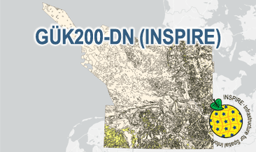
INSPIRE: Surface geology – Geological overview map of the German North Sea (GÜK200-DN)
The General Geological Map of the Federal Republic of Germany 1:200,000 (GÜK200) provides detailed information on the stratigraphy, petrography and genesis of the geological units shown. In this revised GÜK200-DN, the onshore surface geology is shown in up to two overlayers. The thin overlying soil is not shown. In the marine environment, only the petrography of the recent seabed is shown, which comprises the uppermost 20 cm of the seabed. In accordance with the original GÜK200 map sheets, the seabed is referred to stratigraphically as the recent seabed. According to the Data Specification on Geology (D2.8.II.4_v3.0) the content of the geological map is stored in three INSPIRE-compliant GML files: GUEK200_DN_GeologicUnit_BaseLayer.gml, GUEK200_DN_GeologicUnit_OverlayLayer1.gml, and GUEK200_DN_GeologicUnit_OverlayLayer2.gml contain the geologic units. The GML files together with a Readme.txt file are provided in ZIP format (GUEK200_DN-INSPIRE.zip). The Readme.text file (German/English) contains detailed information on the GML files content. Data transformation was proceeded by using the INSPIRE Solution Pack for FME according to the INSPIRE requirements.
Simple
- Alternate title
-
GÜK200-DN (INSPIRE)
- Date (Publication)
- 2024-11-01
- Citation identifier
- https://registry.gdi-de.org/id/de.bund.bgr.csw/33005830-0580-1c55-526a-ced7a5a1571a
- Status
- Completed
-
GEMET - INSPIRE themes, version 1.0
-
-
Geologie
-
Geology
-
- Theme
-
-
GPDN
-
Geopotenzial Deutsche Nordsee
-
Geopotential
-
Stratigraphie
-
Petrographie
-
Genese
-
GeolDG
-
inspireidentifiziert
-
opendata
-
- Place
-
-
Deutsche Nordsee
-
-
Spatial scope
-
-
Regional
-
-
High-value dataset categories
-
-
Erdbeobachtung und Umwelt
-
- Access constraints
- Other restrictions
- Other constraints
- Es gelten keine Zugriffsbeschränkungen
- Use constraints
- Other restrictions
- Other constraints
-
General Terms and Conditions, s. https://www.bgr.bund.de/agb_en
- Other constraints
-
Dieser Datensatz kann gemäß der "Nutzungsbestimmungen für die Bereitstellung von Geodaten des Bundes" ( https://sg.geodatenzentrum.de/web_public/gdz/lizenz/geonutzv.pdf ) genutzt werden.
- Other constraints
-
{"id": "geonutz/20130319", "name": "Nutzungsbestimmungen für die Bereitstellung von Geodaten des Bundes", "url": " https://sg.geodatenzentrum.de/web_public/gdz/lizenz/geonutzv.pdf ", "quelle": "Quelle: Bundesanstalt für Geowissenschaften und Rohstoffe (BGR)"}
- Spatial representation type
- Vector
- Denominator
- 200000
- Language
- English
- Character set
- UTF8
- Topic category
-
- Geoscientific information
))
- Unique resource identifier
- EPSG:25832
- Distribution format
-
-
INSPIRE-GML
(
n/a
)
-
INSPIRE-GML
(
n/a
)
- OnLine resource
-
GÜK200-DN (INSPIRE) (INSPIRE-GML)
GÜK200-DN (INSPIRE) im Format INSPIRE-GML
- OnLine resource
- Karte im BGR-Geoviewer
- Hierarchy level
- Dataset
Conformance result
- Date (Publication)
- 2013-12-10
- Explanation
-
See the referenced specification
- Pass
- Yes
Conformance result
- Date (Publication)
- 2010-12-08
- Explanation
-
See the referenced specification
- Statement
-
The GÜK200-DN (INSPIRE) GML files are based on the spatial dataset Surface geology – Geological overview map of the German North Sea (GÜK200-DN) transformed according to INSPIRE. The WMS GÜK200-DN (INSPIRE) is based on the spatial dataset Surface geology – Geological overview map of the German North Sea (GÜK200-DN) transformed according to INSPIRE. Die GÜK200-DN (INSPIRE) GML-Dateien beruhen auf dem nach INSPIRE transformierten Geodatensatz Oberflächengeologie – Geologische Übersichtskarte Deutsche Nordsee (GÜK200-DN). Der WMS GÜK200-DN (INSPIRE) beruht auf dem nach INSPIRE transformierten Geodatensatz Oberflächengeologie – Geologische Übersichtskarte Deutsche Nordsee (GÜK200-DN).
- File identifier
- cc10382e-6261-489c-ad46-9fc5aca334d3 XML
- Metadata language
- English
- Character set
- UTF8
- Hierarchy level
- Dataset
- Hierarchy level name
-
Geologie
- Hierarchy level name
-
INSPIRE
- Hierarchy level name
-
GeolDG
- Date stamp
- 2024-12-03
- Metadata standard name
-
INSPIRE Metadata Implementing Rules: Technical Guidelines based on EN ISO 19115 and EN ISO 19119
- Metadata standard version
-
n/a
Overviews
Spatial extent
Provided by
