 My GeoNetwork catalogue
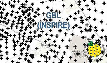
INSPIRE: German Borehole Locations (GBL)
The GBL (INSPIRE) represents mechanically drilled boreholes approved by the State Geological Surveys of Germany (SGS). Most of the drilling data were not collected by the SGS, but were transmitted to SGS by third parties in accordance with legal requirements. Therefore, the SGS can accept no responsibility for the accuracy of the information. According to the Data Specification on Geology (D2.8.II.4_v3.0) the boreholes of each federal state are stored in one INSPIRE-compliant GML file. The GML file together with a Readme.txt file is provided in ZIP format (e.g. GBL-INSPIRE_Lower_Saxony.zip). The Readme.txt file (German/English) contains detailed information on the GML file content. Data transformation was proceeded by using the INSPIRE Solution Pack for FME according to the INSPIRE requirements.
INSPIRE
Identification
- File identifier
- d3844378-5373-4b5f-bcf8-31ffc9d220db XML
- Hierarchy level
- Series
Online resource
Resource identifier
- Metadata language
- Deutsch
- Spatial representation type
- Vector
Encoding
- Format
-
INSPIRE-GML
- Version
-
n/a
Projection
- code
- EPSG:25832
Classification of data and services
- Topic category
-
- Geoscientific information
Classification of data and services
Coupled resource
Coupled resource
Classification of data and services
Coupled resource
Coupled resource
Keywords
-
GEMET - INSPIRE themes, version 1.0
-
-
Geologie
-
Geology
-
-
Spatial scope
-
-
National
-
-
GEMET - Themes, version 4.1.4
-
-
drilling
-
rock
-
-
High-value dataset categories
-
-
Erdbeobachtung und Umwelt
-
Other keywords
- Theme
-
-
borehole
-
genesis
-
layer
-
lithology
-
petrography
-
stratigraphy
-
strata
-
stratum
-
inspireidentifiziert
-
opendata
-
sgd_Bohrungen
-
- Place
-
-
Deutschland
-
Germany
-
Geographic coverage
))
Temporal reference
Temporal extent
Temporal extent
- Date (Publication)
- 2020-10-21
Quality and validity
- Lineage
-
The GBL (INSPIRE) GML file is based on the spatial dataset of the Borehole Map Germany (GBL) transformed according to INSPIRE.
Conformity
Conformity
Conformity
Conformity
Conformity
Conformity
- Explanation
-
siehe dazu die angegebene Durchführungsbestimmung
- Explanation
-
See the referenced specification
Restrictions on access and use
- Access constraints
- Es gelten keine Zugriffsbeschränkungen
- Access constraints
-
General Terms and Conditions, s. https://www.bgr.bund.de/agb_en
- Access constraints
-
Dieser Datensatz kann gemäß der "Nutzungsbestimmungen für die Bereitstellung von Geodaten des Bundes" ( https://sg.geodatenzentrum.de/web_public/gdz/lizenz/geonutzv.pdf ) genutzt werden.
- Access constraints
-
{"id": "geonutz/20130319", "name": "Nutzungsbestimmungen für die Bereitstellung von Geodaten des Bundes", "url": " https://sg.geodatenzentrum.de/web_public/gdz/lizenz/geonutzv.pdf ", "quelle": "Quelle: Bundesanstalt für Geowissenschaften und Rohstoffe (BGR)"}
Responsible organization (s)
Contact for the resource
- Organisation name
-
Bundesanstalt für Geowissenschaften und Rohstoffe (BGR)
Responsible organization (s)
Contact for the resource
- Organisation name
-
Bundesanstalt für Geowissenschaften und Rohstoffe (BGR)
Metadata information
Contact for the metadata
- Organisation name
-
Bundesanstalt für Geowissenschaften und Rohstoffe (BGR)
- Date stamp
- 2026-01-13
- Metadata language
- English
- Character set
- UTF8
SDS
Conformance class 1: invocable
Access Point URL
Endpoint URL
Technical specification
Conformance class 2: interoperable
Access constraints
Limitation
Use constraints
Limitation
Responsible custodian
Contact for the resource
Overviews
Spatial extent
Provided by
