 My GeoNetwork catalogue
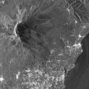
TerraSAR-X - CEOS Geohazard Supersites
This collection contains TerraSAR-X Level 1b data acquired over the pre-defined Geohazard Supersites and a number of CEOS projects regions. The collection comprises mainly complex (SSC) with a number of detected (MGD) products. TerraSAR-X data can be ordered by a Principal Investigator (PI) of a respective Supersite region under the terms of a TerraSAR-X Science proposal accepted by DLR. Data is available for download by the Geohazard scientific community under the terms of the user license.
Supersites are single sites or extended areas of high priority to the Geohazards community in which active single or multiple geological hazards pose a threat to human population and/or critical facilities. The Supersites initiative provides access to spaceborne and in-situ geophysical data of selected sites prone to earthquake, volcano or other hazards.
For further information see: http://ceos.org/ourwork/workinggroups/disasters/gsnl/
Overview of permament Supersites: http://geo-gsnl.org/supersites/permanent-supersites/
- Identification
- Distribution
- Quality
- Spatial rep.
- Ref. system
- Content
- Portrayal
- Metadata
- Md. constraints
- Md. maintenance
- Schema info
Identification
Data identification
Citation
- Date (Creation)
- 2019-02-01T00:00:00
- Citation identifier
- https://geoservice.dlr.de/catalogue/srv/metadata/e514d88d-35de-4d96-8931-db442f2404a7
- Presentation form
- Digital image
- Status
- On going
- Maintenance and update frequency
- Irregular
- Keywords
-
-
TerraSAR-X
-
TSX
-
SAR
-
natural disasters
-
CEOS
-
Geohazard
-
Supersites
-
- GEMET - INSPIRE themes, version 1.0
-
-
Orthoimagery
-
Natural risk zones
-
Legal constraints
- Use limitation
-
Nutzungseinschränkungen: Nur für wissenschaftliche Nutzung. Das DLR ist nicht haftbar für Schäden, die sich aus der Nutzung ergeben. Use limitations: For scientific use only. DLR is not liable for damage resulting from use.
- Use limitation
-
Nutzungsbedingungen: Lizenz / Terms of use: License, https://geoservice.dlr.de/resources/licenses/supersites/TSX-TDX_GEO-Supersite_UserLicense.pdf
Legal constraints
- Access constraints
- Restricted
- Access constraints
- Other restrictions
- Other constraints
-
Zufriffsbeschränkt, Registrierung erforderlich / restricted access, registration required
Legal constraints
- Use constraints
- License
- Use constraints
- Other restrictions
- Other constraints
-
Nutzungsbedingungen: Lizenz / Terms of use: License, https://geoservice.dlr.de/resources/licenses/supersites/TSX-TDX_GEO-Supersite_UserLicense.pdf
- Spatial representation type
- Grid
- Denominator
- 6000
- Language
- English
- Character set
- UTF8
- Topic category
-
- Imagery base maps earth cover
Extent
))
- Begin date
- 2008-05-02T00:00:00
Distribution
Distribution
- Distribution format
-
Digital transfer options
- OnLine resource
-
EOC Download Service
(
WWW:LINK-1.0-http--link
)
EOC Download Service (Supersites)
- OnLine resource
-
TerraSAR-X Science Service System
(
WWW:LINK-1.0-http--link
)
TerraSAR-X Science Website
- OnLine resource
-
Additional information on the TerraSAR-X mission
(
WWW:LINK-1.0-http--link
)
DLR TerraSAR-X mission website
- OnLine resource
- Geohazard Permanent Supersite Locations ( WWW:LINK-1.0-http--link )
- OnLine resource
- CEOS Geohazard Supersites Website ( WWW:LINK-1.0-http--link )
Quality
Data quality
- Hierarchy level
- Series
Domain consistency
- Measure identification
- INSPIRE / Conformity_001
Conformance result
Citation
- Date (Publication)
- 2010-12-08
- Explanation
-
See the referenced specification.
- Pass
- Yes
- Statement
-
Input data sets:
- Orbit products
- Attitude products
- Extracted house-keeping parameters
Ref. system
- Reference system identifier
- UTM/UPS
Metadata
Metadata
- File identifier
- e514d88d-35de-4d96-8931-db442f2404a7 XML
- Metadata language
- English
- Character set
- UTF8
- Hierarchy level
- Series
- Hierarchy level name
-
Dataseries
- Date stamp
- 2024-06-20T13:06:59
- Metadata standard name
-
19115-1:2014/19139
- Metadata standard version
-
1.0
Overviews

Spatial extent
Provided by
