 www.geodatenkatalog.de (S1F)
WMS Verwaltungsgebiete 1:25 000 - Stand 31.12.
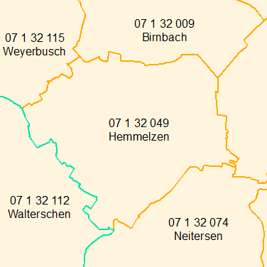
Der Darstellungsdienst stellt die Verwaltungsgebiete 1:25 000 (VG25) mit Stand 31.12. für das Gebiet der Bundesrepublik Deutschland bereit.
Der Datenbestand der Verwaltungsgebiete (VG) umfasst die Verwaltungseinheiten aller hierarchischen Verwaltungsebenen vom Staat bis zu den Gemeinden mit den jeweiligen Verwaltungsgrenzen, statistischen Schlüsselzahlen, den Namen der Verwaltungseinheiten sowie der spezifischen Bezeichnungen der Verwaltungsebenen.
Die Daten sind ebenenweise in Staat, Länder, Regierungsbezirke, Kreise, Verwaltungsgemeinschaften und Gemeinden gegliedert. Darüber hinaus liegen dem Datensatz amtliche Zusatzbezeichnungen, Namen der nationalen Minderheiten bzw. regionalsprachliche Namen sowie Übersichten der Verwaltungszuordnung und Verwaltungseinheiten bei.
Die Geometrie der Grenzen ist hinsichtlich Genauigkeit und Auflösung auf das ATKIS®-Basis-DLM ausgerichtet.
Mit dem Stand 31.12. ist der Anschluss an die Bundesstatistik möglich. Maßstab: 1:25000
|
|
Citation proposal
. WMS Verwaltungsgebiete 1:25 000 - Stand 31.12.. https://gdk.gdi-de.org/geonetwork/srv/api/records/e6a9c5b8-6b38-46e6-90ee-3bbda158fe9b |
INSPIRE
Identification
- File identifier
- e6a9c5b8-6b38-46e6-90ee-3bbda158fe9b XML
- Hierarchy level
- service Service
Online resource
Resource identifier
Encoding
- Format
- TIFF
- Format
- PNG
- Format
- JPEG
Projection
- code
- CRS 84: CRS 84 / mathematisch
Classification of data and services
Classification of data and services
- Service Type
- view
- Coupling Type
- Tight
Coupled resource
Coupled resource
Classification of data and services
- Service Type
- view
- Coupling Type
- Tight
Coupled resource
Coupled resource
Keywords
- GEMET - INSPIRE themes, version 1.0 ( Theme )
-
- Verwaltungseinheiten
- GEMET - Concepts, version 3.1 ( Theme )
-
- national boundary
- county
- municipality
- administration
- Service Classification, version 1.0 ( Theme )
-
- infoMapAccessService
Other keywords
- Keywords
-
- VG25
- Schlüsselzahlen
- Gemeinden
- Bundesländer
- Kreise
- Regierungsbezirke
- Bundesamt für Kartographie und Geodäsie
- BKG
- Deutschland
- Verwaltungsgebiete
- WMS
- Bundesland
- Regierungsbezirk
- Kreisverwaltung
- Kreis
- Verwaltungsgemeinschaft
- Verwaltungseinheit
- Verwaltungsgrenzen
- Gebietsflächen
- Gebiete
- administrative Grenzen
- ViewService
- infoMapAccessService
- Bund
- Stand 31.12.
- wms_vg25
- WMS Verwaltungsgebiete 1:25 000 - Stand 31.12.
- AvD
Geographic coverage
))
Temporal reference
Temporal extent
Temporal extent
- Date ( Creation )
- 2014-06-06T00:00:00.000+02:00
Quality and validity
Conformity
Conformity
Conformity
Conformity
Conformity
Conformity
- Explanation
- see the referenced specification
Restrictions on access and use
Restrictions on access and use
- Access constraints
- Es gelten Zugriffsbeschränkungen. Für den Erwerb von Nutzungsrechten wenden Sie sich deshalb bitte an die Zentrale Stelle Geotopographie der AdV (ZSGT) / Dienstleistungszentrum (DLZ) des Bundesamtes für Kartographie und Geodäsie: https://www.bkg.bund.de/DE/Service/Kontakt/kontakt.html.
- Access constraints
- Die Daten sind urheberrechtlich geschützt. Bundesbehörden und Nutzungsberechtigte im Sinne des § 4 V GeoBund werden die Daten auf Grundlage des Vertrages über die kontinuierliche Übermittlung von amtlichen digitalen Geobasisdaten der Länder zur Nutzung im Bundesbereich vom 01.07.2019 (V GeoBund) geldleistungsfrei zur Verfügung gestellt. Der Quellenvermerk ist zu beachten.
- Access constraints
- Quellenvermerk: © GeoBasis-DE / BKG (Jahr)
Responsible organization (s)
Contact for the resource
- Organisation name
- Bundesamt für Kartographie und Geodäsie (BKG)
- dlz@bkg.bund.de
- Organisation name
- Bundesamt für Kartographie und Geodäsie (BKG)
- mailbox@bkg.bund.de
Responsible organization (s)
Contact for the resource
- Organisation name
- Bundesamt für Kartographie und Geodäsie (BKG)
- dlz@bkg.bund.de
- Organisation name
- Bundesamt für Kartographie und Geodäsie (BKG)
- mailbox@bkg.bund.de
Metadata information
Contact for the metadata
- Organisation name
- Bundesamt für Kartographie und Geodäsie (BKG)
- dlz@bkg.bund.de
- Date stamp
- 2024-02-28
- Metadata language
- German
SDS
Conformance class 1: invocable
- Pass
- true
Access Point URL
Endpoint URL
Technical specification
- Date
- Explanation
- see the referenced specification
Conformance class 2: interoperable
Coordinate reference system
Quality of Service
Access constraints
Limitation
- string
- Es gelten Zugriffsbeschränkungen. Für den Erwerb von Nutzungsrechten wenden Sie sich deshalb bitte an die Zentrale Stelle Geotopographie der AdV (ZSGT) / Dienstleistungszentrum (DLZ) des Bundesamtes für Kartographie und Geodäsie: https://www.bkg.bund.de/DE/Service/Kontakt/kontakt.html.
Use constraints
Limitation
- string
- Die Daten sind urheberrechtlich geschützt. Bundesbehörden und Nutzungsberechtigte im Sinne des § 4 V GeoBund werden die Daten auf Grundlage des Vertrages über die kontinuierliche Übermittlung von amtlichen digitalen Geobasisdaten der Länder zur Nutzung im Bundesbereich vom 01.07.2019 (V GeoBund) geldleistungsfrei zur Verfügung gestellt. Der Quellenvermerk ist zu beachten.
- string
- Quellenvermerk: © GeoBasis-DE / BKG (Jahr)
Responsible custodian
Contact for the resource
Conformance class 3: harmonized
Contains Operations
- Operation Name
- GetCapabilities
- Distributed Computing Platforms
- HTTPGet
- Invocation Name
- GetCapabilities
Parameter
- Name
- REQUEST=GetCapabilities
- Description
- Request name
- Optionality
- 0
- Repeatability
- false
- Name
Parameter
- Name
- SERVICE=WMS
- Description
- Service type
- Optionality
- 0
- Repeatability
- false
- Name
Parameter
- Name
- VERSION=1.3.0
- Description
- Request version
- Optionality
- 1
- Repeatability
- false
- Name
Parameter
- Name
- UPDATESEQUENCE=number
- Description
- Sequence number for cache control
- Optionality
- 1
- Repeatability
- false
- Name
- Connect Point
- https://sg.geodatenzentrum.de/wms_vg25?
Contains Operations
- Operation Name
- GetMap
- Distributed Computing Platforms
- HTTPGet
- Invocation Name
- GetMap
Parameter
- Name
- TIME=time
- Description
- Time value of layer desired
- Optionality
- 1
- Repeatability
- false
- Name
Parameter
- Name
- SRS=namespace:identifier
- Description
- Spatial Reference System
- Optionality
- 0
- Repeatability
- false
- Name
Parameter
- Name
- WFS=web_feature_service_URL
- Description
- URL of Web Feature Service providing features to be symbolized using SLD
- Optionality
- 1
- Repeatability
- false
- Name
Parameter
- Name
- BBOX=minx,miny,maxx,maxy
- Description
- Bounding box corners (lower left, upper right) in SRS units
- Optionality
- 0
- Repeatability
- false
- Name
Parameter
- Name
- BGCOLOR=color_value
- Description
- Hexadecimal red-green-blue color value for the background color (default=0xFFFFFF)
- Optionality
- 1
- Repeatability
- false
- Name
Parameter
- Name
- SLD=styled_layer_descriptor_URL
- Description
- URL of Styled Layer Descriptor (as defined in SLD Specification)
- Optionality
- 1
- Repeatability
- false
- Name
Parameter
- Name
- VERSION=1.3.0
- Description
- Request version
- Optionality
- 0
- Repeatability
- false
- Name
Parameter
- Name
- EXCEPTIONS=exception_format
- Description
- The format in which exceptions are to be reported by the WMS (default=SE_XML)
- Optionality
- 1
- Repeatability
- false
- Name
Parameter
- Name
- STYLES=style_list
- Description
- Comma-separated list of one rendering style per requested layer. Optional if SLD parameter is present
- Optionality
- 0
- Repeatability
- false
- Name
Parameter
- Name
- Vendor-specific parameters
- Description
- Optional experimental parameters
- Optionality
- 1
- Repeatability
- false
- Name
Parameter
- Name
- WIDTH=output_width
- Description
- Width in pixels of map picture
- Optionality
- 0
- Repeatability
- false
- Name
Parameter
- Name
- HEIGHT=output_height
- Description
- Height in pixels of map picture
- Optionality
- 0
- Repeatability
- false
- Name
Parameter
- Name
- TRANSPARENT=TRUE|FALSE
- Description
- Background transparency of map (default=FALSE)
- Optionality
- 1
- Repeatability
- false
- Name
Parameter
- Name
- LAYERS=layer_list
- Description
- Comma-separated list of one or more map layers. Optional if SLD parameter is present
- Optionality
- 0
- Repeatability
- false
- Name
Parameter
- Name
- Other sample dimension(s)
- Description
- Value of other dimensions as appropriate
- Optionality
- 1
- Repeatability
- false
- Name
Parameter
- Name
- ELEVATION=elevation
- Description
- Elevation of layer desired
- Optionality
- 1
- Repeatability
- false
- Name
Parameter
- Name
- REQUEST=GetMap
- Description
- Request name
- Optionality
- 0
- Repeatability
- false
- Name
Parameter
- Name
- FORMAT=output_format
- Description
- Output format of map
- Optionality
- 0
- Repeatability
- false
- Name
- Connect Point
- https://sg.geodatenzentrum.de/wms_vg25?
Contains Operations
- Operation Name
- GetFeatureInfo
- Distributed Computing Platforms
- HTTPGet
- Invocation Name
- GetFeatureInfo
Parameter
- Name
- Y=pixel_row
- Description
- Y coordinate in pixels of feature (measured from upper left corner=0)
- Optionality
- 0
- Repeatability
- false
- Name
Parameter
- Name
- EXCEPTIONS=exception_format
- Description
- The format in which exceptions are to be reported by the WMS (default=application/vnd.ogc.se_xml)
- Optionality
- 1
- Repeatability
- false
- Name
Parameter
- Name
- Vendor-specific parameters
- Description
- Optional experimental parameters
- Optionality
- 1
- Repeatability
- false
- Name
Parameter
- Name
- VERSION=1.3.0
- Description
- Request version
- Optionality
- 0
- Repeatability
- false
- Name
Parameter
- Name
- (map_request_copy)
- Description
- Partial copy of the Map request parameters that generated the map for which information is desired
- Optionality
- 0
- Repeatability
- false
- Name
Parameter
- Name
- X=pixel_column
- Description
- X coordinate in pixels of feature (measured from upper left corner=0)
- Optionality
- 0
- Repeatability
- false
- Name
Parameter
- Name
- INFO_FORMAT=output_format
- Description
- Return format of feature information (MIME type)
- Optionality
- 1
- Repeatability
- false
- Name
Parameter
- Name
- REQUEST=GetFeatureInfo
- Description
- Request name
- Optionality
- 0
- Repeatability
- false
- Name
Parameter
- Name
- QUERY_LAYERS=layer_list
- Description
- Comma-separated list of one or more layers to be queried
- Optionality
- 0
- Repeatability
- false
- Name
Parameter
- Name
- FEATURE_COUNT=number
- Description
- Number of features about which to return information (default=1)
- Optionality
- 1
- Repeatability
- false
- Name
- Connect Point
- https://sg.geodatenzentrum.de/wms_vg25?
Overviews
Provided by
