My GeoNetwork catalogue
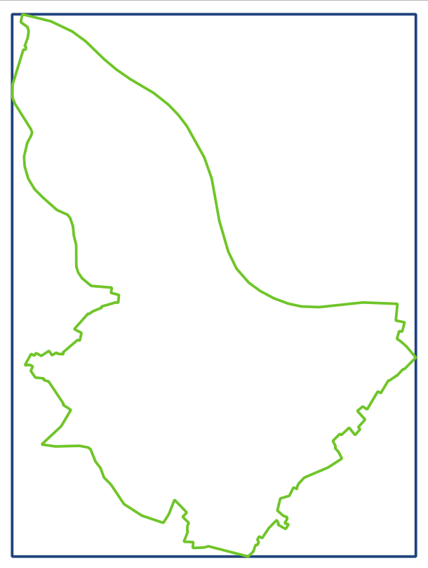
Vereinfachte Umringe Kalkar
Dieser Datensatz enthält die vereinfachten Umringe und die minimal umgebenden Rechtecke (Bounding Box) um das Gebiet der Stadt Kalkar.
Grundlage sind die Gemeindegrenzen des Verbands. Da die zugrundeliegenden Daten einen sehr hohen Detailgrad haben, und die Punktmenge für viele weitere Anwendungen zu hoch ist, werden die Daten über einen Douglas-Peucker-Filter mit einer Toleranz von 20m generalisiert (vereinfacht) und anschließend als OGC WKT String in Textdateien ausgegeben. Diese Textdatei liegt jeweils sowohl in EPSG:4326 (WGS 84) als auch in EPSG:25832 (UTM-32N auf ETRS) vor.
INSPIRE
Identification
- File identifier
- ebbe2bb3-4a83-4a4e-acc5-7e1b2d932a52 XML
- Hierarchy level
- Dataset
Online resource
Resource identifier
- Metadata language
- Deutsch
Encoding
- Format
-
WKT
Classification of data and services
- Topic category
-
- Boundaries
Classification of data and services
Coupled resource
Coupled resource
Classification of data and services
Coupled resource
Coupled resource
Keywords
Other keywords
- Keywords
-
-
Gemeinde
-
Umring
-
BBOX
-
Boundingbox
-
WKT
-
Grenze
-
Kalkar
-
opendata
-
- Theme
-
-
REGI
-
Geographic coverage
))
Temporal reference
Temporal extent
- End
- 2025-09-11T00:00:00.000+02:00
Temporal extent
- Date (Creation)
- 2023-09-19T00:00:00.000+02:00
- Date (Revision)
- 2025-09-12T00:00:00.000+02:00
Quality and validity
- Lineage
-
Fachliche Grundlage sind jeweils die ALKIS Daten.
Conformity
Conformity
Conformity
Conformity
Conformity
Conformity
Restrictions on access and use
- Access constraints
-
Datenlizenz Deutschland – Zero – Version 2.0
- Access constraints
-
{"id":"dl-zero-de/2.0","name":"Datenlizenz Deutschland – Zero – Version 2.0","url":" https://www.govdata.de/dl-de/zero-2-0","quelle":""}
- Access constraints
- Es gelten keine Zugriffsbeschränkungen
Responsible organization (s)
Contact for the resource
- Organisation name
-
Kreis Kleve - Der Landrat
Responsible organization (s)
Contact for the resource
- Organisation name
-
Kreis Kleve - Der Landrat
Metadata information
Contact for the metadata
- Organisation name
-
Kommunales Rechenzentrum Niederrhein (KRZN)
- Date stamp
- 2026-02-06
- Metadata language
- Deutsch