 My GeoNetwork catalogue
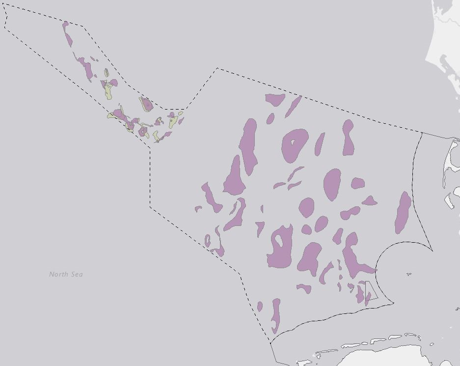
CO2 storage potentials in the Exclusive Economic Zone (EEZ) of the German North Sea - Results of the GEOSTOR-Project
Storage of CO2 in deep geological formations is one possibility of reducing CO2 emissions from industry that are difficult to avoid. High-quality geological models and capacity estimates are crucial for the successful planning and implementation of safe storage projects. This study analyses the storage potential of the Middle Buntssandstein (Lower Triassic) and Lower to Middle Jurassic within the Exclusive Economic Zone (EEZ) of the German North Sea. The dataset includes maps of potential storage sites and classifications. Link https://geostor.cdrmare.de/
Simple
- Alternate title
-
CO2 storage potentials German North Sea
- Date (Publication)
- 2024-09-30
- Citation identifier
- 1650ab94-2c86-888b-4193-f990fcd13bee
- Status
- Completed
-
GEMET - INSPIRE themes, version 1.0
-
-
Geologie
-
Geology
-
- Theme
-
-
CO2 storage capacity
-
Carbon capture and storage (CCS)
-
Buntsandstein
-
Jurassic
-
German North Sea
-
Reservoir evaluation
-
Saline aquifers
-
- Place
-
-
German North Sea
-
- Access constraints
- Other restrictions
- Other constraints
- Es gelten keine Zugriffsbeschränkungen
- Use constraints
- Other restrictions
- Other constraints
- Dieser Datensatz kann gemäß der Lizenz "Datenlizenz Deutschland Namensnennung 2.0" (https://www.govdata.de/dl-de/by-2-0) genutzt werden.
- Other constraints
-
{ "id": "dl-by-de/2.0", "name": "Datenlizenz Deutschland Namensnennung 2.0", "url": " https://www.govdata.de/dl-de/by-2-0 ", "quelle": "CO2 storage potentials German North Sea, BGR, 2024" }
- Language
- English
- Character set
- UTF8
))
- Distribution format
-
-
WMS
(
OGC:WMS 1.3.0
)
-
WMS
(
OGC:WMS 1.3.0
)
- OnLine resource
- BGR-Projektseite
- OnLine resource
- Geostor-Webseite
- OnLine resource
- Geostor-Datenkatalog
- OnLine resource
- Karte im BGR-Geoviewer
- Hierarchy level
- Series
- Statement
-
Basierend auf seismischen Daten und Bohrungsdaten - verfügbar über GeolDG
- File identifier
- ec1975a4-e9ac-44be-b19f-f6e01ef5177f XML
- Metadata language
- English
- Character set
- UTF8
- Hierarchy level
- Series
- Hierarchy level name
-
Geologie
- Date stamp
- 2024-11-21
- Metadata standard name
-
INSPIRE Metadata Implementing Rules: Technical Guidelines based on EN ISO 19115 and EN ISO 19119
- Metadata standard version
-
Version 2.0.1
Overviews
Spatial extent
Provided by
