 My GeoNetwork catalogue
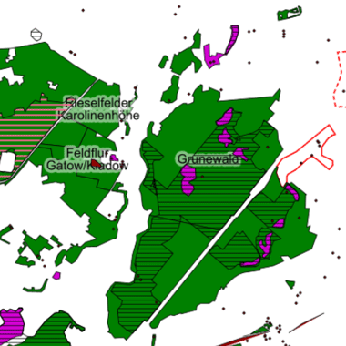
Schutzgebiete nach Naturschutzrecht 2003 (Umweltatlas, historisch)
Natur- und Landschaftsschutzgebiete, Naturdenkmale, Geschützte Landschaftsbestandteile, FFH - und Natura 2000 - Gebiete, Landschaftspläne (historische Überblicksdarstellung ohne Grundstücksbezug mit Umland für das Jahr 2003 im Maßstab 1:50.000)
INSPIRE
Identification
- File identifier
- ec4b92ad-8364-32d7-aa08-4dba27803baf XML
- Hierarchy level
- Dataset
Online resource
Resource identifier
- Metadata language
- Deutsch
- Spatial representation type
- Vector
Encoding
- Format
-
Text/HTML
- Version
-
4.01
- Specification
-
Keine Angabe
Projection
Classification of data and services
- Topic category
-
- Environment
Classification of data and services
Coupled resource
Coupled resource
Classification of data and services
Coupled resource
Coupled resource
Keywords
Other keywords
- Theme
-
-
open data
-
opendata
-
Karten
-
Sachdaten
-
Geodaten
-
Berlin
-
Umweltatlas
-
Naturschutzgebiete
-
Landschaftsschutzgebiete
-
Geschützte Landschaftsbestandteile
-
Naturdenkmale
-
Natura 2000-Gebiete
-
Landschaftspläne
-
NSG
-
LSG
-
GLB
-
ND
-
FND
-
Flora-Fauna-Habitat-Richtlinie
-
FFH-Gebiete
-
Vogelschutzrichtlinie
-
Objektschutz
-
Flächenschutz
-
Geographic coverage
))
Temporal reference
Temporal extent
- Begin
- 2003-12-01T00:00:00Z
- End
- 2003-12-01T00:00:00Z
Temporal extent
- Date (Publication)
- 2003-12-01
Quality and validity
- Lineage
-
Schutzgebietskarten, Senatsverwaltung für Stadtentwicklung I E 2 (naturschutzrechtliche Unterschutzstellungen), Stand Okt 2003; Übersicht der Landschaftspläne, Senatsverwaltung für Stadtentwicklung, I E 1, Landschaftsplanung, Stand Dez 2003; Digitale Karte Schutzgebiete, I E 1, Stand Dez 2003; Digitale Grundkarte Berlin 1:50.000 des ISU (Informationssystem Stadt und Umwelt, ISU50), Stand 2001, Für Berlin: Schutzverordnungen, Stand Dezember 2003,Senatsverwaltung für Stadtentwicklung, Gruppe I E 2, Landschaftspläne, Stand Dezember 2003,Senatsverwaltung für Stadtentwicklung, Gruppe I E 1, Für Brandenburg: Schutzverordnungen Stand Dezember 2000,Landesumweltamt Brandenburg,Abt. Naturschutz, Ministerium für Umwelt, Naturschutz undRaumordnung des Landes Brandenburg; Abt. N
- Denominator
- 50000
Conformity
Conformity
Conformity
Conformity
Conformity
Conformity
Restrictions on access and use
- Access constraints
- Es gelten keine Zugriffsbeschränkungen
- Access constraints
-
Für die Nutzung der Daten ist die Datenlizenz Deutschland - Zero - Version 2.0 anzuwenden. Die Lizenz ist über https://www.govdata.de/dl-de/zero-2-0 abrufbar.
- Access constraints
-
{"id":"dl-zero-de/2.0","name":"Datenlizenz Deutschland - Zero - Version 2.0","url":" https://www.govdata.de/dl-de/zero-2-0"}
Responsible organization (s)
Contact for the resource
- Organisation name
-
Senatsverwaltung für Stadtentwicklung, Bauen und Wohnen Berlin
Responsible organization (s)
Contact for the resource
- Organisation name
-
Senatsverwaltung für Stadtentwicklung, Bauen und Wohnen Berlin
Metadata information
Contact for the metadata
- Organisation name
-
Senatsverwaltung für Stadtentwicklung, Bauen und Wohnen Berlin
- Date stamp
- 2026-01-15T14:12:41.799045626Z
- Metadata language
- Deutsch
- Character set
- UTF8
SDS
Conformance class 1: invocable
Access Point URL
Endpoint URL
Technical specification
Conformance class 2: interoperable
Access constraints
Limitation
Use constraints
Limitation
Responsible custodian
Contact for the resource
Overviews
Spatial extent
Provided by
