 My GeoNetwork catalogue
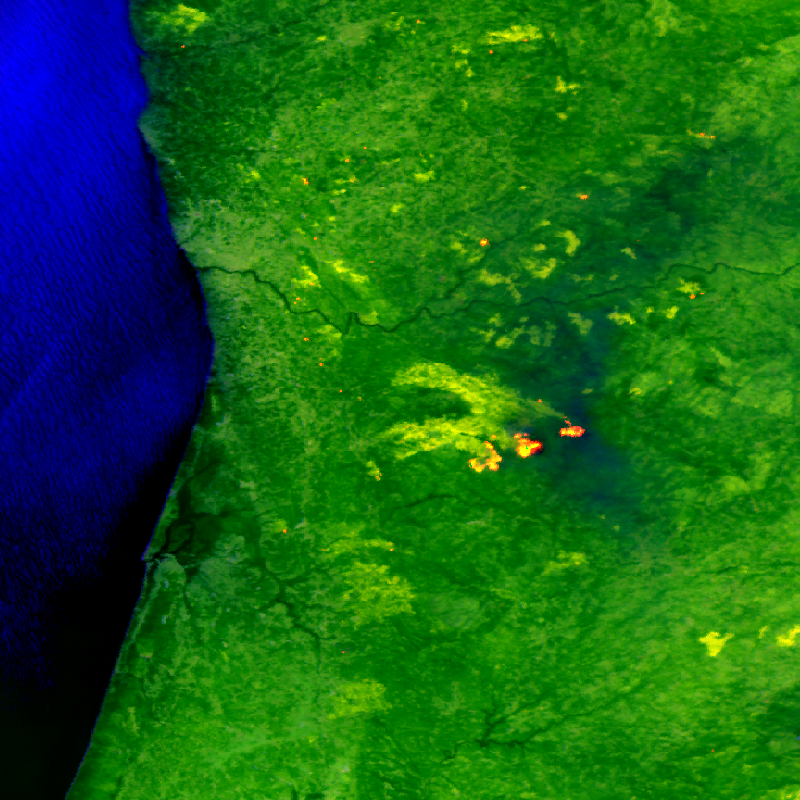
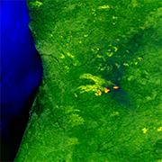
Firebird MSC - Level 0 Multispectral Images
The FireBIRD mission consists of two small satellites, TET-1 and BIROS. Together, the two satellites are on an Earth observation mission that aims to detect forest fires, or high-temperature events, from space. The new infrared system provides high-quality data that is capable of measuring the spread of the fire and the amount of heat generated with great accuracy very early on - almost in real time - meaning that FireBIRD can serve as an early warning system. The data acquired from this Earth observation mission can also be used as a basis for scientific climate research. In addition to the main payload of the cameras, further experiments have been planned for developing the technology on board the small satellites. Further information can be found on the following website: http://www.dlr.de/firebird/en/ and in the FireBIRD brochure available at: http://www.dlr.de/firebird/en/Portaldata/79/Resources/dokumente/FireBIRD_Broschuere_HighRes_v3_english.pdf
Simple
- Date (Creation)
- 2017-07-03T08:12:00
- Citation identifier
- https://geoservice.dlr.de/catalogue/srv/metadata/f920473c-15a2-490c-8b24-b48f9b8a0226
- Presentation form
- Digital image
- Other citation details
-
DOI: 10.15489/abur0my1ge92
- Status
- On going
- Maintenance and update frequency
- Continual
- Keywords
-
-
Satellite
-
Earth Observation
-
FireBIRD
-
BIROS
-
TET-1
-
FireBIRD Multi-Spectral Camera
-
MSC
-
Optical
-
Thermal Infrared
-
Natural Hazards
-
Wildfire
-
High Temperature Events
-
Volcanoes
-
FBI.MSC.L0
-
FEDEO
-
-
GEMET - INSPIRE themes, version 1.0
-
-
Orthoimagery
-
- Use constraints
- Other restrictions
- Other constraints
-
Nutzungsbedingungen: https://geoservice.dlr.de/resources/licenses/firebird/FireBird_Image_Data_Policy.pdf / Terms of Use: https://geoservice.dlr.de/resources/licenses/firebird/FireBird_Image_Data_Policy.pdf
- Access constraints
- Other restrictions
- Other constraints
-
Restricted - Data available upon request ( science-firebird@dlr.de )
- Use limitation
-
Nutzungseinschränkungen: Das DLR ist nicht haftbar für Schäden, die sich aus der Nutzung ergeben. / Use Limitations: DLR not liable for damage resulting from use.
- Spatial representation type
- Grid
- Denominator
- 80000
- Language
-
eng
- Character set
- UTF8
- Topic category
-
- Imagery base maps earth cover
))
- Begin date
- 2014-03-22T00:00:00
- Reference system identifier
- EPSG / WGS 84 (EPSG:4326) / 7.4
- Distribution format
-
-
(
)
-
(
)
- OnLine resource
-
Additional information on the FireBIRD mission
(
WWW:LINK-1.0-http--related
)
DLR mission website
- Hierarchy level
- Series
Domain consistency
- Measure identification
- INSPIRE / Conformity_001
Conformance result
- Date (Publication)
- 2010-12-08
- Explanation
-
See the referenced specification
- Pass
- Yes
- Statement
-
Input data sets: Raw data from the TET-1 and BIROS satellites
- Description
-
Data consolidation and geo-location annotation. Metadata retrieved from Level 1B data (radiometric parameter, geolocation parameter) and level 2 processing (high temperature events sum parameter).
Geolocation accuracy: 3 km
- File identifier
- f920473c-15a2-490c-8b24-b48f9b8a0226 XML
- Metadata language
- English
- Character set
- UTF8
- Hierarchy level
- Series
- Hierarchy level name
-
Dataseries
- Date stamp
- 2024-06-20T14:12:24
- Metadata standard name
-
ISO 19115:2003/19139
- Metadata standard version
-
1.0
Overviews
Spatial extent
Provided by
