 My GeoNetwork catalogue
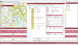
Borehole Map Germany
The "Borehole Map Germany" provides information on the geology of the subsurface in the Federal Republic of Germany and contains approx. 2 million boreholes (total length approx. 80,000 km). The application resulted from a cooperation between the BGR and the Geological Survey Organisations of Germany (SGD), which are responsible for the management and long-term storage of the borehole information shown. The BoreholeML format, which is the common denominator of all drilling data in Germany to ensure interoperability, was developed as the basis for cross-national data exchange. The application displays metadata of boreholes, strata data, groundwater measurements, evidence of loggings and samplings, casing and technical drilling data. This makes the data suitable for subsoil investigations, well construction or pipeline construction. A search and an export function work on borehole metadata level. The application starts with a tiled view of the borehole density distribution in Germany, which changes to an view of all single boreholes from a scale 1:80,000. The data is updated irregularly. Unfortunately, not all SGD distribute their data to the application yet.
- Identification
- Distribution
- Quality
- Spatial rep.
- Ref. system
- Content
- Portrayal
- Metadata
- Md. constraints
- Md. maintenance
- Schema info
Identification
Data identification
Citation
- Alternate title
-
BoreholeMap
- Date (Publication)
- 2013-06-11
- Date (Revision)
- 2017-03-01
- Citation identifier
- 45c7c54b-3f65-1044-9638-40ab173f2b43
- Status
- On going
- Theme
-
-
Drilling
-
BoreholeML
-
Geologie
-
Geology
-
Gestein
-
Gebirge
-
Bohrung
-
rock
-
lithology
-
genesis
-
borehole
-
header data
-
strata data
-
layer
-
casing
-
groundwater
-
stratigraphy
-
BoreholeML
-
Schichtdaten
-
Ausbaudaten
-
Verrohrung
-
Grundwasserbeobachtung
-
logging
-
sampling
-
Lithologie
-
Petrographie
-
Genese
-
Stratigraphie
-
Gesteinsalter
-
age
-
Gesteinsart
-
Entstehung
-
Bohrdichte
-
- Place
-
-
Deutschland
-
Germany
-
Legal constraints
- Access constraints
- Other restrictions
- Other constraints
- Es gelten keine Zugriffsbeschränkungen
Legal constraints
- Use constraints
- Other restrictions
- Other constraints
-
Allgemeine Geschäftsbedingungen, siehe https://www.bgr.bund.de/AGB - General terms and conditions, see https://www.bgr.bund.de/AGB_en . Die bereitgestellten Informationen sind bei Weiterverwendung wie folgt zu zitieren: Datenquelle: Bohrpunktkarte Deutschland, (c) BGR, Hannover, 2020
- Language
- Deutsch
- Character set
- UTF8
- Topic category
-
- Geoscientific information
))
Distribution
Distribution
- Distribution format
-
-
Webapplication
(
n/a
)
-
Webapplication
(
n/a
)
- OnLine resource
- Start der Anwendung Bohrpunktkarte Deutschland
- OnLine resource
- Projektseite Infogeo.de
- OnLine resource
- BGR Projektseite
- OnLine resource
- BoreholeML
Quality
Data quality
- Hierarchy level
- application
Conformance result
Citation
- Date (Publication)
- 2011-10-18
- Explanation
-
siehe Spezifikation
- Pass
- Yes
- Statement
-
Alle Bohrdaten bis auf die der AWZ werden von den jeweiligen SGD der Bundesländer an die BGR übermittelt. Gemäß Geologiedatengesetz sind alle Bohrdaten in Deutschland beim jeweils zuständigen SGD anzeigepflichtig und werden dort verwaltet. Eine Gewähr für die Richtigkeit der Informationen wird nicht übernommen.
Metadata
Metadata
- File identifier
- f9c33c9d-335d-4878-a73b-efe654f4814a XML
- Metadata language
- Deutsch
- Character set
- UTF8
- Hierarchy level
- application
- Hierarchy level name
-
Geologie
- Date stamp
- 2026-01-13
- Metadata standard name
-
INSPIRE Metadata Implementing Rules: Technical Guidelines based on EN ISO 19115 and EN ISO 19119
- Metadata standard version
-
n/a
Overviews
Spatial extent
Provided by
