 My GeoNetwork catalogue
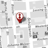
Stadt Dortmund: sonstige_religioese_Einrichtung
Karte mit den Standorten der sonstigen religiösen Einrichtungen in Dortmund.
Sachinformationen können über den Layer „Stadt Dortmund: INFO_religioese_Einrichtung“ aufgerufen werden.
INSPIRE
Identification
- File identifier
- fa2d103e5334746a3c3b48cafefb7101c9b07f18 XML
- Hierarchy level
- Dataset
Online resource
- Protocol
-
OGC:WMS-1.3.0-http-get-map
- Protocol
-
image/png
Resource identifier
Encoding
- Format
-
WMS
- Version
-
1.3.0
Projection
- code
-
CRS:84
- code
-
EPSG:25832
- code
-
EPSG:3857
- code
-
EPSG:31467
- code
-
EPSG:31466
- code
-
EPSG:4326
Classification of data and services
- Topic category
-
- Society
Classification of data and services
Coupled resource
Coupled resource
Classification of data and services
Coupled resource
Coupled resource
Keywords
-
Anwendungen
-
-
map.apps
-
-
theme.govdata
-
-
Bevölkerung
-
Kultur, Freizeit, Sport und Tourismus
-
Other keywords
- Theme
-
-
infoMapAccessService
-
- Theme
-
-
Dortmund
-
Religion
-
Geographic coverage
N
S
E
W
))
Temporal reference
Temporal extent
Temporal extent
- Date (Revision)
- 2017-10-12T12:00:37
Quality and validity
- Lineage
-
Eigene Erfassung
Conformity
Conformity
Conformity
Conformity
Conformity
Conformity
Responsible organization (s)
Contact for the resource
- Organisation name
-
Stadt Dortmund
Responsible organization (s)
Contact for the resource
- Organisation name
-
Stadt Dortmund
Metadata information
Contact for the metadata
- Organisation name
-
Stadt Dortmund
- Date stamp
- 2017-10-12T14:28:48
- Metadata language
-
ger
SDS
Conformance class 1: invocable
Access Point URL
Endpoint URL
Technical specification
Conformance class 2: interoperable
Access constraints
Limitation
Use constraints
Limitation
Responsible custodian
Contact for the resource
Overviews
thumbnail
Spatial extent
N
S
E
W
Provided by

Associated resources
Not available