 My GeoNetwork catalogue
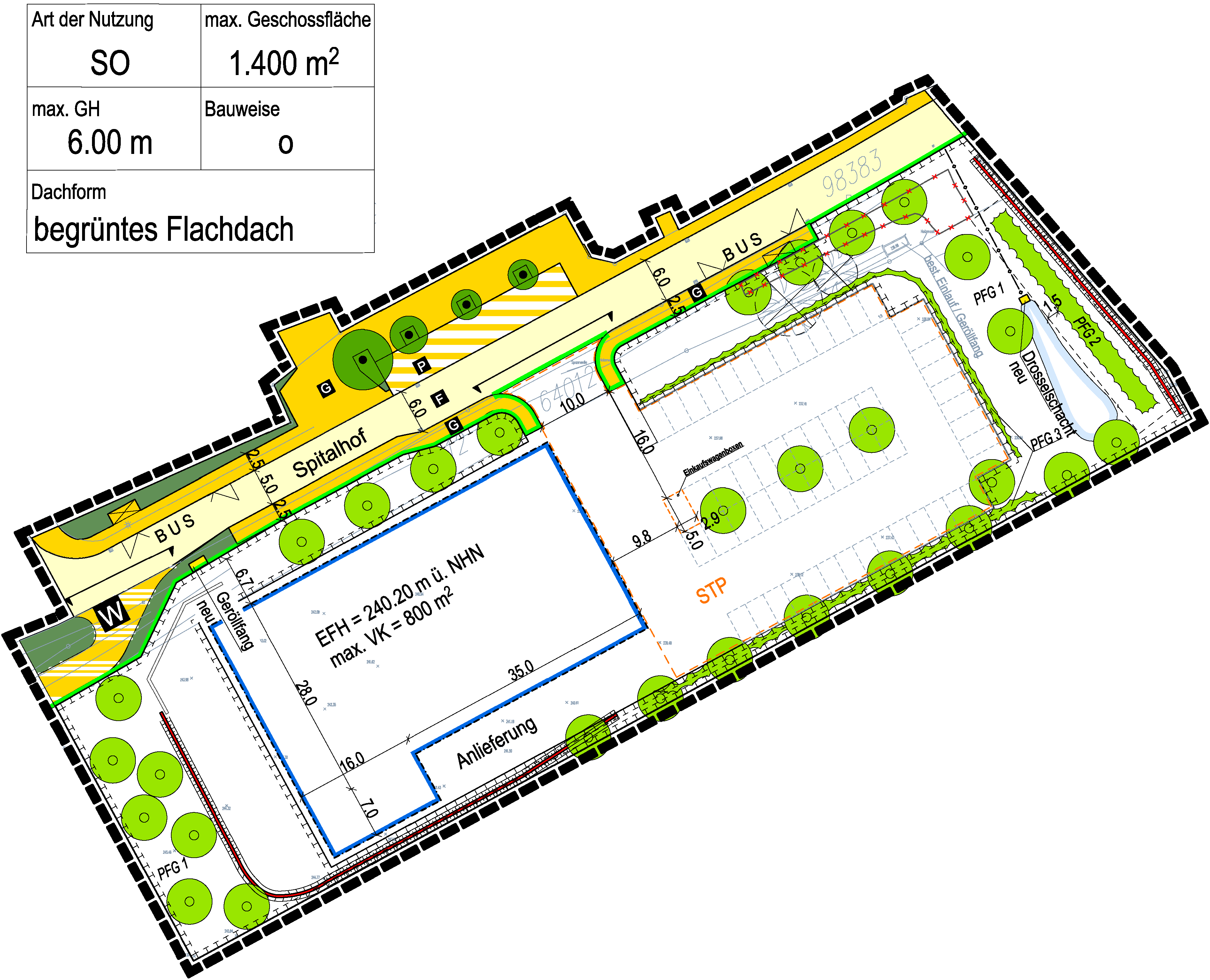
B-Plan 869 Spitalhof (Nahversorgung Hohenwettersbach)
Der Bebauungsplan enthält die rechtsverbindlichen Festsetzungen für die städtebauliche Ordnung.
Simple
- Date (Creation)
- 2021-11-05T12:43:23.0653369
- Citation identifier
-
la_ka_B_869
- Status
- Completed
- Maintenance and update frequency
- As needed
- Keywords
-
-
inspireidentifiziert
-
-
GDI-BW
-
-
Bauleitplanung
-
-
GEMET - INSPIRE themes, version 1.0
-
-
Bodennutzung
-
- Use limitation
-
Nutzungsbedingungen: Es gelten die Nutzungsbestimmungen der digitalen Geodatenauskunft der Stadt Karlsruhe.
- Access constraints
- Other restrictions
- Use constraints
- Other restrictions
- Other constraints
- Siehe INSPIRE Directive Article 13(1)(d)
- Other constraints
-
Keine
- Other constraints
- Es gelten keine Zugriffsbeschränkungen
- Classification
- Restricted
- Spatial representation type
- Grid
- Denominator
- 1000
- Language
- Deutsch
- Character set
- UTF8
- Topic category
-
- Planning cadastre
))
- Reference system identifier
- urn:ogc:def:crs:EPSG / EPSG:25832
- Distribution format
-
-
GeoTIFF
(
GeoTIFF
)
- Specification
-
Hier kann die Angabe zur Spezifikation des verwendeten Formats erfolgen.
-
PDF
(
PDF
)
-
GeoTIFF
(
GeoTIFF
)
Distributor
- OnLine resource
- Bebauungsplan-Auskunft - Geoportal Karlsruhe ( WWW:LINK-1.0-http--link )
- OnLine resource
- Geltungsbereich - Ausfertigung als PDF-Dokument ( WWW:LINK-1.0-http--link )
- OnLine resource
- Archivplan - Ausfertigung als PDF-Dokument ( WWW:LINK-1.0-http--link )
- OnLine resource
- Schriftlicher Teil - Ausfertigung als PDF-Dokument ( WWW:LINK-1.0-http--link )
- OnLine resource
- XPlan GML ( WWW:LINK-1.0-http--link )
- OnLine resource
- INSPIRE GML ( WWW:LINK-1.0-http--link )
- OnLine resource
- .ZIP-Archiv ( WWW:LINK-1.0-http--link )
- Hierarchy level
- Dataset
Domain consistency
- Measure identification
- ??
Conformance result
- Date (Publication)
- 2010-12-01
- Explanation
-
Die Daten wurden mit der Metadatenvalidierung der GDI-BW überprüft.
- Pass
- Yes
- Statement
-
Bebauungspläne Karlsruhe
- Description
-
Flurstücksgenaue Festsetzungen nach § 9 BauGB auf Basis der Automatisierten Liegenschaftskarte (ALK).
- Date / Time
- 2019-10-22T09:00:00
- File identifier
- la_ka_B_869 XML
- Metadata language
- Deutsch
- Character set
- UTF8
- Hierarchy level
- Dataset
- Date stamp
- 2021-11-05T12:43:23.0653369
- Metadata standard name
-
ISO 19115:2003 (GDI-BW)
- Metadata standard version
-
1.3
Overviews
Spatial extent
Provided by
