 My GeoNetwork catalogue
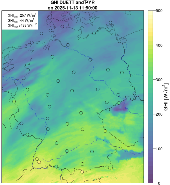
Gridded (1 km) hourly near-realtime data of surface irradiance and sunshine duration based on surface measurements and satellite observations - DUETT Project
These data are generated by combining satellite-based and surface-measured data of the surface irradiance (global radiation) and the sunshine duration. The associated algorithms have been developed within the DUETT-project and are continuously adjusted and improved. Gridded data (EPSG-3035 projection, Germany) of the surface irradiance and the sunshine duration are generated with a spatial resolution of 1 km and a temporal resolution of 1 hour (average / sum for synoptic hours, ending at minute 50). The data set is separated into two parts: the directory ./{parameter}/recent/ contains the latest data; in the directory ./{parameter}/historical/ older data are archived.
Simple
- Alternate title
-
urn:wmo:md:de-dwd-cdc:grids_germany-climate-hourly-duett_1km
- Date (Publication)
- 2025
- Edition
-
v8d
- Edition date
- 2025
- Citation identifier
-
urn:wmo:md:de-dwd-cdc:5ffce5ae-3b32-4e43-9457-374c1bce6204
WMO-WIS2:de-dwd-cdc WMO-WIS2:de-dwd-cdc 2025
- Presentation form
- Digital table
- Status
- On going
+ 49 (0) 69 8062-4499
https://dwd.de
- Hours of service
-
09:00 - 16:00
- Maintenance and update frequency
- Continual
- Update scope
- Dataset
- Maintenance note
-
In the directory ./recent/ the data files are updated hourly.
+49 (0) 69 8062-4499
https://dwd.de
- Hours of service
-
10:00 - 15:00
- Maintenance and update frequency
- Annually
- Maintenance note
-
In the directories ./{parameter}/historical/ the data files are updated annually.
The hourly data files are merged into monthly files.
+49 (0) 69 8062-4499
https://dwd.de
- Hours of service
-
10:00 - 15:00
-
GEMET - INSPIRE themes, version 1.0
-
-
Meteorologisch-geografische Kennwerte
-
Atmosphärische Bedingungen
-
-
DWD Climate Data Center Vocabulary - Geographische Region
-
-
Germany
-
-
DWD Climate Data Center Vocabulary - Datenherkunft
-
-
grids from station and satellite data
-
-
DWD Climate Data Center Vocabulary - Zeitliche Auflösung
-
-
hourly
-
-
Climate and Forecast Standard Names
-
-
surface_downwelling_shortwave_flux
-
duration_of_sunshine
-
-
DWD Climate Data Center Vocabulary - Parameterklasse
-
-
radiation and sunshine duration
-
-
DWD Climate Data Center Vocabulary - Parameter
-
-
global radiation
-
sunshine duration
-
- Keywords
-
-
opendata
-
- Specific usage
-
The data represent the spatially averaged value for the specified grid area.
- User determined limitations
- considerations
- Specific usage
-
The main focus of these products is on the provision of near real-time observations. The software for generating the gridded data is constantly being improved and updated, which can lead to discontinuities when analysing long time series. In the case of heterogeneous cloud conditions, especially in mountainous regions, the gridded data may differ, sometimes significantly, from the measurements of nearby stations. This is due to the different spatial representativeness of the two measurement methods. Small-scale features such as cumulus clouds or fog patches may not be represented in the gridded data. Further sources of error are geometric errors, which are caused by different positions of the satellite and the sun relative to the observation point. When the sky is clear and there is snow cover, the grid data may potentially underestimate solar radiation and sunshine duration, as it is difficult for satellites to distinguish between snow-covered ground and cloud cover.
- User determined limitations
- uncertainties
- Access constraints
- Other restrictions
- Other constraints
- no Limitations
- Use constraints
- Other restrictions
- Other constraints
- The Creative Commons BY 4.0 - Licence 'CC BY 4.0' apply.
- Spatial representation type
- Grid
- Distance
- 1 km
- Language
- Deutsch
- Topic category
-
- Climatology, meteorology, atmosphere
))
- Geographic identifier
- stations in Germany
- Begin date
- 2024-01-01
- End date
- -PT1H Now
- Supplemental Information
-
The gridded data are obtained from ground measurements and satellite data using a geo-statistical method. This method is subject to continuous further development; a temporal homogeneity of the data cannot be guaranteed. Changes in the method used are indicated in the file name. A complete check of the data does not take place; we are grateful for information on problematic data points in the raster data (see Contact).
- Unique resource identifier
- EPSG:3035
- Number of dimensions
- 2
- Dimension name
- Column
- Dimension size
- 740
- Resolution
- 1000 m
- Dimension name
- Row
- Dimension size
- 940
- Resolution
- 1000 m
- Cell geometry
- Area
- Transformation parameter availability
- No
Spatial representation info
- Distribution format
-
-
NetCDF
()
-
NetCDF
()
+ 49 (0) 69 8062-4499
https://dwd.de
- Hours of service
-
09:00 - 16:00
- OnLine resource
-
recent hourly mean surface downwelling shortwave radiation (SIS)
(
WWW:LINK-1.0-http--download
)
The folder .radiation_global/recent/ contains recent hourly gridded data files in netcdf-format. The naming of the files follows:
{parameter}_duett_1km_DE_60min_{YYYYmmddHHMM}_{version}.nc
- OnLine resource
-
recent hourly sunshine duration (SDU)
(
WWW:LINK-1.0-http--download
)
The folder .sunshine_duration/recent/ contains hourly gridded data of the current year in netcdf format. The namng convention of the netcdf-files is: {parameter}_duett_1km_DE_60min_{YYYYmmddHHMM}_{version}.nc
- OnLine resource
-
Brinckmann et al., EMS 2022: Combination of satellite and ground measurements of hourly surface solar radiation data in Germany
(
WWW:LINK-1.0-http--link
)
Brinckmann, S., Klameth, A., and Trentmann, J.: Combination of satellite and ground measurements of hourly surface solar radiation data in Germany, EMS Annual Meeting 2022, Bonn, Germany, 5–9 Sep 2022
- OnLine resource
-
Klameth et al., 2022: Towards the combination of in-situ and satellite-based solar radiation data in near-realtime – the project DUETT at DWD
(
WWW:LINK-1.0-http--link
)
Klameth, A., Brinckmann, S., and Trentmann, J.: Towards the combination of in-situ and satellite-based solar radiation data in near-realtime – the project DUETT at DWD, EMS Annual Meeting 2022, Bonn, Germany, 5–9 Sep 2022
- OnLine resource
-
List of stations
(
WWW:DOWNLOAD-1.0-http--download
)
Liste der Stationen mit Insitu-Messungen, welche zur Erzeugung des Rasterproduktes verwendet werden.
- Hierarchy level
- Dataset
Conformance result
- Date (Publication)
- 2010-12-08
- Pass
- Yes
Conceptual consistency
- Name of measure
- quality_estimation
- Measure description
-
So-called standard uncertainties are estimated on the basis of the following statistics: (a) standard deviation, based on the so-called ‘kriging variance’ of the interpolated regional bias; (b) spatial standard deviation of hourly GHI / DNI Duett around each grid point (based on 25 adjacent grid points each); (c) spatial offset caused by differences in the observation or irradiation angles of the satellite or the sun (assuming a small-scale cloud with a top height of 5 km). The variables (b) and (c) are linked, as the spatial offset in satellite observation only has an effect if the data field around a station is heterogeneous. For this reason, a so-called geometry factor is calculated from (c), and afterwards (b) is multiplied by this factor. The uncertainties are provided as standard uncertainties in the NetCDF files.
Conformance result
- Explanation
-
The gridded data are regularly compared with direct measurements of sunshine duration and global radiation at independent stations. There are only minor systematic differences (approx. 1 min for the sunshine duration, approx. 10 W/m2 for the global radiation, each approx. 5%); the mean absolute deviations are in the range of approx. 6 min and 30 W/m2, respectively. For specific situations, the deviations can be significantly lower or higher than the average. The data contain also information on the uncertainty of the surface irradiance and the sunshine duration. These are estimated on the basis of the statistics of the differences between the satellite and the surface measurement data, the surrounding data variability and the geometric uncertainty of the cloud observation.
- Pass
- Yes
- Statement
-
The gridded data are based on satellite observations and surface measurements. The used satellite data are generated by DWD in near-realtime every 10-min as instantaneous data of the suface radiation in 1.5 km resolution based on data from the geostationary Meteosat satellite. The surface measurements (aggregated over 10 min) are collected at 42 locations from the DWD network (mainly pyranometer instruments). Both data sets are aggregated to synoptic hourly data. A geostatistical algorithm is used to generate the gridded data of surface irradiance and sunshine duration from those two data sources.
- File identifier
- urn:wmo:md:de-dwd-cdc:5ffce5ae-3b32-4e43-9457-374c1bce6204 XML
- Metadata language
- Deutsch
- Character set
- UTF8
- Hierarchy level
- Dataset
- Date stamp
- 2025-11-28T06:52:27
- Metadata standard name
-
ISO 19115-2 Geographic information Metadata Part 2: Extensions for imagery and gridded data
- Metadata standard version
-
ISO 19115-2:2009-02-15
+49 (0) 69 8062-4499
https://dwd.de
- Hours of service
-
10:00 - 15:00
- Dataset URI
-
urn:wmo:md:de-dwd-cdc:5ffce5ae-3b32-4e43-9457-374c1bce6204
Overviews
Spatial extent
Provided by
