 www.geodatenkatalog.de (S2F)
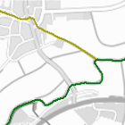
Risikogewässer - WMS
Risikogewässer sind alle bayerischen Gewässer, für die bei der vorläufigen Risikobewertung ein besonderes Hochwasserrisiko ermittelt wurde. Entlang dieser Gewässer werden Hochwassergefahren- und -risikokarten (HWGK/HWRK) erstellt.
Die im 1. Umsetzungszyklus der EG-Hochwasserrisikomanagement-Richtlinie 2007/60/EG (EG-HWRM-RL) betrachtete Risikokulisse umfasste zunächst ca. 7.650 Gewässerkilometer und wurde im 2. Umsetzungszyklus auf ca. 8.400 Kilometer erweitert. Mit dem aktuell laufenden 3. Umsetzungszyklus werden nun rund 8.500 Kilometer der bayerischen Gewässer als Risikogewässer geführt.
Im Abstand von jeweils sechs Jahren wird die vorläufige Risikobewertung einer Prüfung unterzogen und die Risikokulisse gegebenenfalls angepasst.
Maximale Bildgröße: 4096 x 4096 Pixel.
|
|
Citation proposal
(2024) . Risikogewässer - WMS. https://gdk.gdi-de.org/geonetwork/srv/api/records/00df75fa-b1e8-4167-aeb2-3593e33c8069 |
INSPIRE
Identification
- File identifier
- 00df75fa-b1e8-4167-aeb2-3593e33c8069 XML
- Hierarchy level
- service Service
Online resource
Resource identifier
Encoding
- Format
- Sonstiges
Projection
Classification of data and services
Classification of data and services
- Service Type
- view
- Coupling Type
- Tight
Coupled resource
Coupled resource
Classification of data and services
- Service Type
- view
- Coupling Type
- Tight
Coupled resource
Coupled resource
Keywords
- Service Classification, version 1.0 ( Theme )
-
- infoMapAccessService
Other keywords
- Keywords
-
- gdiby
- Risikokulisse
- Hochwasser
- Gewässerkulisse
- Risikogewässer
- vorläufige Risikobewertung
- Hochwasserrisiko
- Bayern
Geographic coverage
))
Temporal reference
Temporal extent
Temporal extent
- Date ( Publication )
- 2024-10-31T00:00:00.000+01:00
Quality and validity
Conformity
Conformity
Conformity
Conformity
Conformity
Conformity
Restrictions on access and use
Restrictions on access and use
- Access constraints
- Creative Commons Namensnennung - Weitergabe unter gleichen Bedingungen 4.0 International (CC BY-SA 4.0); Datenquelle: Bayerisches Landesamt für Umwelt, www.lfu.bayern.de
- Access constraints
- {"id":"cc-by-sa/4.0","name":"Creative Commons Namensnennung - Weitergabe unter gleichen Bedingungen 4.0 International (CC BY-SA 4.0)","url":"https://creativecommons.org/licenses/by-sa/4.0/deed.de","quelle":"Bayerisches Landesamt für Umwelt, www.lfu.bayern.de"}
Responsible organization (s)
Contact for the resource
- Organisation name
- Bayerisches Landesamt für Umwelt
Responsible organization (s)
Contact for the resource
- Organisation name
- Bayerisches Landesamt für Umwelt
Metadata information
Contact for the metadata
- Organisation name
- Bayerisches Landesamt für Umwelt
- Date stamp
- 2025-06-11
- Metadata language
- German
SDS
Conformance class 1: invocable
Access Point URL
Endpoint URL
Technical specification
Conformance class 2: interoperable
Coordinate reference system
Quality of Service
Access constraints
- Access constraints
- otherRestrictions Other restrictions
Limitation
Use constraints
Limitation
- string
- Creative Commons Namensnennung - Weitergabe unter gleichen Bedingungen 4.0 International (CC BY-SA 4.0); Datenquelle: Bayerisches Landesamt für Umwelt, www.lfu.bayern.de
- string
- {"id":"cc-by-sa/4.0","name":"Creative Commons Namensnennung - Weitergabe unter gleichen Bedingungen 4.0 International (CC BY-SA 4.0)","url":"https://creativecommons.org/licenses/by-sa/4.0/deed.de","quelle":"Bayerisches Landesamt für Umwelt, www.lfu.bayern.de"}
Responsible custodian
Contact for the resource
Conformance class 3: harmonized
Contains Operations
- Operation Name
- GetCapabilities
- Distributed Computing Platforms
- Web services
- Operation Description
- application/vnd.ogc.wms_xml; text/xml;
Contains Operations
- Operation Name
- GetMap
- Distributed Computing Platforms
- Web services
- Operation Description
- image/bmp; image/jpeg; image/tiff; image/png; image/png8; image/png24; image/png32; image/gif; image/svg+xml;
Contains Operations
- Operation Name
- GetFeatureInfo
- Distributed Computing Platforms
- Web services
- Operation Description
- application/vnd.esri.wms_raw_xml; application/vnd.esri.wms_featureinfo_xml; application/vnd.ogc.wms_xml; text/xml; text/html; text/plain;
Contains Operations
- Operation Name
- esri_wms:GetStyles
- Distributed Computing Platforms
- Web services
- Operation Description
- application/vnd.ogc.sld+xml;
Overviews
Provided by
