 www.geodatenkatalog.de (S3L)
Digitale Verwaltungsgrenzen
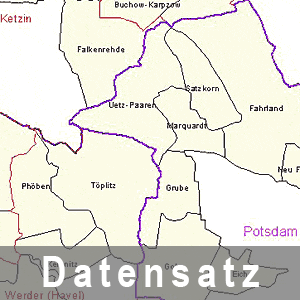
Die digitalen Verwaltungsgrenzen geben in einer GIS - Anwendung einen Überblick über den Aufbau der öffentlichen Verwaltungsstruktur in Brandenburg. Die Daten werden über automatisierte Verfahren oder durch Selbstentnahme kostenfrei bereitgestellt. Bei Nutzung der Daten sind die Lizenzbedingungen zu beachten.
|
|
Citation proposal
(2025) . Digitale Verwaltungsgrenzen. Landesvermessung und Geobasisinformation Brandenburg (LGB) https://gdk.gdi-de.org/geonetwork/srv/api/records/00fdc3fb-3bc1-4548-bca2-e735fb11c974 |
INSPIRE
Identification
- File identifier
- 00fdc3fb-3bc1-4548-bca2-e735fb11c974 XML
- Hierarchy level
- dataset Dataset
Online resource
Resource identifier
- Metadata language
- ger German
- Spatial representation type
- vector Vector
Encoding
Projection
Classification of data and services
- Topic category
-
- Boundaries
Classification of data and services
Coupled resource
Coupled resource
Classification of data and services
Coupled resource
Coupled resource
Keywords
- BE/BB Schlagwortliste, Version 1.0 ( Theme )
-
- Vermessung
- High-value dataset categories ( Theme )
-
- Georaum
Other keywords
- Keywords
-
- opendata
- Keywords ( Theme )
-
- Gemeinden
- Verwaltung
- Berlin
- GDI
- 1:25.000
- Navigation
- Verwaltungsgrenzen
- AdVMIS
- Vektordaten
- Brandenburg
- bboxbebb
Geographic coverage
N
S
E
W
))
Temporal reference
Temporal extent
Temporal extent
- Date ( Publication )
- 2025-10-01T00:00:00
- Date ( Revision )
- 2025-09-30T00:00:00
- Date ( Creation )
- 1998-12-01T00:00:00
Quality and validity
- Lineage
- auf der Grundlage von ALKIS bearbeitet
- Denominator
- 25000
Conformity
Conformity
Conformity
Conformity
Conformity
Conformity
Restrictions on access and use
- Access constraints
- Die Daten können gemäß der „Datenlizenz Deutschland - Namensnennung - Version 2.0“ (https://www.govdata.de/dl-de/by-2-0) genutzt werden. Namensnennung: "GeoBasis-DE/LGB", Beispiel: „© GeoBasis-DE/LGB, dl-de/by-2-0, (Daten geändert)“, (Klammer = optional)
- Access constraints
- {"id":"dl-by-de/2.0","name":"Datenlizenz Deutschland - Namensnennung - Version 2.0","url":"https://www.govdata.de/dl-de/by-2-0","quelle":"Quelle: © GeoBasis-DE/LGB, dl-de/by-2-0"}
Restrictions on access and use
Responsible organization (s)
Contact for the resource
- Organisation name
- Landesvermessung und Geobasisinformation Brandenburg (LGB)
Responsible organization (s)
Contact for the resource
- Organisation name
- Landesvermessung und Geobasisinformation Brandenburg (LGB)
Metadata information
Contact for the metadata
- Organisation name
- Landesvermessung und Geobasisinformation Brandenburg (LGB)
- Date stamp
- 2025-10-01T11:58:39
- Metadata language
- ger German
- Character set
- utf8 UTF8
SDS
Conformance class 1: invocable
Access Point URL
Endpoint URL
Technical specification
Conformance class 2: interoperable
Coordinate reference system
Quality of Service
Access constraints
Limitation
Use constraints
Limitation
Responsible custodian
Contact for the resource
Conformance class 3: harmonized
Overviews
Provided by

Views
00fdc3fb-3bc1-4548-bca2-e735fb11c974
Access to the portal
Read here the full details and access to the data.
Associated resources
Not available