 www.geodatenkatalog.de (S3L)
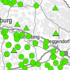
Landesmessnetze Grundwasser und Quellen - WMS
Der Landesgrundwasserdienst-quantitativ hat das Ziel, an repräsentativen Messstellen in anthropogen wenig beeinflussten Gebieten und weiträumig repräsentativen Grundwasservorkommen lange und weitgehend lückenlose Zeitreihen fehlerfreier Messdaten zeitnah zu erheben. Zu diesem Zweck werden Daten über Grundwasserstände und Quellschüttungen aller überregional bedeutenden Grundwasserleiter kontinuierlich aufgezeichnet, aufbereitet und bereitgestellt. Maximale Bildgröße: 4096 x 4096 Pixel.
|
|
Citation proposal
(2014) . Landesmessnetze Grundwasser und Quellen - WMS. https://gdk.gdi-de.org/geonetwork/srv/api/records/035afa49-477e-4740-92c2-0e0758b965ce |
INSPIRE
Identification
- File identifier
- 035afa49-477e-4740-92c2-0e0758b965ce XML
- Hierarchy level
- service Service
Online resource
Resource identifier
Encoding
- Format
- Sonstiges
Projection
Classification of data and services
Classification of data and services
- Service Type
- view
- Coupling Type
- Tight
Coupled resource
Coupled resource
Classification of data and services
- Service Type
- view
- Coupling Type
- Tight
Coupled resource
Coupled resource
Keywords
- GEMET - INSPIRE themes, version 1.0 ( Theme )
-
- Umweltüberwachung
- Service Classification, version 1.0 ( Theme )
-
- infoMapAccessService
- Spatial scope
Other keywords
- Keywords
-
- gdiby
- Quellen
- Grundwasserstand
- Keywords
-
- inspireidentifiziert
Geographic coverage
N
S
E
W
))
Temporal reference
Temporal extent
Temporal extent
- Date ( Publication )
- 2014-05-19T00:00:00.000+02:00
Quality and validity
Conformity
Conformity
Conformity
Conformity
Conformity
Conformity
- Explanation
- see the referenced specification
- Explanation
- see the referenced specification
- Explanation
- see the referenced specification
Restrictions on access and use
Restrictions on access and use
- Access constraints
- Creative Commons Namensnennung - Weitergabe unter gleichen Bedingungen 4.0 International (CC BY-SA 4.0); Datenquelle: Bayerisches Landesamt für Umwelt, www.lfu.bayern.de
- Access constraints
- {"id":"cc-by-sa/4.0","name":"Creative Commons Namensnennung - Weitergabe unter gleichen Bedingungen 4.0 International (CC BY-SA 4.0)","url":"https://creativecommons.org/licenses/by-sa/4.0/deed.de","quelle":"Bayerisches Landesamt für Umwelt, www.lfu.bayern.de"}
Responsible organization (s)
Contact for the resource
- Organisation name
- Bayerisches Landesamt für Umwelt
Responsible organization (s)
Contact for the resource
- Organisation name
- Bayerisches Landesamt für Umwelt
Metadata information
Contact for the metadata
- Organisation name
- Bayerisches Landesamt für Umwelt
- Date stamp
- 2025-08-13
- Metadata language
- German
SDS
Conformance class 1: invocable
- Pass
- true
- Pass
- true
- Pass
- false
Access Point URL
Endpoint URL
Technical specification
- Date
- Explanation
- see the referenced specification
- Date
- Explanation
- see the referenced specification
- Date
- Explanation
- see the referenced specification
Conformance class 2: interoperable
Coordinate reference system
Quality of Service
Access constraints
- Access constraints
- otherRestrictions Other restrictions
Limitation
Use constraints
Limitation
- string
- Creative Commons Namensnennung - Weitergabe unter gleichen Bedingungen 4.0 International (CC BY-SA 4.0); Datenquelle: Bayerisches Landesamt für Umwelt, www.lfu.bayern.de
- string
- {"id":"cc-by-sa/4.0","name":"Creative Commons Namensnennung - Weitergabe unter gleichen Bedingungen 4.0 International (CC BY-SA 4.0)","url":"https://creativecommons.org/licenses/by-sa/4.0/deed.de","quelle":"Bayerisches Landesamt für Umwelt, www.lfu.bayern.de"}
Responsible custodian
Contact for the resource
Conformance class 3: harmonized
Contains Operations
- Operation Name
- GetCapabilities
- Distributed Computing Platforms
- Web services
- Operation Description
- application/vnd.ogc.wms_xml; text/xml;
Contains Operations
- Operation Name
- GetMap
- Distributed Computing Platforms
- Web services
- Operation Description
- image/bmp; image/jpeg; image/tiff; image/png; image/png8; image/png24; image/png32; image/gif; image/svg+xml;
Contains Operations
- Operation Name
- GetFeatureInfo
- Distributed Computing Platforms
- Web services
- Operation Description
- application/vnd.esri.wms_raw_xml; application/vnd.esri.wms_featureinfo_xml; application/vnd.ogc.wms_xml; text/xml; text/html; text/plain;
Contains Operations
- Operation Name
- esri_wms:GetStyles
- Distributed Computing Platforms
- Web services
- Operation Description
- application/vnd.ogc.sld+xml;
Overviews
Provided by

Views
035afa49-477e-4740-92c2-0e0758b965ce
Access to the portal
Read here the full details and access to the data.
Associated resources
Not available