 www.geodatenkatalog.de (S2L)
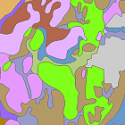
Übersichtsbodenkarte von Bayern 1:25.000 (ÜBK25) - Downloaddienst
Die Übersichtsbodenkarte 1:25.000 (ÜBK25) ist aus vorhandenen Unterlagen konzeptionell abgeleitet und durch Übersichtbegehungen im Gelände überprüft und ergänzt. Die ÜBK25 ist blattschnittfrei, liegt flächendeckend für Bayern vor und verfügt über eine einheitliche Legende über alle Kartenblätter. Alle 613 Kartenblätter werden im "UmweltAtlas Bayern" angezeigt und als Vektordaten im SHAPE-Format zum Download zur Verfügung gestellt. Zudem sind die Daten über Geodatendienste (WMS- und Downloaddienst) verfügbar oder können im Publikationsshop des StMUV als PDF bestellt werden.
|
|
Citation proposal
(2017) . Übersichtsbodenkarte von Bayern 1:25.000 (ÜBK25) - Downloaddienst. https://gdk.gdi-de.org/geonetwork/srv/api/records/052f9934-dd4b-4d3e-86d2-2c9eb6372e4e |
- Identification
- Distribution
- Quality
- Spatial rep.
- Ref. system
- Content
- Portrayal
- Metadata
- Md. constraints
- Md. maintenance
- Schema info
Identification
Identification info
Service Identification (19119)
Citation
- Alternate title
- Boden
- Date ( Publication )
- 2017-02-28T00:00:00.000+01:00
- Date ( Revision )
- 2023-03-16T00:00:00.000+01:00
- Status
- On going
Point of contact
- Website
- https://www.lfu.bayern.de
Distributor
- Website
- https://www.lfu.bayern.de
Maintenance information
- Maintenance and update frequency
- As needed
- Update scope
- Service
- GEMET - INSPIRE themes, version 1.0 ( Theme )
-
- Boden
- Service Classification, version 1.0 ( Theme )
-
- infoFeatureAccessService
- Keywords
-
- gdiby
- ÜBK25_Stand_Februar_2017
- ÜBK25
- opendata
- Spatial scope
- Keywords ( Theme )
-
- ENVI
- Keywords
-
- inspireidentifiziert
- Use limitation
- keine Einschränkungen
Legal constraints
- Use constraints
- Other restrictions
- Other constraints
- Creative Commons Namensnennung 4.0 International (CC BY 4.0); Bayerisches Landesamt für Umwelt, www.lfu.bayern.de
- Other constraints
- {"id":"cc-by/4.0","name":"Creative Commons Namensnennung 4.0 International (CC BY 4.0)","url":"https://creativecommons.org/licenses/by/4.0/deed.de","quelle":"Bayerisches Landesamt für Umwelt, www.lfu.bayern.de"}
Legal constraints
- Access constraints
- otherRestrictions Other restrictions
- Service Type
- download
- Service Version
- predefined ATOM
Extent
- Description
- Der Dienst ist bayernweit verfügbar.
N
S
E
W
))
Coupled Resource
- Operation Name
- GetDownloadServiceMetadata
Coupled Resource
- Operation Name
- DescribeSpatialDataset
Coupled Resource
- Operation Name
- GetSpatialDataset
Coupled Resource
- Operation Name
- GetCapabilities
- Coupling Type
- Tight
Contains Operations
- Operation Name
- GetDownloadServiceMetadata
- Distributed Computing Platforms
- Web services
- Connect Point
- https://www.lfu.bayern.de/gdi/dls/uebk25.xml
Contains Operations
- Operation Name
- DescribeSpatialDataset
- Distributed Computing Platforms
- Web services
- Connect Point
- https://www.lfu.bayern.de/gdi/dls/uebk25.xml
Contains Operations
- Operation Name
- GetSpatialDataset
- Distributed Computing Platforms
- Web services
- Connect Point
- https://www.lfu.bayern.de/gdi/dls/uebk25.xml
Contains Operations
- Operation Name
- GetCapabilities
- Distributed Computing Platforms
- Web services
- Connect Point
- https://www.lfu.bayern.de/gdi/dls/uebk25.xml
- Operates On
Distribution
Distribution
- Distribution format
-
- Sonstiges ()
Distributor
Distributor
- Website
- https://www.lfu.bayern.de
- Fees
- geldleistungsfrei
- OnLine resource
-
https://www.lfu.bayern.de/gdi/dls/uebk25.xml
URL des Dienstes
Quality
Data quality
Scope
- Hierarchy level
- Service
- Other
- service
Conformance result
Citation
- Date ( Publication )
- 2013-08-09
- Explanation
- see the referenced specification
- Pass
- true
Conformance result
Citation
- Date ( Publication )
- 2009-10-20
- Explanation
- see the referenced specification
- Pass
- true
Conformance result
Citation
- Date ( Publication )
- 2010-12-07
- Explanation
- see the referenced specification
- Pass
- false
Metadata
Metadata
- File identifier
- 052f9934-dd4b-4d3e-86d2-2c9eb6372e4e XML
- Metadata language
- German
- Character set
- UTF8
- Hierarchy level
- service Service
- Hierarchy level name
- service
- Date stamp
- 2024-07-09
- Metadata standard name
- ISO19119
- Metadata standard version
- 2005/PDAM 1
Point of contact
- Website
- https://www.lfu.bayern.de
Overviews
Provided by

Views
052f9934-dd4b-4d3e-86d2-2c9eb6372e4e
Access to the portal
Read here the full details and access to the data.
Associated resources
Not available