 www.geodatenkatalog.de (S2L)
Energie-Atlas Bayern: Statistik Installierte Leistung - WMS
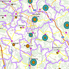
Statistische Daten zur installierten Leistung und Stromerzeugung von Biomasse-, Photovoltaik-, Wasserkraft- und Windenergie-Anlagen in Bayern - auf Gemeinde-, Landkreis- und Regierungsbezirksebene.
|
|
Citation proposal
(2019) . Energie-Atlas Bayern: Statistik Installierte Leistung - WMS. https://gdk.gdi-de.org/geonetwork/srv/api/records/06f23532-32ad-4225-8a09-404f6a085662 |
Simple
Identification info
- Alternate title
- Energie
- Date ( Publication )
- 2019-05-02T00:00:00.000+02:00
- Status
- On going
Point of contact
- Website
- https://www.lfu.bayern.de
Distributor
- Website
- https://www.lfu.bayern.de
- Maintenance and update frequency
- As needed
- Update scope
- Service
- Service Classification, version 1.0 ( Theme )
-
- infoMapAccessService
- Keywords
-
- gdiby
- Energie
- Energie-Atlas Bayern
- Statistik
- Strom
- Biomasse
- Photovoltaik
- Wasserkraft
- Windenergie
- installierte Leistung
- Gemeinde
- Landkreis
- Regierungsbezirk
- Use limitation
- keine Einschränkungen
- Use constraints
- Other restrictions
- Other constraints
- Creative Commons Namensnennung 4.0 International (CC BY 4.0); Datenquelle: Bayerisches Landesamt für Umwelt, www.lfu.bayern.de
- Other constraints
- {"id":"cc-by/4.0","name":"Creative Commons Namensnennung 4.0 International (CC BY 4.0)","url":"https://creativecommons.org/licenses/by/4.0/deed.de","quelle":"Bayerisches Landesamt für Umwelt, www.lfu.bayern.de"}
- Access constraints
- otherRestrictions Other restrictions
- Service Type
- view
- Service Version
- OGC:WMS 1.3.0
- Description
- Der Dienst ist begrenzt auf die Landesfläche Bayerns.
N
S
E
W
))
Coupled Resource
- Operation Name
- GetCapabilities
Coupled Resource
- Operation Name
- GetMap
Coupled Resource
- Operation Name
- GetFeatureInfo
Coupled Resource
- Operation Name
- esri_wms:GetStyles
Coupled Resource
- Operation Name
- GetCapabilities
Coupled Resource
- Operation Name
- GetMap
Coupled Resource
- Operation Name
- GetFeatureInfo
Coupled Resource
- Operation Name
- esri_wms:GetStyles
Coupled Resource
- Operation Name
- GetCapabilities
Coupled Resource
- Operation Name
- GetMap
Coupled Resource
- Operation Name
- GetFeatureInfo
Coupled Resource
- Operation Name
- esri_wms:GetStyles
Coupled Resource
- Operation Name
- GetCapabilities
Coupled Resource
- Operation Name
- GetMap
Coupled Resource
- Operation Name
- GetFeatureInfo
Coupled Resource
- Operation Name
- esri_wms:GetStyles
Coupled Resource
- Operation Name
- GetCapabilities
Coupled Resource
- Operation Name
- GetMap
Coupled Resource
- Operation Name
- GetFeatureInfo
Coupled Resource
- Operation Name
- esri_wms:GetStyles
Coupled Resource
- Operation Name
- GetCapabilities
Coupled Resource
- Operation Name
- GetMap
Coupled Resource
- Operation Name
- GetFeatureInfo
Coupled Resource
- Operation Name
- esri_wms:GetStyles
Coupled Resource
- Operation Name
- GetCapabilities
Coupled Resource
- Operation Name
- GetMap
Coupled Resource
- Operation Name
- GetFeatureInfo
Coupled Resource
- Operation Name
- esri_wms:GetStyles
Coupled Resource
- Operation Name
- GetCapabilities
Coupled Resource
- Operation Name
- GetMap
Coupled Resource
- Operation Name
- GetFeatureInfo
Coupled Resource
- Operation Name
- esri_wms:GetStyles
Coupled Resource
- Operation Name
- GetCapabilities
Coupled Resource
- Operation Name
- GetMap
Coupled Resource
- Operation Name
- GetFeatureInfo
Coupled Resource
- Operation Name
- esri_wms:GetStyles
Coupled Resource
- Operation Name
- GetCapabilities
Coupled Resource
- Operation Name
- GetMap
Coupled Resource
- Operation Name
- GetFeatureInfo
Coupled Resource
- Operation Name
- esri_wms:GetStyles
Coupled Resource
- Operation Name
- GetCapabilities
Coupled Resource
- Operation Name
- GetMap
Coupled Resource
- Operation Name
- GetFeatureInfo
Coupled Resource
- Operation Name
- esri_wms:GetStyles
Coupled Resource
- Operation Name
- GetCapabilities
Coupled Resource
- Operation Name
- GetMap
Coupled Resource
- Operation Name
- GetFeatureInfo
Coupled Resource
- Operation Name
- esri_wms:GetStyles
- Coupling Type
- Tight
Contains Operations
- Operation Name
- GetCapabilities
- Distributed Computing Platforms
- Web services
- Operation Description
- application/vnd.ogc.wms_xml; text/xml;
Contains Operations
- Operation Name
- GetMap
- Distributed Computing Platforms
- Web services
- Operation Description
- image/bmp; image/jpeg; image/tiff; image/png; image/png8; image/png24; image/png32; image/gif; image/svg+xml;
Contains Operations
- Operation Name
- GetFeatureInfo
- Distributed Computing Platforms
- Web services
- Operation Description
- application/vnd.esri.wms_raw_xml; application/vnd.esri.wms_featureinfo_xml; application/vnd.ogc.wms_xml; text/xml; text/html; text/plain;
Contains Operations
- Operation Name
- esri_wms:GetStyles
- Distributed Computing Platforms
- Web services
- Operation Description
- application/vnd.ogc.sld+xml;
- Operates On
-
- Strom aus Biomasse - Installierte Leistung (Reg.-Bez.)
- Strom aus Windenergie - Installierte Leistung (Lkr.)
- Strom aus Photovoltaik - Installierte Leistung (Lkr.)
- Strom aus Windenergie - Installierte Leistung (Gem.)
- Strom aus Wasserkraft - Installierte Leistung (Gem.)
- Strom aus Photovoltaik - Installierte Leistung (Gem.)
- Strom aus Windenergie - Installierte Leistung (Reg.-Bez.)
- Strom aus Wasserkraft - Installierte Leistung (Reg.-Bez.)
- Strom aus Photovoltaik - Installierte Leistung (Reg.-Bez.)
- Strom aus Biomasse - Installierte Leistung (Gem.)
- Strom aus Wasserkraft - Installierte Leistung (Lkr.)
- Strom aus Biomasse - Installierte Leistung (Lkr.)
- Distribution format
-
- Sonstiges ()
Distributor
Distributor
- Website
- https://www.lfu.bayern.de
- Fees
- geldleistungsfrei
- OnLine resource
-
URL des Dienstes
URL des Dienstes
- OnLine resource
-
Dienst "Energie-Atlas Bayern: Statistik Installierte Leistung - WMS" (GetCapabilities)
application/vnd.ogc.wms_xml; text/xml;
gmd:MD_Metadata
- File identifier
- 06f23532-32ad-4225-8a09-404f6a085662 XML
- Metadata language
- German
- Character set
- UTF8
- Hierarchy level
- service Service
- Hierarchy level name
- service
- Date stamp
- 2024-06-28
- Metadata standard name
- ISO19119
- Metadata standard version
- 2005/PDAM 1
Point of contact
- Website
- https://www.lfu.bayern.de
Overviews
Provided by

Views
06f23532-32ad-4225-8a09-404f6a085662
Access to the portal
Read here the full details and access to the data.
Associated resources
Not available