 www.geodatenkatalog.de (S3L)
Ökoflächenkataster - WMS
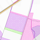
Das ÖFK 2020 (Ökoflächenkataster) ist ein Verzeichnis ökologisch bedeutsamer Flächen. Darin aufgenommen werden für den Naturschutz angekaufte bzw. gepachtete Flächen, Ausgleichs- und Ersatzflächen gemäß der naturschutzrechtlichen und der baurechtlichen Eingriffsregelung, Landschaftspflegeflächen der ländlichen Entwicklung (Flurb) und Ökokontoflächen. Die Daten des Ökoflächenkatasters werden auf Grundlage der digitalen Flurkarte erfasst. Die unterschiedlichen Flächentypen werden verschiedenfarbig dargestellt.
|
|
Citation proposal
(2023) . Ökoflächenkataster - WMS. https://gdk.gdi-de.org/geonetwork/srv/api/records/08700f56-611f-4481-ac4f-ec85975ff9a7 |
Simple
Identification info
- Alternate title
- Natur
- Date ( Publication )
- 2023-03-31T00:00:00.000+02:00
- Status
- On going
Point of contact
- Website
- https://www.lfu.bayern.de
- Maintenance and update frequency
- Weekly
- Update scope
- Service
- Service Classification, version 1.0 ( Theme )
-
- infoMapAccessService
- Keywords
-
- gdiby
- Ökoflächenkataster
- ÖFK 2020
- Ökokonto
- Ökoflächen
- Use limitation
- keine Einschränkungen
- Use constraints
- Other restrictions
- Other constraints
- Creative Commons Namensnennung 4.0 International (CC BY 4.0); Datenquelle: Bayerisches Landesamt für Umwelt, www.lfu.bayern.de
- Other constraints
- {"id":"cc-by/4.0","name":"Creative Commons Namensnennung 4.0 International (CC BY 4.0)","url":"https://creativecommons.org/licenses/by/4.0/deed.de","quelle":"Bayerisches Landesamt für Umwelt, www.lfu.bayern.de"}
- Access constraints
- otherRestrictions Other restrictions
- Service Type
- view
- Service Version
- OGC:WMS 1.3.0
- Description
- Der Dienst umfasst die Landesfläche Bayerns.
N
S
E
W
))
Coupled Resource
- Operation Name
- GetCapabilities
Coupled Resource
- Operation Name
- GetMap
Coupled Resource
- Operation Name
- GetFeatureInfo
Coupled Resource
- Operation Name
- esri_wms:GetStyles
Coupled Resource
- Operation Name
- GetCapabilities
Coupled Resource
- Operation Name
- GetMap
Coupled Resource
- Operation Name
- GetFeatureInfo
Coupled Resource
- Operation Name
- esri_wms:GetStyles
Coupled Resource
- Operation Name
- GetCapabilities
Coupled Resource
- Operation Name
- GetMap
Coupled Resource
- Operation Name
- GetFeatureInfo
Coupled Resource
- Operation Name
- esri_wms:GetStyles
Coupled Resource
- Operation Name
- GetCapabilities
Coupled Resource
- Operation Name
- GetMap
Coupled Resource
- Operation Name
- GetFeatureInfo
Coupled Resource
- Operation Name
- esri_wms:GetStyles
- Coupling Type
- Tight
Contains Operations
- Operation Name
- GetCapabilities
- Distributed Computing Platforms
- Web services
- Operation Description
- application/vnd.ogc.wms_xml; text/xml;
Contains Operations
- Operation Name
- GetMap
- Distributed Computing Platforms
- Web services
- Operation Description
- image/bmp; image/jpeg; image/tiff; image/png; image/png8; image/png24; image/png32; image/gif; image/svg+xml;
- Connect Point
- https://www.lfu.bayern.de/gdi/wms/natur/oefk?
Contains Operations
- Operation Name
- GetFeatureInfo
- Distributed Computing Platforms
- Web services
- Operation Description
- application/vnd.esri.wms_raw_xml; application/vnd.esri.wms_featureinfo_xml; application/vnd.ogc.wms_xml; application/geojson; text/xml; text/html; text/plain;
- Connect Point
- https://www.lfu.bayern.de/gdi/wms/natur/oefk?
Contains Operations
- Operation Name
- esri_wms:GetStyles
- Distributed Computing Platforms
- Web services
- Operation Description
- application/vnd.ogc.sld+xml;
- Connect Point
- https://www.lfu.bayern.de/gdi/wms/natur/oefk?
- Distribution format
-
- Sonstiges ()
Distributor
Distributor
- Website
- https://www.lfu.bayern.de
- Fees
- geldleistungsfrei
- OnLine resource
-
URL des Dienstes
URL des Dienstes
- OnLine resource
-
Informationsseite des LfU zu Ökoflächenkataster + Ökokonto
Informationsseite des LfU und weiterführende Informationen
- OnLine resource
-
Dienst "Ökoflächenkataster - WMS" (GetCapabilities)
application/vnd.ogc.wms_xml; text/xml;
gmd:MD_Metadata
- File identifier
- 08700f56-611f-4481-ac4f-ec85975ff9a7 XML
- Metadata language
- German
- Character set
- UTF8
- Hierarchy level
- service Service
- Hierarchy level name
- service
- Date stamp
- 2025-08-13
- Metadata standard name
- ISO19119
- Metadata standard version
- 2005/PDAM 1
Point of contact
- Website
- https://www.lfu.bayern.de
Overviews
Provided by

Views
08700f56-611f-4481-ac4f-ec85975ff9a7
Access to the portal
Read here the full details and access to the data.
Associated resources
Not available