 www.geodatenkatalog.de (S3L)
Biotopkataster - Geschützte Biotope (GB), Fläche
|
|
Citation proposal
. Biotopkataster - Geschützte Biotope (GB), Fläche. Ministerium für Umwelt, Klima, Mobilität, Agrar und Verbraucherschutz https://gdk.gdi-de.org/geonetwork/srv/api/records/0b645b03-7d75-3e4c-aaba-69a41b504c75 |
Simple
Identification info
- Alternate title
- Date ( Revision )
- 2025-04-15
- Keywords
-
- Biotope
- Biotopkartierung
- Biotopkataster
- Geschützte Biotope
- Regional
- opendata
- HVD
- opendata
- infoMapAccessService
- inspireidentifiziert
- natur_landschaft
- High-Value dataset categories
- Access constraints
- Other restrictions
- Use constraints
- Other restrictions
- Other constraints
- Lizenz: cc-by-4.0 - Namensnennung 4.0 International - https://creativecommons.org/licenses/by/4.0/deed.de - Quellenvermerk: © GDI-SL (Jahr)
- Other constraints
- {"id":"cc-by-4.0","name":"Namensnennung 4.0 International","url":"https://creativecommons.org/licenses/by/4.0/deed.de","quelle":"© GDI-SL (Jahr)"}
- Service Type
- view
- Service Version
- OGC:WMS 1.1.1
))
- Coupling Type
- Tight
Contains Operations
- Operation Name
- GetCapabilities
- Distributed Computing Platforms
- Web services
- Distribution format
-
- ()
- OnLine resource
-
Geschuetzte_Biotope_f
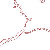
Geschützte Biotope des Saarlandes in flächenhafter Ausprägung. In dieser Objektklasse werden Flächen erfasst und dargestellt, die nach § 22 SNG in Verbindung mit § 30 BNatSchG geschützt sind. Es können mehrere Biotoptypen gemeinsam in einer GB-Fläche zusammengefasst werden, sofern sie eine sinnvolle funktionale Einheit bilden, z. B. Kalk-Halbtrockenrasen und wärmeliebende Gebüsche, genutzte Feuchtwiesen und Nasswiesen oder mesotraphente Mädesüßfluren und Großseggenwiesen. Betrachtungsobjekt im GDZ; Export der flächenhaften Featureklasse GDZ2010.A_nggbt und der Businesstabelle mit den Sachdaten (GDZ2010.nggbt) in die Filegdb. Außer zahlreichen datenbankinternen Attributen sind folgende anwenderrelevante Attribute vorhanden: KENNUNG : Kennung OSIRIS; BEZEICHNUNG; PROJ_URSPRUNG: Projekt Ursprung; NUTZUNGSTYP; EINSPEICHERUNGSDATUM:Datum der Übernahme in OSIRIS; AUFNAHMETYP; FLAECHENANZAHL; OFFIZIEL_FL : Fläche in ha (offiziell); GEOGENAU: Geometrische Genauigkeit; GKRW: Rechtswert; GKHW: Hochwert; INSDATE: Datum der Übernahme in GDZ; BEMERKNG;
- Hierarchy level
- service Service
- Other
- Dienst
Conformance result
- Date ( Publication )
- 2010-12-08
- Explanation
- No explanation available
- Pass
- true
Conformance result
- Date ( Publication )
- 2009-10-20
- Explanation
- No explanation available
- Pass
- true
Conformance result
- Date ( Publication )
- 2014-12-11
- Explanation
- No explanation available
- Pass
- true
Conformance result
- Date ( Publication )
- 2008-12-04
- Explanation
- No explanation available
- Pass
- true
Conformance result
- Date ( Publication )
- 2014-12-11
- Explanation
- No explanation available
- Pass
- true
Conformance result
- Date ( Publication )
- 2013-12-10
- Explanation
- No explanation available
- Pass
- true
Conformance result
- Date ( Publication )
- 2011-02-05
- Explanation
- No explanation available
- Pass
- true
Conformance result
- Date ( Publication )
- 2010-12-08
- Explanation
- No explanation available
- Pass
- true
gmd:MD_Metadata
- File identifier
- 0b645b03-7d75-3e4c-aaba-69a41b504c75 XML
- Metadata language
- ger German
- Character set
- UTF8
- Hierarchy level
- service Service
- Hierarchy level name
- Darstellungsdienst
- Date stamp
- 2025-04-15
- Metadata standard name
- ISO19119
- Metadata standard version
- 2005/PDAM 1
Point of contact
Overviews
Provided by
