 My GeoNetwork catalogue
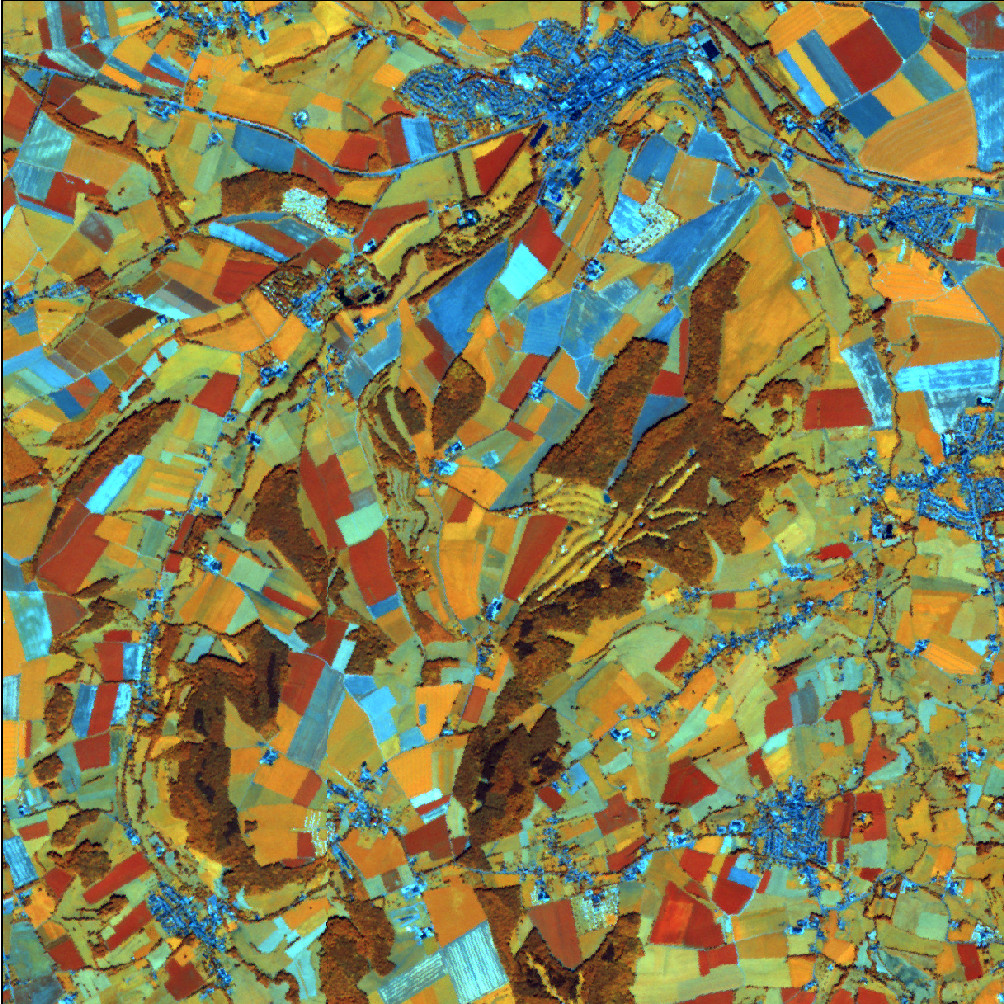
RapidEye Satellitenbilddaten 2012
Es handelt sich um Satellitenbilder der Konstellation RapidEye mit einer Bodenauflösung von 5m und 5 Spektralkanälen. Neben dem sichtbaren Spektralbereich (Rot, Grün, Blau) wird auch Strahlung im Infrarot-Bereich detektiert (nahes Infrarot, RedEdge). Die zusätzlichen Spektralkanäle ermöglichen eine differenzierte Analyse der Vegetation.
INSPIRE
Identification
- File identifier
- 1075885C-FA6D-4223-8C47-5CE3C5A41A73 XML
- Hierarchy level
- Dataset
Online resource
- Protocol
- OGC Web Map Service
Resource identifier
- Metadata language
- Deutsch
Encoding
- Format
-
TIFF
Projection
Classification of data and services
- Topic category
-
- Imagery base maps earth cover
Classification of data and services
Coupled resource
Coupled resource
Classification of data and services
Coupled resource
Coupled resource
Keywords
-
GEMET - Concepts, version 3.1
Geographic coverage
))
Temporal reference
Temporal extent
- Begin
- 2012-01-01T00:00:00.000+01:00
- End
- 2012-12-31T00:00:00.000+01:00
Temporal extent
- Date (Creation)
- 2013-01-01T00:00:00.000+01:00
Quality and validity
- Lineage
-
Mittels CCD-Sensor aufgezeichnete, elektromagnetische Strahlung
- Distance
- 5 meter
Conformity
Conformity
Conformity
Conformity
Conformity
Conformity
Restrictions on access and use
- Access constraints
-
Quellenvermerk: Includes material © (Jahr) Planet Labs Netherlands BV. All rights reserved.
- Access constraints
-
Es gelten Zugriffsbeschränkungen. Für den Erwerb von Nutzungsrechten wenden Sie sich deshalb bitte an die Zentrale Stelle Geotopographie der AdV (ZSGT) / Dienstleistungszentrum (DLZ) des Bundesamtes für Kartographie und Geodäsie: https://www.bkg.bund.de/DE/Service/Kontakt/kontakt.html .
Responsible organization (s)
Contact for the resource
- Organisation name
-
Bundesamt für Kartographie und Geodäsie (BKG)
- Organisation name
-
Bundesamt für Kartographie und Geodäsie (BKG)
Responsible organization (s)
Contact for the resource
- Organisation name
-
Bundesamt für Kartographie und Geodäsie (BKG)
- Organisation name
-
Bundesamt für Kartographie und Geodäsie (BKG)
Metadata information
Contact for the metadata
- Organisation name
-
Bundesamt für Kartographie und Geodäsie (BKG)
- Date stamp
- 2026-05-05
- Metadata language
- Deutsch
SDS
Conformance class 1: invocable
Access Point URL
Endpoint URL
Technical specification
Conformance class 2: interoperable
Access constraints
Limitation
Use constraints
Limitation
Responsible custodian
Contact for the resource
Overviews
Spatial extent
Provided by
