 www.geodatenkatalog.de (S3L)
IS GK 100 DS - Informationssystem Geologische Karte von Nordrhein-Westfalen 1:100.000 - Datensatz
Der Datensatz zum Informationssystem Geologische Karte von Nordrhein-Westfalen 1:100.000 [IS GK 100] stellt geologische Fachdaten über Alter, Beschaffenheit und Verbreitung der Gesteine zur Verfügung. Das Kartenwerk enthält eine flächendeckende, blattschnittfreie und durch neue Kartiererkenntnisse in regelmäßigen Abständen aktualisierte Karte. Es ist eine wichtige Planungsgrundlage bei großräumigen Nutzungsvorhaben der Landesplanung: Rohstoffgewinnung, Baugrundsicherung, Grundwassererschließung oder Ausweisung von Naturschutzgebieten. Verfügbare Kartenthemen: Geologische Oberflächenkarte bis 2 Meter Tiefe (Deckschichten), Geologische Karte in 2 Meter Tiefe (Hauptschichten) und Verlauf der Verwerfungen (Tektonik).
|
|
Citation proposal
. IS GK 100 DS - Informationssystem Geologische Karte von Nordrhein-Westfalen 1:100.000 - Datensatz. https://gdk.gdi-de.org/geonetwork/srv/api/records/11ED9860-D540-4F77-8AF8-97CEE14CE91F |
INSPIRE
Identification
- File identifier
- 11ED9860-D540-4F77-8AF8-97CEE14CE91F XML
- Hierarchy level
- dataset Dataset
Online resource
Resource identifier
- Metadata language
- German
- Spatial representation type
- Vector
Encoding
- Format
- Geodatabase
- Version
- 10.x
- Format
- Shape
- Version
- n.a.
Projection
Classification of data and services
- Topic category
-
- Geoscientific information
Classification of data and services
Coupled resource
Coupled resource
Classification of data and services
Coupled resource
Coupled resource
Keywords
- UMTHES Thesaurus ( Theme )
-
- Geologie
- Untergrund
- Gestein
- Störung
- Verwerfung
- OGDD-Kategorien
-
- geo
Other keywords
- Keywords ( Discipline )
-
- Geologische Karte
- Regionalgeologie
- Keywords ( Theme )
-
- ISGK100
- opendata
Geographic coverage
N
S
E
W
))
Temporal reference
Temporal extent
Temporal extent
- Date ( Revision )
- 2009-01-01
Quality and validity
- Lineage
- Teil des Geologischen Informationssysstems, abgeleitet aus der GK 100, blattschnittfrei
- Denominator
- 100000
Conformity
Conformity
Conformity
Conformity
Conformity
Conformity
Restrictions on access and use
- Access constraints
- {"id": "dl-by-de/2.0","name": "Datenlizenz Deutschland Namensnennung 2.0","url": "https://www.govdata.de/dl-de/by-2-0","quelle": "ISGK100@Geologischer Dienst NRW, 2009"}
Restrictions on access and use
Responsible organization (s)
Contact for the resource
- Organisation name
- Geologischer Dienst NRW
- geodaten@gd.nrw.de
Responsible organization (s)
Contact for the resource
- Organisation name
- Geologischer Dienst NRW
- geodaten@gd.nrw.de
Metadata information
Contact for the metadata
- Organisation name
- Geologischer Dienst NRW
- metadaten@gd.nrw.de
- Date stamp
- 2023-06-28
- Metadata language
- ger German
- Character set
- UTF8
SDS
Conformance class 1: invocable
Access Point URL
Endpoint URL
Technical specification
Conformance class 2: interoperable
Coordinate reference system
Quality of Service
Access constraints
Limitation
Use constraints
Limitation
Responsible custodian
Contact for the resource
Conformance class 3: harmonized
Overviews
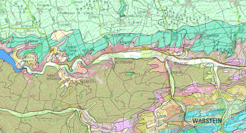
Vorschaubild GK 100
Provided by

Views
11ED9860-D540-4F77-8AF8-97CEE14CE91F
Access to the portal
Read here the full details and access to the data.
Associated resources
Not available