 www.geodatenkatalog.de (S3L)
Höhenschichtenkarte des Landes Brandenburg 1 : 500 000
Die Höhenschichtenkarte des Landes Brandenburg 1 : 500 000 stellt die Höhenlagen in unterschiedlich gefärbten Flächenfarben (Höhenschichten) dar. Zur besseren Orientierung sind zusätzlich die wichtigsten Eisenbahnlinien und Orte in der Karte enthalten. Brandenburg gehört als Flächenland zum Norddeutschen Tiefland und weist wie dieses nur relativ geringe Höhenunterschiede auf.
|
|
Citation proposal
. Höhenschichtenkarte des Landes Brandenburg 1 : 500 000. Landesvermessung und Geobasisinformation Brandenburg (LGB) https://gdk.gdi-de.org/geonetwork/srv/api/records/17ed1512-1ad0-4919-aeee-fbec7ef17d76 |
INSPIRE
Identification
- File identifier
- 17ed1512-1ad0-4919-aeee-fbec7ef17d76 XML
- Hierarchy level
- dataset Dataset
Online resource
Resource identifier
- Metadata language
- ger German
Encoding
Projection
Classification of data and services
- Topic category
-
- Geoscientific information
Classification of data and services
Coupled resource
Coupled resource
Classification of data and services
Coupled resource
Coupled resource
Keywords
- GEMET - INSPIRE themes, version 1.0 ( Theme )
-
- Bodenbedeckung
- BE/BB Schlagwortliste, Version 1.0 ( Theme )
-
- Vermessung
Other keywords
- Keywords
-
- opendata
- Keywords ( Theme )
-
- 1:200.000 - 1:500.000
- Relief
- Karte
Geographic coverage
N
S
E
W
))
Temporal reference
Temporal extent
Temporal extent
- Date ( Revision )
- 2000-12-31T00:00:00
- Date ( Creation )
- 2000-12-31T00:00:00
Quality and validity
- Lineage
- Eine Auskunft über die Herkunft der Daten erhalten Sie per Anfrage an die E-Mail kundenservice@geobasis-bb.de.
- Denominator
- 500000
Conformity
Conformity
Conformity
Conformity
Conformity
Conformity
Restrictions on access and use
- Access constraints
- Die Daten können gemäß der „Datenlizenz Deutschland - Namensnennung - Version 2.0“ (https://www.govdata.de/dl-de/by-2-0) genutzt werden. Namensnennung: "GeoBasis-DE/LGB", Beispiel: „© GeoBasis-DE/LGB, dl-de/by-2-0, (Daten geändert)“, (Klammer = optional)
- Access constraints
- {"id":"dl-by-de/2.0","name":"Datenlizenz Deutschland - Namensnennung - Version 2.0","url":"https://www.govdata.de/dl-de/by-2-0","quelle":"Quelle: © GeoBasis-DE/LGB, dl-de/by-2-0"}
Restrictions on access and use
Responsible organization (s)
Contact for the resource
- Organisation name
- Landesvermessung und Geobasisinformation Brandenburg (LGB)
Responsible organization (s)
Contact for the resource
- Organisation name
- Landesvermessung und Geobasisinformation Brandenburg (LGB)
Metadata information
Contact for the metadata
- Organisation name
- Landesvermessung und Geobasisinformation Brandenburg (LGB)
- Date stamp
- 2020-02-27T15:29:10
- Metadata language
- ger German
- Character set
- utf8 UTF8
SDS
Conformance class 1: invocable
Access Point URL
Endpoint URL
Technical specification
Conformance class 2: interoperable
Coordinate reference system
Quality of Service
Access constraints
Limitation
Use constraints
Limitation
Responsible custodian
Contact for the resource
Conformance class 3: harmonized
Overviews
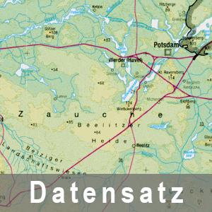
Ausschnitt aus der Höhenschichtenkarte des Landes Brandenburg 1 : 500 000
Provided by

Views
17ed1512-1ad0-4919-aeee-fbec7ef17d76
Access to the portal
Read here the full details and access to the data.
Associated resources
Not available