 My GeoNetwork catalogue
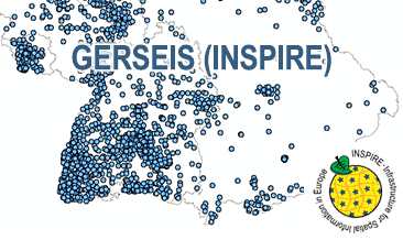
INSPIRE: German Earthquake Catalogue (GERSEIS)
The German Earthquake Catalogue is based on a database providing information on the seismicity in Germany an adjacent areas. It contains locations of seismic events since year 800 where their epicentre determinations are based on historical sources as well as on measurements at seismometer stations since the start of instrumental seismological recording in the 20th century. Today, digital data acquisition at seismometer stations of the German regional seismic network (GRSN), the seismic GERES array, and the Gräfenberg array (GRF) takes place. All events with a local magnitude ML 2.0 and higher are listed. The GML file together with a Readme.txt file are provided in ZIP format (GERSEIS-INSPIRE.zip). The Readme.text file (German/English) contains detailed information on the GML file content. Data transformation was proceeded by using the INSPIRE Solution Pack for FME according to the INSPIRE requirements. Due to the continuous processing of the seismic events, the INSPIRE dataset is updated annually.
INSPIRE
Identification
- File identifier
- 18383924-d115-47c5-b443-6d3e5c01a87b XML
- Hierarchy level
- Dataset
Online resource
Resource identifier
- Metadata language
- Deutsch
- Spatial representation type
- Vector
Encoding
- Format
-
INSPIRE-GML
- Version
-
n/a
Projection
- code
- EPSG:25832
Classification of data and services
- Topic category
-
- Geoscientific information
Classification of data and services
Coupled resource
Coupled resource
Classification of data and services
Coupled resource
Coupled resource
Keywords
-
GEMET - INSPIRE themes, version 1.0
-
-
Gebiete mit naturbedingten Risiken
-
-
GEMET - Concepts, version 2.4
-
-
Seismische Überwachung
-
-
Spatial scope
-
-
National
-
-
High-value dataset categories
-
-
Erdbeobachtung und Umwelt
-
Other keywords
- Theme
-
-
Seismologie
-
Epizentrum
-
Erdbeben
-
Induzierte Seismizität
-
Tektonik
-
inspireidentifiziert
-
opendata
-
- Place
-
-
Germany and its EEZ
-
Deutschland und deutsche AWZ
-
Geographic coverage
))
Temporal reference
Temporal extent
Temporal extent
- Date (Creation)
- 2018-07-26
Quality and validity
- Lineage
-
The GERSEIS (INSPIRE) GML file is based on historical descriptions of damages due to earthquakes and measured and analysed data of current earthquakes recorded by the German seismological stations transformed according to INSPIRE.
Conformity
Conformity
Conformity
Conformity
Conformity
Conformity
- Explanation
-
See the referenced specification
- Explanation
-
See the referenced specification
Restrictions on access and use
- Access constraints
- Es gelten keine Zugriffsbeschränkungen
- Access constraints
-
Allgemeine Geschäftsbedingungen, siehe https://www.bgr.bund.de/AGB - General terms and conditions, see https://www.bgr.bund.de/AGB_en . Die bereitgestellten Informationen sind bei Weiterverwendung wie folgt zu zitieren: Datenquelle: GERSEIS-INSPIRE, (c) BGR, Hannover, 2018
- Access constraints
-
Dieser Datensatz kann gemäß der "Nutzungsbestimmungen für die Bereitstellung von Geodaten des Bundes" ( https://sg.geodatenzentrum.de/web_public/gdz/lizenz/geonutzv.pdf ) genutzt werden.
- Access constraints
-
{"id": "geoNutz/20130319", "name": "Nutzungsbestimmungen für die Bereitstellung von Geodaten des Bundes", "url": " https://sg.geodatenzentrum.de/web_public/gdz/lizenz/geonutzv.pdf ", "quelle": "GERSEIS-INSPIRE, (c) BGR, Hannover, 2018"}
Responsible organization (s)
Contact for the resource
- Organisation name
-
Bundesanstalt für Geowissenschaften und Rohstoffe
Responsible organization (s)
Contact for the resource
- Organisation name
-
Bundesanstalt für Geowissenschaften und Rohstoffe
Metadata information
Contact for the metadata
- Organisation name
-
Bundesanstalt für Geowissenschaften und Rohstoffe (BGR)
- Date stamp
- 2025-04-07
- Metadata language
- English
- Character set
- UTF8
SDS
Conformance class 1: invocable
Access Point URL
Endpoint URL
Technical specification
Conformance class 2: interoperable
Access constraints
Limitation
Use constraints
Limitation
Responsible custodian
Contact for the resource
Overviews
Spatial extent
Provided by
