 My GeoNetwork catalogue
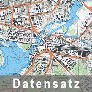
Topographische Karte 1 : 25 000 - Ausgabe Staat (1981-1989) N-33-97-B-b Zepkow
Die als Ausgabe Staat (AS) bezeichneten Topographischen Kartenwerke hatten vorrangig militärische Zweckbestimmung und trugen den Geheimhaltungsgrad Vertrauliche Verschlusssache. Im Maßstab 1 : 25 000 gab es 2 Ausgabevarianten: TK=topographische Karten und TSP=Topographische Stadtpläne.
INSPIRE
Identification
- File identifier
- 1ca87c74-696a-425e-8042-215b03466f98 XML
- Hierarchy level
- Dataset
Resource identifier
- Metadata language
- Deutsch
Encoding
Projection
Classification of data and services
- Topic category
-
- Imagery base maps earth cover
Classification of data and services
Coupled resource
Coupled resource
Classification of data and services
Coupled resource
Coupled resource
Keywords
-
BE/BB Schlagwortliste, Version 1.0
-
-
Vermessung
-
Other keywords
- Keywords
-
-
opendata
-
- Theme
-
-
Historisch
-
Karte
-
bodenbedeckung
-
1:25.000
-
Geographic coverage
))
Temporal reference
Temporal extent
Temporal extent
- Date (Revision)
- 1985-01-01T00:00:00
- Date (Creation)
- 1953-01-01T00:00:00
Quality and validity
- Lineage
-
Eine Auskunft über die Herkunft der Daten erhalten Sie per Anfrage an die E-Mail kundenservice@geobasis-bb.de .
- Denominator
- 25000
Conformity
Conformity
Conformity
Conformity
Conformity
Conformity
Restrictions on access and use
- Access constraints
-
Die Daten können gemäß der „Datenlizenz Deutschland - Namensnennung - Version 2.0“ ( https://www.govdata.de/dl-de/by-2-0 ) genutzt werden. Namensnennung: "GeoBasis-DE/LGB", Beispiel: „© GeoBasis-DE/LGB, dl-de/by-2-0, (Daten geändert)“, (Klammer = optional)
- Access constraints
-
{"id":"dl-by-de/2.0","name":"Datenlizenz Deutschland - Namensnennung - Version 2.0","url":" https://www.govdata.de/dl-de/by-2-0","quelle":"Quelle : © GeoBasis-DE/LGB, dl-de/by-2-0"}
- Access constraints
- Es gelten keine Zugriffsbeschränkungen
Responsible organization (s)
Contact for the resource
- Organisation name
-
Landesvermessung und Geobasisinformation Brandenburg (LGB)
Responsible organization (s)
Contact for the resource
- Organisation name
-
Landesvermessung und Geobasisinformation Brandenburg (LGB)
Metadata information
Contact for the metadata
- Organisation name
-
Landesvermessung und Geobasisinformation Brandenburg (LGB)
- Date stamp
- 2026-03-09T14:14:12
- Metadata language
- Deutsch
- Character set
- UTF8
SDS
Conformance class 1: invocable
Access Point URL
Endpoint URL
Technical specification
Conformance class 2: interoperable
Access constraints
Limitation
Use constraints
Limitation
Responsible custodian
Contact for the resource
Overviews
Spatial extent
Provided by
