 My GeoNetwork catalogue
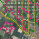
Schutzgebiete des Naturschutzes - WMS
Schutzgebiete in Bayern sind rechtlich geschützte Flächen mit folgenden Zielen: Landschaftsschutz, Erhaltung des Naturhaushalts, Schutz von Arten und ihren Lebensräumen sowie gelenkte Erholungsnutzung. Die Abgrenzungen der FFH- und Vogelschutzgebiete sind durch die "Bayerische Verordnung über die Natura 2000-Gebiete" vom 19.02.2016 rechtsverbindlich festgelegt. Die Bayerische Gesamtmeldung wird im Maßstab 1:5.000 angeboten. (Aktualisierung am 01.05. und 01.12. jährlich)
- Identification
- Distribution
- Quality
- Spatial rep.
- Ref. system
- Content
- Portrayal
- Metadata
- Md. constraints
- Md. maintenance
- Schema info
Identification
Identification info
Service Identification (19119)
Citation
- Alternate title
-
Natur
- Date (Creation)
- 2020-05-01T00:00:00.000+02:00
- Status
- On going
Maintenance information
- Maintenance and update frequency
- Biannually
- Update scope
- Service
- Maintenance note
-
Aktualisierungen immer zum 01.05. und 01.12. jeden Jahres, sofern neue Daten vorliegen.
Das Publikationsdatum ist nicht bekannt. Das Erstellungsdatum bezieht sich auf die Umstellung der Daten von GKK4 auf das Koordinatensystem UTM32N.
-
GEMET - INSPIRE themes, version 1.0
-
-
Schutzgebiete
-
-
Service Classification, version 1.0
-
-
infoMapAccessService
-
- Keywords
-
-
gdiby
-
EU-Richtlinie
-
geschützter Landschaftsbestandteil
-
Naturdenkmal
-
Nationale Naturmonumente
-
Schutzgebiete
-
Protected sites
-
Umweltschutz
-
Naturschutz
-
Landschaftsschutz
-
Landschaft
-
Naturhaushalt
-
natürliche Lebensräume
-
nachhaltige Nutzung
-
Ökosysteme
-
Tourismus
-
umweltverträgliche Landnutzung
-
Vogelschutz
-
NATURA 2000
-
Vogelarten
-
Lebensraumtypen
-
Arten
-
Nationalpark
-
Biosphärenreservat
-
Naturschutzgebiet
-
Landschaftsschutzgebiet
-
Naturpark
-
EU-Vogelschutzgebiet
-
Fauna-Flora-Habitat Gebiet
-
- Keywords
-
-
inspireidentifiziert
-
- Use limitation
-
Rechtsverbindliche Schutzgebietsgrenzen sind bei der jeweils zuständigen Naturschutzbehörde einzusehen. Die hier angegebenen Flächenangaben sind digital berechnet und können von der jeweiligen Verordnungsfläche abweichen.
Legal constraints
- Use constraints
- Other restrictions
- Other constraints
-
Creative Commons Namensnennung 4.0 International (CC BY 4.0); Datenquelle: Bayerisches Landesamt für Umwelt, www.lfu.bayern.de
- Other constraints
-
{"id":"cc-by/4.0","name":"Creative Commons Namensnennung 4.0 International (CC BY 4.0)","url":" https://creativecommons.org/licenses/by/4.0/deed.de","quelle":"Bayerisches Landesamt für Umwelt, www.lfu.bayern.de"}
Legal constraints
- Access constraints
- Other restrictions
- Other constraints
- Es gelten keine Zugriffsbeschränkungen
- Service Type
- view
- Service Version
-
OGC:WMS 1.3.0
Extent
- Description
-
Der Dienst umfasst die Landesfläche Bayerns.
))
- Coupling Type
- Tight
Contains Operations
- Operation Name
-
GetCapabilities
- Distributed Computing Platforms
- Web services
- Operation Description
-
application/vnd.ogc.wms_xml;
Contains Operations
- Operation Name
-
GetMap
- Distributed Computing Platforms
- Web services
- Operation Description
-
image/png; image/jpeg; image/gif;
- Connect Point
- https://www.lfu.bayern.de/gdi/wms/natur/schutzgebiete?
Contains Operations
- Operation Name
-
GetFeatureInfo
- Distributed Computing Platforms
- Web services
- Operation Description
-
application/vnd.ogc.wms_xml; text/xml; text/html; text/plain;
- Connect Point
- https://www.lfu.bayern.de/gdi/wms/natur/schutzgebiete?
- Operates On
Distribution
Distribution
- Distribution format
-
-
Sonstiges
()
-
Sonstiges
()
Distributor
- Fees
-
geldleistungsfrei
- OnLine resource
-
URL des WMS-Dienstes
URL des Dienstes
- OnLine resource
-
Dienst "Schutzgebiete des Naturschutzes - WMS" (GetCapabilities)
(
OGC Web Map Service
)
application/vnd.ogc.wms_xml;
Quality
Data quality
Scope
- Hierarchy level
- Service
- Other
-
service
Conformance result
Citation
- Date (Publication)
- 2013-04-04
- Explanation
-
see the referenced specification
- Pass
- Yes
Conformance result
Citation
- Date (Publication)
- 2009-10-20
- Explanation
-
see the referenced specification
- Pass
- Yes
Conformance result
Citation
- Date (Publication)
- 2010-12-07
- Explanation
-
see the referenced specification
- Pass
- No
Ref. system
- Unique resource identifier
- EPSG 4326: WGS 84 / geographisch
- Unique resource identifier
- EPSG 31467: DHDN / Gauss-Krüger Zone 3
- Unique resource identifier
- EPSG 31468: DHDN / Gauss-Krüger Zone 4
- Unique resource identifier
- EPSG 25833: ETRS89 / UTM Zone 33N
- Unique resource identifier
- EPSG 25832: ETRS89 / UTM Zone 32N
- Unique resource identifier
- EPSG 4258: ETRS89 / geographisch
- Unique resource identifier
- EPSG 3857: WGS 84 / Pseudo-Mercator
- Unique resource identifier
- EPSG 31258: MGI / Austria GK M31
Metadata
Metadata
- File identifier
- 1e025cc4-d4b1-378e-9924-45950aef2334 XML
- Metadata language
- Deutsch
- Character set
- UTF8
- Hierarchy level
- Service
- Hierarchy level name
-
service
- Date stamp
- 2026-04-08
- Metadata standard name
-
ISO19119
- Metadata standard version
-
2005/PDAM 1
Overviews
Spatial extent
Provided by
