 www.geodatenkatalog.de (S3L)
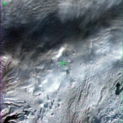
IRS-1C - Multispectral Images (LISS-III) - Europe
Indian Remote Sensing satellites (IRS) are a series of Earth Observation satellites, built, launched and maintained by Indian Space Research Organisation. The IRS series provides many remote sensing services to India and international ground stations.
IRS LISS-III data are well suited for agricultural and forestry monitoring tasks. Because of their simultaneous acquisition with IRS PAN data and the availability of a synthetic blue band, LISS-III data are ideal for colouring IRS PAN products.
|
|
Citation proposal
GAF AG. IRS-1C - Multispectral Images (LISS-III) - Europe. https://gdk.gdi-de.org/geonetwork/srv/api/records/1f1940e4-ec31-4925-8fa8-942a59531888 |
INSPIRE
Identification
- File identifier
- 1f1940e4-ec31-4925-8fa8-942a59531888 XML
- Hierarchy level
- Series
Online resource
- Protocol
- WWW:LINK-1.0-http--link
- Protocol
- WWW:LINK-1.0-http--link
Resource identifier
- Metadata language
- eng
- Spatial representation type
- Grid
Encoding
Projection
- code
- WGS 84 (EPSG:4326)
Classification of data and services
- Topic category
-
- Imagery base maps earth cover
Classification of data and services
Coupled resource
Coupled resource
Classification of data and services
Coupled resource
Coupled resource
Keywords
- GEMET - INSPIRE themes, version 1.0 ( Theme )
-
- Orthoimagery
- Spatial scope ( Theme )
Other keywords
- Keywords
-
- urn:eop:DLR:EOWEB:IRS-1C.LISS-III.P
- IRS-1C
- LISS-III
- multispectral
- visible wavelengths
- infrared wavelengths
- FEDEO
Geographic coverage
N
S
E
W
))
Temporal reference
Temporal extent
Temporal extent
- Date ( Creation )
- 2013-12-02T00:00:00
Quality and validity
- Lineage
- For details see: https://www.euromap.de/site/index.html
- Denominator
- 46000
Conformity
Conformity
Conformity
Conformity
Conformity
Conformity
- Explanation
- See the referenced specification
Restrictions on access and use
- Access constraints
- Nutzungsbedingungen / Terms of Use: https://geoservice.dlr.de/resources/licenses/D-SDA_DataLicenseTerms.pdf
Restrictions on access and use
Responsible organization (s)
Contact for the resource
- Organisation name
- GAF AG
- data@gaf.de
- Organisation name
- GAF AG
- data@gaf.de
Responsible organization (s)
Contact for the resource
- Organisation name
- GAF AG
- data@gaf.de
- Organisation name
- GAF AG
- data@gaf.de
Metadata information
Contact for the metadata
- Organisation name
- German Aerospace Center (DLR)
- geoservice@dlr.de
- Date stamp
- 2024-09-27T12:48:43
- Metadata language
- English
- Character set
- UTF8
SDS
Conformance class 1: invocable
Access Point URL
Endpoint URL
Technical specification
Conformance class 2: interoperable
Coordinate reference system
Quality of Service
Access constraints
Limitation
Use constraints
Limitation
Responsible custodian
Contact for the resource
Conformance class 3: harmonized
Overviews
thumbnail

large_thumbnail
Provided by

Views
1f1940e4-ec31-4925-8fa8-942a59531888
Access to the portal
Read here the full details and access to the data.
Associated resources
Not available