 www.geodatenkatalog.de (S1L)
Wasserhaushalt 2012 (Umweltatlas)
Wasserhaushaltsgrößen einschl. Grundwasserneubildung und Eingangsparameter aus dem Modell ABIMO (Sachstand 2012) auf Grundlage der Blockkarte 1 : 5.000 (ISU5, Raumbezug Umweltatlas 2010), Bearbeitungsstand November 2012.
|
|
Citation proposal
(2013) . Wasserhaushalt 2012 (Umweltatlas). https://gdk.gdi-de.org/geonetwork/srv/api/records/1f2a64aa-aadb-33ac-bcc3-cc3843f2ab5c |
INSPIRE
Identification
- File identifier
- 1f2a64aa-aadb-33ac-bcc3-cc3843f2ab5c XML
- Hierarchy level
- Dataset
Online resource
Resource identifier
- Metadata language
- German
- Spatial representation type
- Vector
Encoding
- Format
- Text/HTML
- Version
- 4.01
- Specification
- Keine Angabe
Projection
Classification of data and services
- Topic category
-
- Geoscientific information
Classification of data and services
Coupled resource
Coupled resource
Classification of data and services
Coupled resource
Coupled resource
Keywords
- Räumlicher Anwendungsbereich ( Theme )
Other keywords
- Keywords ( Theme )
-
- open data
- opendata
- Karten
- Sachdaten
- Geodaten
- Berlin
- Blöcke
- Gesamtabfluss
- Verdunstung
- Oberflächenabfluss
- Versickerung
- Grundwasserneubildung
Geographic coverage
N
S
E
W
))
Temporal reference
Temporal extent
Temporal extent
- Date ( Creation )
- 2012-12-12
- Date ( Publication )
- 2013-07-15
Quality and validity
- Lineage
- Daten des Informationssystems Stadt und Umwelt:, - Flächennutzung 2010 (Karten 06.01, 06.02, Ausgabe 2011), - Niederschlag (langjähriges Mittel 1961 - 1990), - Versiegelung 2011 (Karte 01.02, Ausgabe 2011), - Belagsartenverteilung 1988, z. T. aktualisiert 2012, - Vegetationsstruktur 2010, - Nutzbare Feldkapazität 2012, - Flurabstand des Grundwassers 2009 (Karte 02.07, Ausgabe 2010), - Kanalisation und Kanalisierungsgrad 2012, - Versiegelung 2011 (Karte 01.02, Ausgabe 2012), - Versickerung aus Niederschlägen 2012, - Abflussmessungen des Gewässerkundlichen Landesdienstes, - Charakterisierung der Deckschichten nach WRRL (SenStadt VIII E, 2002)
- Denominator
- 5000
Conformity
Conformity
Conformity
Conformity
Conformity
Conformity
Restrictions on access and use
- Access constraints
- Für die Nutzung der Daten ist die Datenlizenz Deutschland - Zero - Version 2.0 anzuwenden. Die Lizenz ist über https://www.govdata.de/dl-de/zero-2-0 abrufbar.
- Access constraints
- {"id":"dl-zero-de/2.0","name":"Datenlizenz Deutschland - Zero - Version 2.0","url":"https://www.govdata.de/dl-de/zero-2-0"}
Restrictions on access and use
Responsible organization (s)
Contact for the resource
- Organisation name
- Senatsverwaltung für Stadtentwicklung, Bauen und Wohnen Berlin
Responsible organization (s)
Contact for the resource
- Organisation name
- Senatsverwaltung für Stadtentwicklung, Bauen und Wohnen Berlin
Metadata information
Contact for the metadata
- Organisation name
- Senatsverwaltung für Stadtentwicklung, Bauen und Wohnen Berlin
- Date stamp
- 2025-11-19T00:00:00Z
- Metadata language
- German
- Character set
- UTF8
SDS
Conformance class 1: invocable
Access Point URL
Endpoint URL
Technical specification
Conformance class 2: interoperable
Coordinate reference system
Quality of Service
Access constraints
Limitation
Use constraints
Limitation
Responsible custodian
Contact for the resource
Conformance class 3: harmonized
Overviews
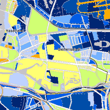
Vorschaubild
Provided by

Views
1f2a64aa-aadb-33ac-bcc3-cc3843f2ab5c
Access to the portal
Read here the full details and access to the data.
Associated resources
Not available