 www.geodatenkatalog.de (S1L)
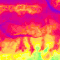
Helicopter-borne Electromagnetics (HEM) Area 138 Nordenham
BGR conducted within the project „Airborne geophysical surveys for mapping the shallow subsurface in Germany “ (D-AERO) airborne surveys at the German North Sea coast. The survey area Nordenham (2009/10) is bounded by the Jade Bight to the west and by the river Weser to the east. The size of the area is about 368 km². The area was surveyed with 12 flights totalling to 1569 line-km (435,878 survey points). The nominal separation of the 97 ESE-WNW lines and 11 NNE-SSW tie lines was 250 m and 2000 m, respectively. The maps display the geophysical parameters apparent resistivity and centroid depth derived from the HEM data at the six frequencies of the HEM system (0.4 - 130 kHz). Furthermore, horizontal and vertical slices were derived from layered-earth models (resistivities and thicknesses of six model layers).
|
|
Citation proposal
(2014) . Helicopter-borne Electromagnetics (HEM) Area 138 Nordenham. https://gdk.gdi-de.org/geonetwork/srv/api/records/2039b55b-c5fe-4e41-a24e-5e7431fa4d18 |
Simple
- Alternate title
- 138NordenhamHEM
- Date ( Publication )
- 2014-07-15
- Identifier
- b6dd7e52-62fe-4184-ac4f-bcd29b401c7a
- Identifier
- https://doi.org/10.25928/bgr138hem_znhc-7e09
- Status
- completed Completed
Point of contact
- GEMET - INSPIRE themes, version 1.0 ( Theme )
-
- Geologie
- Geology
- GEMET - Concepts, version 2.4 ( Theme )
-
- Geophysik
- Keywords ( Theme )
-
- Aerogeophysik
- Hubschrauber-Elektromagnetik
- elektrische Leitfähigkeit
- spezifischer Widerstand
- Halbraumwiderstand
- Schwerpunktstiefe
- airborne geophysics
- helicopter-borne electromagnetics
- electrical conductivity
- resistivity
- apparent resistivity
- centroid depth
- Keywords ( Place )
-
- Niedersachsen
- Access constraints
- Other restrictions
- Use constraints
- Other restrictions
- Other constraints
- Allgemeine Geschäftsbedingungen, siehe https://www.bgr.bund.de/AGB - General terms and conditions, see https://www.bgr.bund.de/AGB_en. Die bereitgestellten Informationen sind bei Weiterverwendung wie folgt zu zitieren: Datenquelle: 138NordenhamHEM, (c) BGR, Hannover, 2016, doi:10.25928/bgr138hem_znhc-7e09
- Spatial representation type
- Grid
- Metadata language
- German
- Character set
- UTF8
- Topic category
-
- Geoscientific information
N
S
E
W
))
- Distribution format
-
- georef. TIFF (n/a )
- PDF (n/a )
- Transfer size
- 43
- OnLine resource
-
138NordenhamHEM (georef. TIFF)
138NordenhamHEM im Format georef. TIFF
- Transfer size
- 294
- OnLine resource
-
138NordenhamHEM (PDF)
138NordenhamHEM im Format Adobe Acrobat
- OnLine resource
-
BGR-Website: Projekt D-AERO
BGR-Website: Projekt D-AERO
- OnLine resource
-
Technischer Bericht Archiv-Nr. 0132100
Technischer Bericht Archiv-Nr. 0132100
- Hierarchy level
- Dataset
Conformance result
- Date ( Publication )
- 2010-12-08
- Explanation
- siehe dazu die angegebene Durchführungsbestimmung
- Statement
- Erarbeitung im Rahmen des BGR-Projektes "D-AERO" mit Unterstützung durch das LIAG-Projekt "Flächenhafte Befliegung mit Aerogeophysik"
gmd:MD_Metadata
- File identifier
- 2039b55b-c5fe-4e41-a24e-5e7431fa4d18 XML
- Metadata language
- German
- Character set
- UTF8
- Parent identifier
- 5d3c332a-bce3-498f-840f-3cbf19359aef
- Hierarchy level
- Dataset
- Hierarchy level name
- Geophysik
- Date stamp
- 2025-10-22
- Metadata standard name
- INSPIRE Metadata Implementing Rules: Technical Guidelines based on EN ISO 19115 and EN ISO 19119
- Metadata standard version
- n/a
Point of contact
Overviews
Provided by

Views
2039b55b-c5fe-4e41-a24e-5e7431fa4d18
Access to the portal
Read here the full details and access to the data.
Associated resources
Not available