 www.geodatenkatalog.de (S1F)
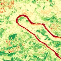
Sentinel2 - Normalized Difference Vegetation Index
Sentinel-2 Normierter Differenzierter Vegetationsindex (NDVI), räumliche Auflösung 10 m (2019)
|
|
Citation proposal
. Sentinel2 - Normalized Difference Vegetation Index. https://gdk.gdi-de.org/geonetwork/srv/api/records/205aab1b-bcbf-4838-8c37-e48f48553b44 |
- Identification
- Distribution
- Quality
- Spatial rep.
- Ref. system
- Content
- Portrayal
- Metadata
- Md. constraints
- Md. maintenance
- Schema info
Identification
Data identification
Citation
- Alternate title
- Sentinel2 - NDVI
- Date ( Creation )
- 2015-08-02
- Date ( Revision )
- 2023-07-18
- Status
- On going
Point of contact
Landesamt für Vermessung, Geoinformation und Landentwicklung
-
Abt.2 Grundlagen, Geotopographie, Kartographie, Fernerkundung
Von der Heydt 22
Saarbrücken
Saarland
66115
Deutschland
- Keywords ( Theme )
-
- Sentinel2
- Keywords ( Place )
-
- Saarland
- mapbender.2.inspireDownload
-
- 0
- mapbender.2.inspireWholeArea
-
- 2500
- mapbender.2.inspireActualCoverage
-
- 2500
- Keywords
-
- Geoportal
- AdVMIS
- Geobasisdaten
- Spatial scope ( Theme )
- GEMET - INSPIRE themes, version 1.0 ( Theme )
-
- Orthofotografie
- Classification
- Restricted
- Use limitation
- Die Daten sind urheberrechtlich geschützt. Der Datensatz wird entgeltfrei unter folgenden Nutzungsbedingungen zur Verfügung gestellt: <a href="https://sentinel.esa.int/documents/247904/690755/Sentinel_Data_Legal_Notice">Legal notice on the use of Copernicus Sentinel Data and Service Information</a>. Der Quellenvermerk ist zu beachten. | Quellenvermerk: © Europäische Union, enthält Copernicus Sentinel-2 Daten [Jahr], verarbeitet durch das Landesamt für Vermessung, Geoinformation und Landentwicklung (LVGL).
Legal constraints
- Access constraints
- Other restrictions
- Access constraints
- License
Legal constraints
- Use constraints
- Other restrictions
- Spatial representation type
- Grid
- Distance
- 10 m
- Metadata language
- Deutsch German
- Character set
- UTF8
- Topic category
-
- Imagery base maps earth cover
Extent
N
S
E
W
))
- Geographic identifier
- Saarland
Distribution
Distribution
- Distribution format
-
- GeoTIFF (1.0 )
Point of contact
Landesamt für Vermessung, Geoinformation und Landentwicklung
-
Sachgebiet 4.3 Vertrieb, Gebühren, Reproduktion
Von der Heydt 22
Saarbrücken
Saarland
66115
Deutschland
- OnLine resource
- Fachanwendung Sentinel-2
- OnLine resource
-
Geoportal Saarland
Kartenanwendung im Geoportal Saarland
Quality
Data quality
Scope
- Hierarchy level
- Dataset
- Statement
- ESA Copernicus Open Access Hub
Metadata
Metadata
- File identifier
- 205aab1b-bcbf-4838-8c37-e48f48553b44 XML
- Metadata language
- Deutsch German
- Character set
- UTF8
- Hierarchy level
- Dataset
- Hierarchy level name
- basisdaten
- Hierarchy level name
- lvgl_abt2
- Date stamp
- 2023-10-27T09:56:58
- Metadata standard name
- ISO19115
- Metadata standard version
- 2003/Cor.1:2006
Point of contact
Landesamt für Vermessung, Geoinformation und Landentwicklung
-
Sachgebiet 3.1 Geoinformationssysteme, E-Government
Von der Heydt 22
Saarbrücken
Saarland
66115
Deutschland
Overviews
Sentinel2 - Normalized Difference Vegetation Index
Provided by

Views
205aab1b-bcbf-4838-8c37-e48f48553b44
Access to the portal
Read here the full details and access to the data.
Associated resources
Not available