 www.geodatenkatalog.de (S3L)
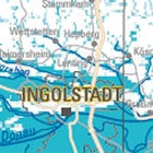
Hinweiskarte Hohe Grundwasserstände - WMS
In der Hinweiskarte „Hohe Grundwasserstände“ werden im Maßstab 1:500 000 bayernweit Bereiche hoher Grundwasserstände abgegrenzt. Dabei sind hohe Grundwasserstände definiert als Grundwasserstände, die temporär oder dauerhaft weniger als drei Meter unter der Geländeoberfläche liegen. Die Karte ist für Übersichtsbetrachtungen vorgesehen und wendet sich an alle, die mit dem Thema hoher Grundwasserstände befasst sind.
In die Darstellung sind folgende Informationen eingeflossen: Wassersensible Bereiche (Stand: 09/2017), Überschwemmungsgebiete und Hochwassergefahrenflächen (Stand: 08/2017), Grundwassermessstellen, Flurabstandskarten (Stand: 08/2018), Topographischer Index "Höhe über Tiefenlinie" (Stand: 11/2015), Objektinformationen aus dem Bayerischen Bodeninformationssystem, Geologische und Hydrogeologische Karten, Grundwassermodelle. Grundsätzlich können hohe Grundwasserstände auch außerhalb der gekennzeichneten Bereiche auftreten.
Es wird grundsätzlich empfohlen, für jedes Bauvorhaben ein umfassendes, qualifiziertes Baugrundgutachten mit hydrogeologischer Untersuchung durchzuführen. Aus den Inhalten der Karte ergeben sich keine Rechtsansprüche. Maßstab: 1:null; Bodenauflösung: nullm; Scanauflösung (DPI): null
|
|
Citation proposal
(2018) . Hinweiskarte Hohe Grundwasserstände - WMS. https://gdk.gdi-de.org/geonetwork/srv/api/records/210c5d1e-673b-4880-9873-3effba191359 |
Simple
Identification info
- Alternate title
- Wasser
- Date ( Creation )
- 2018-03-01T00:00:00.000+01:00
- Date ( Publication )
- 2018-07-01T00:00:00.000+02:00
- Status
- Completed
Point of contact
- Website
- https://www.lfu.bayern.de
- Maintenance and update frequency
- Not planned
- Update scope
- Service
- Service Classification, version 1.0 ( Theme )
-
- infoMapAccessService
- Keywords
-
- gdiby
- HWK HGW
- Vernässung
- Bayern
- hohe Grundwasserstände
- Hochwasser
- Use limitation
- keine Einschränkungen
- Use constraints
- Other restrictions
- Other constraints
- Creative Commons Namensnennung - Keine Bearbeitung 4.0 International (CC BY-ND 4.0); Datenquelle: Bayerisches Landesamt für Umwelt, www.lfu.bayern.de
- Other constraints
- {"id":"cc-by-nd/4.0","name":"Creative Commons Namensnennung - Keine Bearbeitung 4.0 International (CC BY-ND 4.0)","url":"https://creativecommons.org/licenses/by-nd/4.0/deed.de","quelle":"Bayerisches Landesamt für Umwelt, www.lfu.bayern.de"}
- Access constraints
- otherRestrictions Other restrictions
- Service Type
- view
- Service Version
- OGC:WMS 1.3.0
- Description
- Bayern
))
Coupled Resource
- Operation Name
- GetCapabilities
Coupled Resource
- Operation Name
- GetMimage/bmp; imageap
Coupled Resource
- Operation Name
- GetFeatureInfo
Coupled Resource
- Operation Name
- esri_wms:GetStyles
- Coupling Type
- Tight
Contains Operations
- Operation Name
- GetCapabilities
- Distributed Computing Platforms
- Web services
- Operation Description
- application/vnd.ogc.wms_xml; text/xml;
Contains Operations
- Operation Name
- GetMimage/bmp; imageap
- Distributed Computing Platforms
- Web services
- Operation Description
- /jpeg; image/tiff; image/png; image/png8; image/png24; image/png32; image/gif; image/svg+xml;
Contains Operations
- Operation Name
- GetFeatureInfo
- Distributed Computing Platforms
- Web services
- Operation Description
- application/vnd.esri.wms_raw_xml; application/vnd.esri.wms_featureinfo_xml; application/vnd.ogc.wms_xml; text/xml; text/html; text/plain;
Contains Operations
- Operation Name
- esri_wms:GetStyles
- Distributed Computing Platforms
- Web services
- Operation Description
- application/vnd.ogc.sld+xml;
- Operates On
- Distribution format
-
- Sonstiges ()
Distributor
Distributor
- Website
- https://www.lfu.bayern.de
- Fees
- geldleistungsfrei
- OnLine resource
-
URL des Dienstes
URL zum Aufruf des WMS: Hinweiskarte Hohe Grundwasserstände
- OnLine resource
- Informationsseite des LfU
- OnLine resource
-
Dienst "Hinweiskarte Hohe Grundwasserstände - WMS" (GetCapabilities)
application/vnd.ogc.wms_xml; text/xml;
gmd:MD_Metadata
- File identifier
- 210c5d1e-673b-4880-9873-3effba191359 XML
- Metadata language
- German
- Character set
- UTF8
- Hierarchy level
- service Service
- Hierarchy level name
- service
- Date stamp
- 2025-08-27
- Metadata standard name
- ISO19119
- Metadata standard version
- 2005/PDAM 1
Point of contact
- Website
- https://www.lfu.bayern.de
Overviews
Provided by
