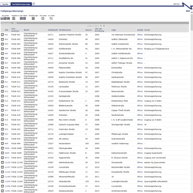
Geologie - Sachdaten zur Karte Quartärbasis
Sachdaten zur Karte der Quartärbasis, die im Überblick die Basis der durch einen mehrfachen Wechsel von Kalt- und Warmzeiten gekennzeichneten quartären Sedimente in Berlin bezogen auf m NHN abbilden.
|
|
Citation proposal
(2024) . Geologie - Sachdaten zur Karte Quartärbasis. https://gdk.gdi-de.org/geonetwork/srv/api/records/24680e6e-c365-33ae-841e-f8eb5bc2c95f |
- Identification
- Distribution
- Quality
- Spatial rep.
- Ref. system
- Content
- Portrayal
- Metadata
- Md. constraints
- Md. maintenance
- Schema info
Identification
Identification info
Service Identification (19119)
Citation
- Date ( Creation )
- 2024-02-01
- Date ( Publication )
- 2024-03-26
- Presentation form
- Digital table
Point of contact
Point of contact
- Keywords
-
- infoFeatureAccessService
- Keywords ( Theme )
-
- inspireidentifiziert
- Karten
- Geodaten
- open data
- opendata
- Berlin
- Geologie
- Quartärbasis
Legal constraints
- Access constraints
- Other restrictions
- Service Type
- download
- Service Version
- OGC:WFS 1.0.0
- Service Version
- OGC:WFS 1.1.0
- Service Version
- OGC:WFS 2.0.0
Extent
N
S
E
W
))
Geographic description
- Extent type code
- true
- Geographic identifier
- 110000000000
- Coupling Type
- Tight
Contains Operations
- Operation Name
- GetCapabilities
- Distributed Computing Platforms
- Web services
- Connect Point
- https://gdi.berlin.de/services/wfs/quartaerbasis
Distribution
Distribution
- Distribution format
-
- Text/HTML (4.01 )
Digital transfer options
- OnLine resource
-
GetCapabilities Aufruf des WFS mit maschinenlesbarer Antwort
GetCapabilities Aufruf des WFS mit maschinenlesbarer Antwort
- OnLine resource
-
Aufruf des Geoportals Berlin mit Darstellung der downloadbaren Daten als Karte(nlayer)
Aufruf des Geoportals Berlin mit Darstellung der downloadbaren Daten als Karte(nlayer)
- OnLine resource
-
Inhaltliche Beschreibung
Inhaltliche Beschreibung
- OnLine resource
-
Technische Beschreibung
Technische Beschreibung
Quality
Data quality
Scope
- Hierarchy level
- Service
- Other
- Dienst
Conformance result
Citation
- Date ( Publication )
- 2009-10-20
- Explanation
- see referenced specification
- Pass
- true
Metadata
Metadata
- File identifier
- 24680e6e-c365-33ae-841e-f8eb5bc2c95f XML
- Metadata language
- German
- Character set
- UTF8
- Hierarchy level
- Service
- Hierarchy level name
- Geologie - Sachdaten zur Karte Quartärbasis Dienst
- Date stamp
- 2024-03-26T08:47:33
- Metadata standard name
- ISO 19115/19119 – BE
- Metadata standard version
- 1.0.0
Overviews

Vorschaugrafik
Provided by

Views
24680e6e-c365-33ae-841e-f8eb5bc2c95f
Access to the portal
Read here the full details and access to the data.
Associated resources
Not available
 www.geodatenkatalog.de (S1L)