 www.geodatenkatalog.de (S1F)
ATKIS - DTK50
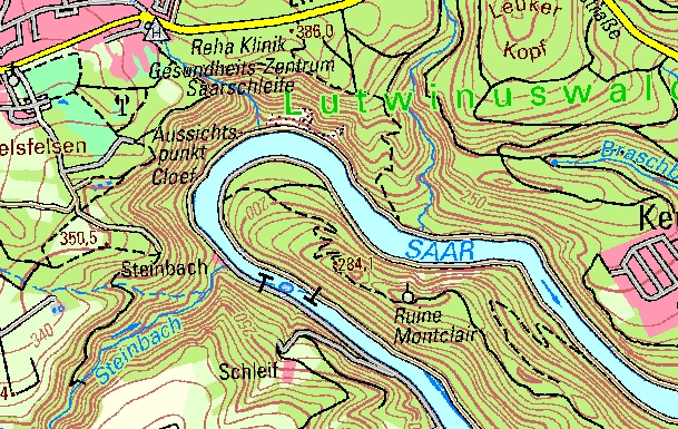
Die Digitale Topographische Karte 1:50 000 ist rechnergestützt und in neuer Kartengraphik aus dem Digitalen Landschaftsmodell und dem Digitalen Geländemodell abgeleitet. Sie liegt sowohl gedruckt (TK50), als auch im Rasterformat (DTK50) vor. Da gegenüber der TK25 die vierfache Fläche auf der gleichen Kartengröße dargestellt wird, kann ihre Lesbarkeit nur gewährleistet sein, wenn ausgewählte Elemente in vereinfachter Form wiedergegeben werden (Generalisierung). Die neue Kartengraphik zeichnet sich durch eine moderne Farbgebung aus. Insbesondere das Verkehrsnetz, die Siedlungs- und Vegetationsflächen sind in ihrer thematischen Gliederung durch ihre Farbgebung übersichtlich und schnell zu erfassen. Abgabe: digital: DTK50 (digitale Version der TK50): Rasterdaten, auf Wunsch Ebenenstrukturiert, Format: TIFF, PDF Plotausgabe: gefaltet: 11 cm x 25 cm, plano: 75 cm x 56 cm, mit dreisprachiger Legende (D, GB, F)
|
|
Citation proposal
(2012) . ATKIS - DTK50. https://gdk.gdi-de.org/geonetwork/srv/api/records/25473a50-cb77-4f4f-8e09-9e697ceb6f34 |
INSPIRE
Identification
- File identifier
- 25473a50-cb77-4f4f-8e09-9e697ceb6f34 XML
- Hierarchy level
- Dataset
Online resource
Resource identifier
- Metadata language
- German
- Spatial representation type
- Grid
Encoding
- Format
- GeoTIFF
- Version
- 1.0
- Format
- Version
- 1.5
Projection
Classification of data and services
- Topic category
-
- Structure
- Inland waters
- Boundaries
- Imagery base maps earth cover
- Location
- Planning cadastre
- Transportation
Classification of data and services
Coupled resource
Coupled resource
Classification of data and services
Coupled resource
Coupled resource
Keywords
- GEMET - INSPIRE themes, version 1.0 ( Theme )
-
- Bodenbedeckung
- Verkehrsnetze
- Gewässernetz
- Geografische Bezeichnungen
- Verwaltungseinheiten
- Bodennutzung
- Gebäude
- GEMET - Concepts, version 2.4 ( Theme )
-
- Bahnhof
- Lagefestpunkt
- Insel
- Höhenlinie
- Tiefenlinie
- Teich
- Stausee
- Verwaltungsgebiete
- Meer
- Bach
- Straße
- Höhenfestpunkt
- Ortslage
- Strom
- Fluß
- Binnensee
- Autobahn
- Kanal
- Schienenbahn
- Ortsangaben
- Grenzen
- Verkehrswesen
- Binnengewässer
- Bildaten
- Basiskarten
- Landbedeckung
- Bauwerke
- Planungsunterlagen
- Kataster
Other keywords
- Keywords
-
- AdVMIS
- Geoportal
- Geobasisdaten
- opendata
- Keywords ( Place )
-
- Saarland
Geographic coverage
N
S
E
W
))
Temporal reference
Temporal extent
Temporal extent
- Date ( Creation )
- 2012-03-30
- Date ( Publication )
- 2012-03-30
- Date ( Revision )
- 2023-07-07
Quality and validity
- Lineage
- ATKIS- DLM50
- Denominator
- 50000
Conformity
Conformity
Conformity
Conformity
Conformity
Conformity
- Explanation
- keine
- Explanation
- keine
- Explanation
- INSPIRE Annex-Thema "Geografische Bezeichnungen"
- Explanation
- INSPIRE Annex-Thema "Verwaltungseinheiten"
- Explanation
- INSPIRE Annex-Thema "Verkehrsnetze"
- Explanation
- INSPIRE Annex-Thema "Gewässernetz"
- Explanation
- INSPIRE Annex-Thema "Bodenbedeckung"
- Explanation
- INSPIRE Annex-Thema "Gebäude"
- Explanation
- INSPIRE Annex-Thema "Bodennutzung"
Restrictions on access and use
- Access constraints
- Lizenz: dl-de-by-2.0 - Datenlizenz Deutschland Namensnennung 2.0 - https://www.govdata.de/dl-de/by-2-0 - Quellenvermerk: © GeoBasis DE/LVGL-SL (Jahr)
- Access constraints
- {"id":"dl-de-by-2.0","name":"Datenlizenz Deutschland Namensnennung 2.0","url":"https://www.govdata.de/dl-de/by-2-0","quelle":"© GeoBasis DE/LVGL-SL (Jahr)"}
Restrictions on access and use
Responsible organization (s)
Contact for the resource
- Organisation name
- Landesamt für Vermessung, Geoinformation und Landentwicklung
Responsible organization (s)
Contact for the resource
- Organisation name
- Landesamt für Vermessung, Geoinformation und Landentwicklung
Metadata information
Contact for the metadata
- Organisation name
- Landesamt für Vermessung, Geoinformation und Landentwicklung
- Date stamp
- 2024-10-23T10:30:15
- Metadata language
- German
- Character set
- UTF8
SDS
Conformance class 1: invocable
Access Point URL
Endpoint URL
Technical specification
Conformance class 2: interoperable
Coordinate reference system
Quality of Service
Access constraints
Limitation
Use constraints
Limitation
Responsible custodian
Contact for the resource
Conformance class 3: harmonized
Overviews
Digitale Topografische Karte 1:50.000
Provided by

Views
25473a50-cb77-4f4f-8e09-9e697ceb6f34
Access to the portal
Read here the full details and access to the data.
Associated resources
Not available