 www.geodatenkatalog.de (S1L)
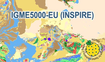
INSPIRE: The 1:5 Million International Geological Map of Europe and Adjacent Areas (IGME5000-EU) (WMS)
The IGME5000-EU (INSPIRE) represents the pre-quaternary bedrock geology (onshore and offshore) of the European map on a scale of 1:5,000,000. According to the Data Specification on Geology (D2.8.II.4_v3.0) the geological map provides INSPIRE-compliant data. The WMS IGME5000-EU contains layers of the geologic units (GE.GeologicUnit) and faults (GE.GeologicFault) mostly displayed according to the INSPIRE portrayal rules. The geologic units are represented graphically by stratigraphy (GE.GeologicUnit.AgeOfRocks) and lithology (GE.GeologicUnit.Lithology). For different geochronologic minimum and maximum ages, e.g. Ordovician - Silurian, the portrayal is defined by the color of the geochronologic minimum age (olderNamedAge). The portrayal of the lithology is defined by the first named rock or rock group. In case of the geologic units the user obtains detailed information via the getFeatureInfo request on the lithology and stratigraphy (age).
|
|
Citation proposal
Bundesanstalt für Geowissenschaften und Rohstoffe (BGR) (2022) . INSPIRE: The 1:5 Million International Geological Map of Europe and Adjacent Areas (IGME5000-EU) (WMS). https://gdk.gdi-de.org/geonetwork/srv/api/records/29b9cd33-b5ec-4295-b54c-465907706242 |
INSPIRE
Identification
- File identifier
- 29b9cd33-b5ec-4295-b54c-465907706242 XML
- Hierarchy level
- Service
Online resource
Resource identifier
Encoding
- Format
- png
- Version
- n/a
- Format
- jpeg
- Version
- n/a
- Format
- gif
- Version
- n/a
Projection
Classification of data and services
Classification of data and services
- Service Type
- view
- Coupling Type
- Tight
Coupled resource
Coupled resource
Classification of data and services
- Service Type
- view
- Coupling Type
- Tight
Coupled resource
Coupled resource
Keywords
- GEMET - INSPIRE themes, version 1.0 ( Theme )
-
- Geologie
- Geology
- Spatial scope
-
- European
Other keywords
- Keywords ( Theme )
-
- inspireidentifiziert
- infoMapAccessService
- opendata
- GeolDG
- Keywords ( Place )
-
- Europa
- Europe
Geographic coverage
N
S
E
W
))
Temporal reference
Temporal extent
Temporal extent
- Date ( Publication )
- 2022-03-17
Quality and validity
- Lineage
- The WMS IGME5000-EU (INSPIRE) is based on the spatial dataset of The 1:5 Million International Geological Map of Europe and Adjacent Areas (IGME5000) transformed according to INSPIRE.
Conformity
Conformity
Conformity
Conformity
Conformity
Conformity
Restrictions on access and use
Restrictions on access and use
- Access constraints
- Allgemeine Geschäftsbedingungen, siehe https://www.bgr.bund.de/AGB - General terms and conditions, see https://www.bgr.bund.de/AGB_en. Die bereitgestellten Informationen sind bei Weiterverwendung wie folgt zu zitieren: Datenquelle: IGME5000-EU (INSPIRE), (c) BGR, Hannover, 2022.
- Access constraints
- Dieser Datensatz kann gemäß der "Nutzungsbestimmungen für die Bereitstellung von Geodaten des Bundes" (https://sg.geodatenzentrum.de/web_public/gdz/lizenz/geonutzv.pdf) genutzt werden.
Responsible organization (s)
Contact for the resource
- Organisation name
- Bundesanstalt für Geowissenschaften und Rohstoffe (BGR)
- geologie.daten@bgr.de
- Organisation name
- Bundesanstalt für Geowissenschaften und Rohstoffe (BGR)
Responsible organization (s)
Contact for the resource
- Organisation name
- Bundesanstalt für Geowissenschaften und Rohstoffe (BGR)
- geologie.daten@bgr.de
- Organisation name
- Bundesanstalt für Geowissenschaften und Rohstoffe (BGR)
Metadata information
Contact for the metadata
- Organisation name
- Bundesanstalt für Geowissenschaften und Rohstoffe (BGR)
- Date stamp
- 2024-03-05
- Metadata language
- English
SDS
Conformance class 1: invocable
Access Point URL
Endpoint URL
Technical specification
- Date
- Explanation
- See the referenced specification
Conformance class 2: interoperable
Coordinate reference system
Quality of Service
Access constraints
- Access constraints
- Other restrictions
Limitation
Use constraints
Limitation
- string
- Allgemeine Geschäftsbedingungen, siehe https://www.bgr.bund.de/AGB - General terms and conditions, see https://www.bgr.bund.de/AGB_en. Die bereitgestellten Informationen sind bei Weiterverwendung wie folgt zu zitieren: Datenquelle: IGME5000-EU (INSPIRE), (c) BGR, Hannover, 2022.
- string
- Dieser Datensatz kann gemäß der "Nutzungsbestimmungen für die Bereitstellung von Geodaten des Bundes" (https://sg.geodatenzentrum.de/web_public/gdz/lizenz/geonutzv.pdf) genutzt werden.
Responsible custodian
Contact for the resource
- Organisation name
- Bundesanstalt für Geowissenschaften und Rohstoffe (BGR)
Conformance class 3: harmonized
Contains Operations
- Operation Name
- GetCapabilities
- Distributed Computing Platforms
- Web services
- Connect Point
- https://services.bgr.de/wms/inspire_ge/igme5000eu/?
Contains Operations
- Operation Name
- GetMap
- Distributed Computing Platforms
- Web services
- Connect Point
- https://services.bgr.de/wms/inspire_ge/igme5000eu/?
Overviews
Provided by

Views
29b9cd33-b5ec-4295-b54c-465907706242
Access to the portal
Read here the full details and access to the data.
Associated resources
Not available