 www.geodatenkatalog.de (S3L)
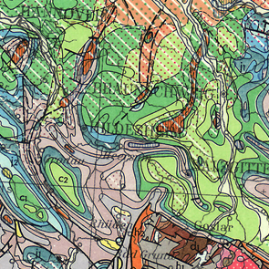
International Geological Map of Europe and the Mediteranean Regions 1:1,500,000 - Sheet B2 Akureyi
The International Geological Map of Europe and the Mediteranean Regions 1 : 1 500 000 ("Carte Géologique Internationale de l'Europe et des Régions Méditerranéennes 1 : 1 500 000") shows the geology of the European continent from the Ural mountains in the east up to Island in the west and the whole mediteranean region in the south. The geology is differenciated in stratigraphy, igneous and metamorphic rocks. In addition there are two legend sheets and a title sheet. The language of the series is French.
|
|
Citation proposal
(1978) . International Geological Map of Europe and the Mediteranean Regions 1:1,500,000 - Sheet B2 Akureyi. https://gdk.gdi-de.org/geonetwork/srv/api/records/2C057ADD-5F85-4DDE-854B-7E9014B27159 |
INSPIRE
Identification
- File identifier
- 2C057ADD-5F85-4DDE-854B-7E9014B27159 XML
- Hierarchy level
- dataset Dataset
Online resource
Resource identifier
- code
- 428C2926-FABA-4419-AC56-3D1869F80624
- Metadata language
- fra fra
- Spatial representation type
- Grid
Encoding
- Format
- Version
- n/a
- Format
- JPEG
- Version
- n/a
- Format
- TIFF
- Version
- n/a
- Format
- gedruckt
- Version
- n/a
- Format
- geotiff
- Version
- n/a
Projection
Classification of data and services
- Topic category
-
- Geoscientific information
Classification of data and services
Coupled resource
Coupled resource
Classification of data and services
Coupled resource
Coupled resource
Keywords
- GEMET - INSPIRE themes, version 1.0 ( Theme )
-
- Geologie
- Geology
- GEMET - Concepts, version 2.4 ( Theme )
-
- tectonic
- Tektonik
Other keywords
- Keywords ( Theme )
-
- Magmatische Gesteine
- Metamorphe Gesteine
- Stratigraphie
- Keywords ( Place )
-
- Island
Geographic coverage
N
S
E
W
))
Temporal reference
Temporal extent
Temporal extent
- Date ( Publication )
- 1978-01-01
Quality and validity
- Lineage
- -
- Denominator
- 1500000
Conformity
Conformity
Conformity
Conformity
Conformity
Conformity
Restrictions on access and use
- Access constraints
- Allgemeine Geschäftsbedingungen, s. https://www.bgr.bund.de/agb - General Terms and Conditions, s. https://www.bgr.bund.de/agb_en
- Access constraints
- Preis der gedruckten Karte: 23,36 EUR (zzgl. 7% MWSt. und Versandkosten) Weitere Informationen zur Bestellung beim Internationalen Landkartenhaus siehe https://www.bgr.bund.de/produktcenter-bestellhinweis-ILH
Restrictions on access and use
Responsible organization (s)
Contact for the resource
- Organisation name
- Bundesanstalt für Geowissenschaften und Rohstoffe
- geologie.daten@bgr.de
Responsible organization (s)
Contact for the resource
- Organisation name
- Bundesanstalt für Geowissenschaften und Rohstoffe
- geologie.daten@bgr.de
Metadata information
Contact for the metadata
- Organisation name
- Bundesanstalt für Geowissenschaften und Rohstoffe (BGR)
- Date stamp
- 2024-05-07
- Metadata language
- German
- Character set
- utf8 UTF8
SDS
Conformance class 1: invocable
Access Point URL
Endpoint URL
Technical specification
Conformance class 2: interoperable
Coordinate reference system
Quality of Service
Access constraints
Limitation
Use constraints
Limitation
Responsible custodian
Contact for the resource
Conformance class 3: harmonized
Overviews
Provided by

Views
2C057ADD-5F85-4DDE-854B-7E9014B27159
Access to the portal
Read here the full details and access to the data.
Associated resources
Not available