 www.geodatenkatalog.de (S3L)
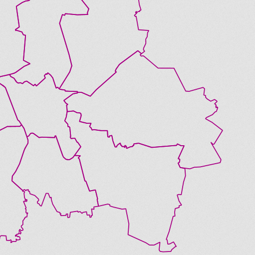
WMS Kommunale Teilgebiete 1:25 000
Dieser Darstellungsdienst stellt die kommunalen Teilgebiete 1:25 000 (KT25) für das Gebiet der Bundesrepublik Deutschland bereit.
Der Datensatz KT25 enthält als Ergänzung zum Datensatz VG25 für die größten Gemeinden (mindestens 75 000 Einwohner) die Flächen der administrativen Verwaltungsebene Kommunale Teilgebiete 1.Ordnung (KT1) sowie deren Grenzlinien innerhalb der Gemeinden (KTLI).
Für die kommunalen Teilgebiete wurde ein gemeindeeigener Schlüssel als KTS übernommen oder für den Datensatz neu erzeugt. Aus der Kombination von Amtlichem Regionalschlüssel (ARS) und KTS wurde der datensatzweit eindeutige Kommunalschlüssel (KS) erstellt.
Die Geometrie der Grenzen ist hinsichtlich Genauigkeit und Auflösung auf das ATKIS®-Basis-DLM ausgerichtet. Maßstab: 1:25000
|
|
Citation proposal
. WMS Kommunale Teilgebiete 1:25 000. https://gdk.gdi-de.org/geonetwork/srv/api/records/2D06A529-4697-479A-8B84-C3B705F43050 |
Simple
Identification info
- Alternate title
- wms_kt25
- Date ( Creation )
- 2018-10-09T00:00:00.000+02:00
- Status
- On going
Resource provider
Point of contact
- Maintenance and update frequency
- Annually
- Update scope
- Service
- Keywords
-
- Verwaltungsgebiete
- Kommunale Teilgebiete
- kt1
- WMS
- ViewService
- infoMapAccessService
- Bund
- BKG
- Bundesamt für Kartographie und Geodäsie
- Deutschland
- Service Classification, version 1.0 ( Theme )
-
- infoMapAccessService
- Access constraints
- otherRestrictions Other restrictions
- Other constraints
- Es gelten Zugriffsbeschränkungen. Für den Erwerb von Nutzungsrechten wenden Sie sich deshalb bitte an die Zentrale Stelle Geotopographie der AdV (ZSGT) / Dienstleistungszentrum (DLZ) des Bundesamtes für Kartographie und Geodäsie: https://www.bkg.bund.de/DE/Service/Kontakt/kontakt.html.
- Use constraints
- otherRestrictions Other restrictions
- Other constraints
- Die Daten sind urheberrechtlich geschützt. Auf Grundlage des Vertrages mit dem Datenanbieter werden die Daten je nach vertraglicher Ausgestaltung allen oder ausgewählten Bundesbehörden und weiteren Nutzungsberechtigten im Sinne des § 4 V GeoBund geldleistungsfrei zur Verfügung gestellt. Der Quellenvermerk ist zu beachten.
- Other constraints
- Quellenvermerk: © BKG (Jahr des letzten Datenbezugs), Datenquellen: https://sg.geodatenzentrum.de/web_public/gdz/datenquellen/datenquellen_kt25.pdf
- Service Type
- view
- Service Version
- OGC:WMS 1.3.0
- Service Version
- OGC:WMS 1.1.1
- Extent type code
- true
- Geographic identifier
- Raumbezug des Datensatzes
))
Coupled Resource
- Operation Name
- GetCapabilities
Coupled Resource
- Operation Name
- GetMap
Coupled Resource
- Operation Name
- GetFeatureInfo
- Coupling Type
- Tight
Contains Operations
- Operation Name
- GetCapabilities
- Distributed Computing Platforms
- HTTPGet
- Invocation Name
- GetCapabilities
Parameter
- Name
- Description
- Service type
- Optionality
- 0
- Repeatability
- false
- Name
Parameter
- Name
- Description
- Sequence number for cache control
- Optionality
- 1
- Repeatability
- false
- Name
Parameter
- Name
- Description
- Request version
- Optionality
- 1
- Repeatability
- false
- Name
Parameter
- Name
- Description
- Request name
- Optionality
- 0
- Repeatability
- false
- Name
- Connect Point
- https://sg.geodatenzentrum.de/wms_kt25?
Contains Operations
- Operation Name
- GetMap
- Distributed Computing Platforms
- HTTPGet
- Invocation Name
- GetMap
Parameter
- Name
- Description
- Request version
- Optionality
- 0
- Repeatability
- false
- Name
Parameter
- Name
- Description
- Request name
- Optionality
- 0
- Repeatability
- false
- Name
Parameter
- Name
- Description
- URL of Web Feature Service providing features to be symbolized using SLD
- Optionality
- 1
- Repeatability
- false
- Name
Parameter
- Name
- Description
- Comma-separated list of one rendering style per requested layer. Optional if SLD parameter is present
- Optionality
- 0
- Repeatability
- false
- Name
Parameter
- Name
- Description
- Height in pixels of map picture
- Optionality
- 0
- Repeatability
- false
- Name
Parameter
- Name
- Description
- Value of other dimensions as appropriate
- Optionality
- 1
- Repeatability
- false
- Name
Parameter
- Name
- Description
- Output format of map
- Optionality
- 0
- Repeatability
- false
- Name
Parameter
- Name
- Description
- Background transparency of map (default=FALSE)
- Optionality
- 1
- Repeatability
- false
- Name
Parameter
- Name
- Description
- Time value of layer desired
- Optionality
- 1
- Repeatability
- false
- Name
Parameter
- Name
- Description
- Hexadecimal red-green-blue color value for the background color (default=0xFFFFFF)
- Optionality
- 1
- Repeatability
- false
- Name
Parameter
- Name
- Description
- Optional experimental parameters
- Optionality
- 1
- Repeatability
- false
- Name
Parameter
- Name
- Description
- URL of Styled Layer Descriptor (as defined in SLD Specification)
- Optionality
- 1
- Repeatability
- false
- Name
Parameter
- Name
- Description
- Bounding box corners (lower left, upper right) in SRS units
- Optionality
- 0
- Repeatability
- false
- Name
Parameter
- Name
- Description
- Comma-separated list of one or more map layers. Optional if SLD parameter is present
- Optionality
- 0
- Repeatability
- false
- Name
Parameter
- Name
- Description
- Elevation of layer desired
- Optionality
- 1
- Repeatability
- false
- Name
Parameter
- Name
- Description
- Spatial Reference System
- Optionality
- 0
- Repeatability
- false
- Name
Parameter
- Name
- Description
- The format in which exceptions are to be reported by the WMS (default=SE_XML)
- Optionality
- 1
- Repeatability
- false
- Name
Parameter
- Name
- Description
- Width in pixels of map picture
- Optionality
- 0
- Repeatability
- false
- Name
- Connect Point
- https://sg.geodatenzentrum.de/wms_kt25?
Contains Operations
- Operation Name
- GetFeatureInfo
- Distributed Computing Platforms
- HTTPGet
- Invocation Name
- GetFeatureInfo
Parameter
- Name
- Description
- The format in which exceptions are to be reported by the WMS (default=application/vnd.ogc.se_xml)
- Optionality
- 1
- Repeatability
- false
- Name
Parameter
- Name
- Description
- Return format of feature information (MIME type)
- Optionality
- 1
- Repeatability
- false
- Name
Parameter
- Name
- Description
- Optional experimental parameters
- Optionality
- 1
- Repeatability
- false
- Name
Parameter
- Name
- Description
- X coordinate in pixels of feature (measured from upper left corner=0)
- Optionality
- 0
- Repeatability
- false
- Name
Parameter
- Name
- Description
- Number of features about which to return information (default=1)
- Optionality
- 1
- Repeatability
- false
- Name
Parameter
- Name
- Description
- Partial copy of the Map request parameters that generated the map for which information is desired
- Optionality
- 0
- Repeatability
- false
- Name
Parameter
- Name
- Description
- Comma-separated list of one or more layers to be queried
- Optionality
- 0
- Repeatability
- false
- Name
Parameter
- Name
- Description
- Request version
- Optionality
- 0
- Repeatability
- false
- Name
Parameter
- Name
- Description
- Y coordinate in pixels of feature (measured from upper left corner=0)
- Optionality
- 0
- Repeatability
- false
- Name
Parameter
- Name
- Description
- Request name
- Optionality
- 0
- Repeatability
- false
- Name
- Connect Point
- https://sg.geodatenzentrum.de/wms_kt25?
- Operates On
- Reference system identifier
- CRS 84: CRS 84 / mathematisch
- Distribution format
-
- TIFF ()
- PNG ()
- JPEG ()
- OnLine resource
- Produktseite des Geodatenzentrums
- OnLine resource
- Dokument zu Nutzungsbedingungen und Quellenvermerk
- OnLine resource
- Dienst "WMS Kommunale Teilgebiete 1:25 000" (GetCapabilities)
- Hierarchy level
- Service
- Other
- 3
Conformance result
- Date ( Publication )
- 2006-03-15
- Explanation
- see the referenced specification
- Pass
- true
gmd:MD_Metadata
- File identifier
- 2D06A529-4697-479A-8B84-C3B705F43050 XML
- Metadata language
- German
- Character set
- UTF8
- Hierarchy level
- service Service
- Hierarchy level name
- service
- Date stamp
- 2025-06-10
- Metadata standard name
- ISO19119
- Metadata standard version
- 2005/PDAM 1
Point of contact
Overviews
Provided by
