 www.geodatenkatalog.de (S1L)
Boden - Grundlagen zur Erstellung der BK25
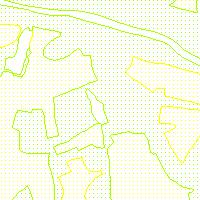
Der Kartendienst (WMS-Gruppe) stellt die Geodaten aus dem Bereich Boden des Saarlandes bereit.:Datengrundlage der BK6707. Bodenkarte BK 25 für das Blatt TK 6707: Übersicht über die Datengrundlagen der BK 25 6707. Das Feld WERT beschreibt die einzelnen Datengrundlagen. Daten wurden ins GDZ importiert und dort als Werte der Multifeatureklasse Bodeneinheiten modelliert, die sich zusammen setzt aus der flaechenhaften Featureklasse GDZ2010.A_gybe und der Businesstabelle mit den Werten (GDZ2010.gybe); anschließend die Werte für den Parameter Grundlage exportiert in die Filegeodatabase GDZ_GDB. Maximalmaßstab 1:25000.
|
|
Citation proposal
. Boden - Grundlagen zur Erstellung der BK25. Ministerium für Umwelt, Klima, Mobilität, Agrar und Verbraucherschutz https://gdk.gdi-de.org/geonetwork/srv/api/records/2a513d04-a2f5-3291-14d9-130bfa281e3c |
INSPIRE
Identification
- File identifier
- 2a513d04-a2f5-3291-14d9-130bfa281e3c XML
- Hierarchy level
- service Service
Online resource
- Protocol
- OGC:WMS-1.1.1-http-get-map
Resource identifier
Encoding
Projection
Classification of data and services
Classification of data and services
- Service Type
- view
- Coupling Type
- Tight
Coupled resource
Coupled resource
Classification of data and services
- Service Type
- view
- Coupling Type
- Tight
Coupled resource
Coupled resource
Keywords
- High-Value dataset categories
Other keywords
- Keywords
-
- Geologie
- Boden
- Bodennutzung
- Bodenuntersuchung
- opendata
- infoMapAccessService
- boden
Geographic coverage
N
S
E
W
))
Temporal reference
Temporal extent
Temporal extent
- Date ( Revision )
- 2025-04-15
Quality and validity
Conformity
Conformity
Conformity
Conformity
Conformity
Conformity
- Explanation
- No explanation available
- Explanation
- No explanation available
- Explanation
- No explanation available
- Explanation
- No explanation available
- Explanation
- No explanation available
- Explanation
- No explanation available
- Explanation
- No explanation available
- Explanation
- No explanation available
Restrictions on access and use
Restrictions on access and use
- Access constraints
- Lizenz: cc-by-4.0 - Namensnennung 4.0 International - https://creativecommons.org/licenses/by/4.0/deed.de - Quellenvermerk: © GDI-SL (Jahr)
- Access constraints
- {"id":"cc-by-4.0","name":"Namensnennung 4.0 International","url":"https://creativecommons.org/licenses/by/4.0/deed.de","quelle":"© GDI-SL (Jahr)"}
Responsible organization (s)
Contact for the resource
- Organisation name
- Ministerium für Umwelt, Klima, Mobilität, Agrar und Verbraucherschutz
Responsible organization (s)
Contact for the resource
- Organisation name
- Ministerium für Umwelt, Klima, Mobilität, Agrar und Verbraucherschutz
Metadata information
Contact for the metadata
- Organisation name
- GDI-Saarland
- gdi-sl@lvgl.saarland.de
- Date stamp
- 2025-04-15
- Metadata language
- ger German
SDS
Conformance class 1: invocable
- Pass
- true
- Pass
- true
- Pass
- true
- Pass
- true
- Pass
- true
- Pass
- true
- Pass
- true
- Pass
- true
Access Point URL
Endpoint URL
Technical specification
- Date
- Explanation
- No explanation available
- Date
- Explanation
- No explanation available
- Date
- Explanation
- No explanation available
- Date
- Explanation
- No explanation available
- Date
- Explanation
- No explanation available
- Date
- Explanation
- No explanation available
- Date
- Explanation
- No explanation available
- Date
- Explanation
- No explanation available
Conformance class 2: interoperable
Coordinate reference system
Quality of Service
Access constraints
- Access constraints
- Other restrictions
Limitation
Use constraints
Limitation
- string
- Lizenz: cc-by-4.0 - Namensnennung 4.0 International - https://creativecommons.org/licenses/by/4.0/deed.de - Quellenvermerk: © GDI-SL (Jahr)
- string
- {"id":"cc-by-4.0","name":"Namensnennung 4.0 International","url":"https://creativecommons.org/licenses/by/4.0/deed.de","quelle":"© GDI-SL (Jahr)"}
Responsible custodian
Contact for the resource
Conformance class 3: harmonized
Contains Operations
- Operation Name
- GetCapabilities
- Distributed Computing Platforms
- Web services
Overviews
Thumbnail
Provided by

Views
2a513d04-a2f5-3291-14d9-130bfa281e3c
Access to the portal
Read here the full details and access to the data.
Associated resources
Not available