 www.geodatenkatalog.de (S2F)
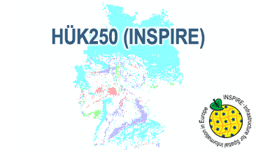
INSPIRE: Hydrogeological Map of Germany 1:250,000 (HÜK250) (WMS)
The HÜK250 (INSPIRE) describes the hydrogeological characteristics of the upper continuous aquifers in Germany at a scale of 1:250,000. According to the Data Specification on Geology (D2.8.II.4_v3.0) the map provides INSPIRE-compliant data. The hydrogeologic units are represented graphically – mostly according to the INSPIRE portrayal rules – by GE.Aquifer.MediaType, GE.Aquifer.HydrogeochemicalRockType, GE.Aquifer.permeabilityCoefficient (BGR colours), GE.Aquitard.approximatePermeabilityCoefficient (BGR colours), GE.Aquitard and GE.Aquiclude.ConstitutionOfAquiclude. The geologic units are represented graphically – according to the INSPIRE portrayal rules – by GE.GeologicUnit.AgeOfRocks and GE.GeologicUnit.Lithology. The HÜK250 is a joint project of the SGD under the leadership of the BGR.
|
|
Citation proposal
Bundesanstalt für Geowissenschaften und Rohstoffe (BGR) (2019) . INSPIRE: Hydrogeological Map of Germany 1:250,000 (HÜK250) (WMS). https://gdk.gdi-de.org/geonetwork/srv/api/records/2c15175a-521a-4b11-8ce1-478a23255614 |
INSPIRE
Identification
- File identifier
- 2c15175a-521a-4b11-8ce1-478a23255614 XML
- Hierarchy level
- Service
Online resource
Resource identifier
Encoding
- Format
- png
- Version
- n/a
- Format
- jpeg
- Version
- n/a
- Format
- gif
- Version
- n/a
Projection
Classification of data and services
Classification of data and services
- Service Type
- view
- Coupling Type
- Tight
Coupled resource
Coupled resource
Classification of data and services
- Service Type
- view
- Coupling Type
- Tight
Coupled resource
Coupled resource
Keywords
- GEMET - INSPIRE themes, version 1.0 ( Theme )
-
- Geologie
- Geology
- GEMET - Concepts, version 2.4 ( Theme )
-
- Groundwater
- Grundwasser
- Spatial scope
-
- National
Other keywords
- Keywords ( Theme )
-
- Hydrogeologie
- Hydrogeology
- Aquifer
- Aquiclude
- Aquitard
- Durchlässigkeit
- Permeabilty
- Grundwassergeringleiter
- Grundwasserleiter
- Geogene Hintergrundwerte
- Oberer Grundwasserleiter
- Hohlraum
- Hohlraumart
- Aquifer media type
- Art des Hohlraums
- Durchlässigkeit
- Permeability
- KF
- Geochemischer Gesteinstyp
- Hydrogeochemical rocktype
- Geochemietyp
- Gesteinsart
- Art des Gesteins
- Verfestigung
- Hydrogeochemie
- Lithologie
- Lithology
- Stratigraphie
- Stratigraphy
- HÜK
- HUEK
- hük
- huek
- HUEK200
- HÜK200
- huek200
- hük200
- HUEK250
- HÜK250
- huek250
- hük250
- inspireidentifiziert
- opendata
- infoMapAccessService
- sgd_Hydrogeologie
Geographic coverage
N
S
E
W
))
Temporal reference
Temporal extent
Temporal extent
- Date ( Publication )
- 2019-03-01
Quality and validity
- Lineage
- The WMS HÜK250 (INSPIRE) is based on the spatial dataset of the Hydrogeological Map of Germany 1:250,000 transformed according to INSPIRE.
Conformity
Conformity
Conformity
Conformity
Conformity
Conformity
- Explanation
- See the referenced specification
Restrictions on access and use
Restrictions on access and use
- Access constraints
- Allgemeine Geschäftsbedingungen, siehe https://www.bgr.bund.de/AGB - General terms and conditions, see https://www.bgr.bund.de/AGB_en. Die bereitgestellten Informationen sind bei Weiterverwendung wie folgt zu zitieren: Datenquelle: HÜK250 © BGR & SGD 2019
- Access constraints
- Dieser Datensatz kann gemäß der "Nutzungsbestimmungen für die Bereitstellung von Geodaten des Bundes" (https://sg.geodatenzentrum.de/web_public/gdz/lizenz/geonutzv.pdf) genutzt werden.
Responsible organization (s)
Contact for the resource
- Organisation name
- Bundesanstalt für Geowissenschaften und Rohstoffe
- fis.hy@bgr.de
- Organisation name
- Bundesanstalt für Geowissenschaften und Rohstoffe (BGR)
Responsible organization (s)
Contact for the resource
- Organisation name
- Bundesanstalt für Geowissenschaften und Rohstoffe
- fis.hy@bgr.de
- Organisation name
- Bundesanstalt für Geowissenschaften und Rohstoffe (BGR)
Metadata information
Contact for the metadata
- Organisation name
- Bundesanstalt für Geowissenschaften und Rohstoffe (BGR)
- Date stamp
- 2025-03-07
- Metadata language
- English
SDS
Conformance class 1: invocable
- Pass
- true
Access Point URL
Endpoint URL
Technical specification
- Date
- Explanation
- See the referenced specification
- Date
- Explanation
- See the referenced specification
Conformance class 2: interoperable
Coordinate reference system
Quality of Service
Access constraints
- Access constraints
- Other restrictions
Limitation
Use constraints
Limitation
- string
- Allgemeine Geschäftsbedingungen, siehe https://www.bgr.bund.de/AGB - General terms and conditions, see https://www.bgr.bund.de/AGB_en. Die bereitgestellten Informationen sind bei Weiterverwendung wie folgt zu zitieren: Datenquelle: HÜK250 © BGR & SGD 2019
- string
- Dieser Datensatz kann gemäß der "Nutzungsbestimmungen für die Bereitstellung von Geodaten des Bundes" (https://sg.geodatenzentrum.de/web_public/gdz/lizenz/geonutzv.pdf) genutzt werden.
Responsible custodian
Contact for the resource
- Organisation name
- Bundesanstalt für Geowissenschaften und Rohstoffe (BGR)
Conformance class 3: harmonized
Contains Operations
- Operation Name
- GetCapabilities
- Distributed Computing Platforms
- Web services
- Connect Point
- https://services.bgr.de/wms/inspire_gw/huek250/?
Contains Operations
- Operation Name
- GetMap
- Distributed Computing Platforms
- Web services
- Connect Point
- https://services.bgr.de/wms/inspire_gw/huek250/?
Overviews
Provided by

Views
2c15175a-521a-4b11-8ce1-478a23255614
Access to the portal
Read here the full details and access to the data.
Associated resources
Not available