 www.geodatenkatalog.de (S1F)
Straßenparkplätze innerhalb des Berliner S-Bahnringes
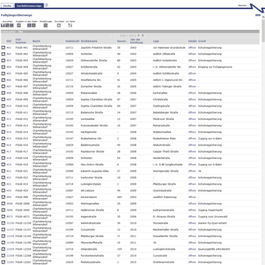
Im Rahmen des Forschungsprojekts zum erweiterten umweltsensitiven Verkehrsmanagementsystem (eUVM), Teilprojekt "Parkraumkartierung und Parkdatenanalyse" wurden Daten zum öffentlichen Straßenparkplatzangebot in Berlin und dessen Nutzung erhoben. Die Parkplatzkartierung und Attributierung erfolgte für den gesamten Berliner S-Bahn-Ring und angrenzende Bereiche. Teilweise wurden auch Gebiete außerhalb des S-Bahn-Rings kartiert.
|
|
Citation proposal
(2024) . Straßenparkplätze innerhalb des Berliner S-Bahnringes. https://gdk.gdi-de.org/geonetwork/srv/api/records/2eb40df3-912b-3710-bfcf-0a4dbe06cc30 |
INSPIRE
Identification
- File identifier
- 2eb40df3-912b-3710-bfcf-0a4dbe06cc30 XML
- Hierarchy level
- Service
Online resource
Resource identifier
Encoding
- Format
- Text/HTML
- Version
- 4.01
Projection
Classification of data and services
Classification of data and services
- Service Type
- download
- Coupling Type
- Tight
Coupled resource
Coupled resource
Classification of data and services
- Service Type
- download
- Coupling Type
- Tight
Coupled resource
Coupled resource
Keywords
Other keywords
- Keywords ( Theme )
-
- open data
- opendata
- Geodaten
- Berlin
- Parken
- Parkdaten
- Parkraumkartierung
- Parkplatz
- Parkplätze
- Parkplatzkartierung
- Parkdatenanalyse
- Straßenparkplatz
- Straßenparkplatzangebot
- Parkraumbewirtschaftung
- Parkpolygone
- Straßenparkraumkartierungsdatensatz
Geographic coverage
N
S
E
W
))
Temporal reference
Temporal extent
Temporal extent
- Date ( Creation )
- 2023-10-02
- Date ( Publication )
- 2024-03-18
- Date ( Revision )
- 2024-03-13
Quality and validity
Conformity
Conformity
Conformity
Conformity
Conformity
Conformity
Restrictions on access and use
Restrictions on access and use
- Access constraints
- Für die Nutzung der Daten ist die Datenlizenz Deutschland - Namensnennung - Version 2.0 anzuwenden. Die Lizenz ist über https://www.govdata.de/dl-de/by-2-0 abrufbar. Der Quellenvermerk gemäß (2) der Lizenz lautet "Geoportal Berlin / [Titel des Datensatzes]".
- Access constraints
- { "id": "dl-by-de/2.0" , "name": " Datenlizenz Deutschland -Namensnennung - Version 2.0 ", "url": "https://www.govdata.de/dl-de/by-2-0", "quelle": "Geoportal Berlin / [Titel des Datensatzes]" }
Responsible organization (s)
Contact for the resource
- Organisation name
- Senatsverwaltung Mobilität, Verkehr, Klimaschutz und Umwelt
- Organisation name
- Senatsverwaltung Mobilität, Verkehr, Klimaschutz und Umwelt
Responsible organization (s)
Contact for the resource
- Organisation name
- Senatsverwaltung Mobilität, Verkehr, Klimaschutz und Umwelt
- Organisation name
- Senatsverwaltung Mobilität, Verkehr, Klimaschutz und Umwelt
Metadata information
Contact for the metadata
- Organisation name
- Senatsverwaltung für Stadtentwicklung, Bauen und Wohnen Berlin
- Date stamp
- 2024-03-18T09:44:46
- Metadata language
- German
SDS
Conformance class 1: invocable
Access Point URL
Endpoint URL
Technical specification
Conformance class 2: interoperable
Coordinate reference system
Quality of Service
Access constraints
- Access constraints
- Other restrictions
Limitation
Use constraints
Limitation
- string
- Für die Nutzung der Daten ist die Datenlizenz Deutschland - Namensnennung - Version 2.0 anzuwenden. Die Lizenz ist über https://www.govdata.de/dl-de/by-2-0 abrufbar. Der Quellenvermerk gemäß (2) der Lizenz lautet "Geoportal Berlin / [Titel des Datensatzes]".
- string
- { "id": "dl-by-de/2.0" , "name": " Datenlizenz Deutschland -Namensnennung - Version 2.0 ", "url": "https://www.govdata.de/dl-de/by-2-0", "quelle": "Geoportal Berlin / [Titel des Datensatzes]" }
Responsible custodian
Contact for the resource
Conformance class 3: harmonized
Contains Operations
- Operation Name
- GetCapabilities
- Distributed Computing Platforms
- Web services
- Connect Point
- https://gdi.berlin.de/services/wfs/parkplaetze
Overviews
Vorschaugrafik
Provided by

Views
2eb40df3-912b-3710-bfcf-0a4dbe06cc30
Access to the portal
Read here the full details and access to the data.
Associated resources
Not available