 www.geodatenkatalog.de (S1L)
Helicopter-borne Electromagnetics (HEM) Area 087 Bremerhaven
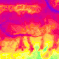
BGR conducted within the project „Pilot study for a detailled airborne geophysical mapping“ (DAGLA) an airborne survey near the city of Bremerhaven. The survey area Bremerhaven (2001) is bounded by the settlements Dorum and Neuenwalde to the north, Bederkesa and Wehdel to the east, Lunestedt and Stotel to the south, and by the river Weser and the North Sea to the west. The size of the area is about 550 km². The area was surveyed with 13 flights totalling to 2227 line-km (588,067 survey points). The nominal separation of the 107 ESE-WNW lines and 26 NNE-SSW tie lines was 250 m and 1000 m, respectively. The maps display the geophysical parameters apparent resistivity and centroid depth derived from the HEM data at the five frequencies of the HEM system (0.4 - 190 kHz). Furthermore, horizontal and vertical slices were derived from layered-earth models (resistivities and thicknesses of five model layers).
|
|
Citation proposal
(2011) . Helicopter-borne Electromagnetics (HEM) Area 087 Bremerhaven. https://gdk.gdi-de.org/geonetwork/srv/api/records/3096d12e-9683-4eba-be11-5dc1fb71cbab |
Simple
- Alternate title
- 087BremerhavenHEM
- Date ( Publication )
- 2011-09-20
- Identifier
- eeabc52c-9f0d-4127-a2e7-b7c645dbb564
- Identifier
- https://doi.org/10.25928/bgr087hem_8qvf-3a91
- Status
- completed Completed
Point of contact
- GEMET - INSPIRE themes, version 1.0 ( Theme )
-
- Geologie
- Geology
- GEMET - Concepts, version 2.4 ( Theme )
-
- Geophysik
- Keywords ( Theme )
-
- Aerogeophysik
- Hubschrauber-Elektromagnetik
- elektrische Leitfähigkeit
- spezifischer Widerstand
- Halbraumwiderstand
- Schwerpunktstiefe
- airborne geophysics
- helicopter-borne electromagnetics
- electrical conductivity
- resistivity
- apparent resistivity
- centroid depth
- Keywords ( Place )
-
- Niedersachsen
- Access constraints
- Other restrictions
- Use constraints
- Other restrictions
- Other constraints
- Allgemeine Geschäftsbedingungen, siehe https://www.bgr.bund.de/AGB - General terms and conditions, see https://www.bgr.bund.de/AGB_en. Die bereitgestellten Informationen sind bei Weiterverwendung wie folgt zu zitieren: Datenquelle: 087BremerhavenHEM, (c) BGR, Hannover, 2016, doi:10.25928/bgr087hem_8qvf-3a91
- Spatial representation type
- Grid
- Metadata language
- German
- Character set
- UTF8
- Topic category
-
- Geoscientific information
N
S
E
W
))
- Distribution format
-
- georef. TIFF (n/a )
- PDF (n/a )
- Transfer size
- 81
- OnLine resource
-
087BremerhavenHEM (georef. TIFF)
087BremerhavenHEM im Format georef. TIFF
- Transfer size
- 218
- OnLine resource
-
087BremerhavenHEM (PDF)
087BremerhavenHEM im Format Adobe Acrobat
- OnLine resource
-
BGR-Website: Projekt D-AERO
BGR-Website: Projekt D-AERO
- OnLine resource
-
BGR-Website: Projekt DAGLA
BGR-Website: Projekt DAGLA
- OnLine resource
-
Technischer Bericht Archiv-Nr. 0130162
Technischer Bericht Archiv-Nr. 0130162
- Hierarchy level
- Dataset
Conformance result
- Date ( Publication )
- 2010-12-08
- Explanation
- siehe dazu die angegebene Durchführungsbestimmung
- Statement
- Erarbeitung im Rahmen der BGR-Projekte "DAGLA" und "D-AERO"
gmd:MD_Metadata
- File identifier
- 3096d12e-9683-4eba-be11-5dc1fb71cbab XML
- Metadata language
- German
- Character set
- UTF8
- Parent identifier
- 5d3c332a-bce3-498f-840f-3cbf19359aef
- Hierarchy level
- Dataset
- Hierarchy level name
- Geophysik
- Date stamp
- 2025-10-22
- Metadata standard name
- INSPIRE Metadata Implementing Rules: Technical Guidelines based on EN ISO 19115 and EN ISO 19119
- Metadata standard version
- n/a
Point of contact
Overviews
Provided by

Views
3096d12e-9683-4eba-be11-5dc1fb71cbab
Access to the portal
Read here the full details and access to the data.
Associated resources
Not available