 www.geodatenkatalog.de (S3L)
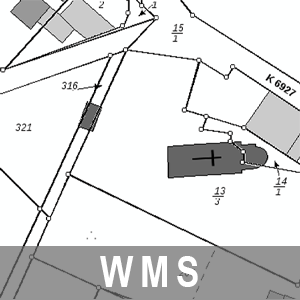
WMS ALKIS Brandenburg
Der Web Map Service für das Amtliche Liegenschaftskataster Informationssystem (ALKIS) des Landes Brandenburg beinhaltet die amtlichen Informationen des Liegenschaftskatasters. Personenbezogene Daten, wie z.B. Eigentümerinformationen und Adressdaten sind nicht Bestandteil dieses Dienstes. Dieser Dienst ist als INSPIRE View Service nach den Vorgaben der INSPIRE Netzdiensteverordnung konfiguriert.
|
|
Citation proposal
. WMS ALKIS Brandenburg. https://gdk.gdi-de.org/geonetwork/srv/api/records/31591bca-bb40-4d8a-98ad-35efc37524c9 |
INSPIRE
Identification
- File identifier
- 31591bca-bb40-4d8a-98ad-35efc37524c9 XML
- Hierarchy level
- service Service
Online resource
Resource identifier
Encoding
Projection
Classification of data and services
Classification of data and services
- Service Type
- view
- Coupling Type
- mixed Mixed
Coupled resource
Coupled resource
Classification of data and services
- Service Type
- view
- Coupling Type
- mixed Mixed
Coupled resource
Coupled resource
Keywords
- BE/BB Schlagwortliste, Version 1.0 ( Theme )
-
- Vermessung
- Gebäude
- Kataster
- Planung
- Bodenschätzung
Other keywords
- Keywords
-
- opendata
- Keywords ( Theme )
-
- AdVMIS
- Verwaltungsgebiete
- Katasterbezirke
- Tatsächliche Nutzung
- LGB
- Lagebezeichnung
- ALKIS
- WMS
- Geobasisdaten
- Amtliches Liegenschaftskatasterinformationssystem
- AdV
- AAA
- Flurstücke
- Liegenschaftskataster
- GDI
- infoMapAccessService
- WMS_BB_ALKIS
- Keywords ( Place )
-
- Brandenburg
- BB
Geographic coverage
N
S
E
W
))
Temporal reference
Temporal extent
Temporal extent
- Date ( Creation )
- 2013-03-15T00:00:00
Quality and validity
Conformity
Conformity
Conformity
Conformity
Conformity
Conformity
Restrictions on access and use
Restrictions on access and use
- Access constraints
- Die Daten können gemäß der „Datenlizenz Deutschland - Namensnennung - Version 2.0“ (https://www.govdata.de/dl-de/by-2-0) genutzt werden. Namensnennung: "GeoBasis-DE/LGB", Beispiel: „© GeoBasis-DE/LGB, dl-de/by-2-0, (Daten geändert)“, (Klammer = optional)
- Access constraints
- {"id":"dl-by-de/2.0","name":"Datenlizenz Deutschland - Namensnennung - Version 2.0","url":"https://www.govdata.de/dl-de/by-2-0","quelle":"Quelle: © GeoBasis-DE/LGB, dl-de/by-2-0"}
Responsible organization (s)
Contact for the resource
- Organisation name
- Landesvermessung und Geobasisinformation Brandenburg (LGB)
Responsible organization (s)
Contact for the resource
- Organisation name
- Landesvermessung und Geobasisinformation Brandenburg (LGB)
Metadata information
Contact for the metadata
- Organisation name
- Landesvermessung und Geobasisinformation Brandenburg (LGB)
- Date stamp
- 2025-04-04T09:37:36
- Metadata language
- ger German
SDS
Conformance class 1: invocable
Access Point URL
Endpoint URL
Technical specification
Conformance class 2: interoperable
Coordinate reference system
Quality of Service
Access constraints
- Access constraints
- Other restrictions
Limitation
Use constraints
Limitation
- string
- Die Daten können gemäß der „Datenlizenz Deutschland - Namensnennung - Version 2.0“ (https://www.govdata.de/dl-de/by-2-0) genutzt werden. Namensnennung: "GeoBasis-DE/LGB", Beispiel: „© GeoBasis-DE/LGB, dl-de/by-2-0, (Daten geändert)“, (Klammer = optional)
- string
- {"id":"dl-by-de/2.0","name":"Datenlizenz Deutschland - Namensnennung - Version 2.0","url":"https://www.govdata.de/dl-de/by-2-0","quelle":"Quelle: © GeoBasis-DE/LGB, dl-de/by-2-0"}
Responsible custodian
Contact for the resource
Conformance class 3: harmonized
Contains Operations
- Operation Name
- GetCapabilities
- Distributed Computing Platforms
- Web services
- Connect Point
- https://isk.geobasis-bb.de/ows/alkis_wms?
Overviews
Provided by

Views
31591bca-bb40-4d8a-98ad-35efc37524c9
Access to the portal
Read here the full details and access to the data.
Associated resources
Not available