 www.geodatenkatalog.de (S3L)
Energie-Atlas Bayern: Potential Geothermie - WMS
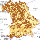
Die Karten geben einen ersten Überblick über die Nutzungsmöglichkeiten der oberflächennahen Geothermie mittels Grundwasserwärmepumpen, Erdwärmesonden oder Erdwärmekollektoren.
|
|
Citation proposal
. Energie-Atlas Bayern: Potential Geothermie - WMS. https://gdk.gdi-de.org/geonetwork/srv/api/records/31656fe2-e67f-4b17-892c-e85c09176b5f |
- Identification
- Distribution
- Quality
- Spatial rep.
- Ref. system
- Content
- Portrayal
- Metadata
- Md. constraints
- Md. maintenance
- Schema info
Identification
Identification info
Service Identification (19119)
Citation
- Alternate title
- Energie
- Date ( Creation )
- 2024-03-13T00:00:00.000+01:00
- Status
- On going
Point of contact
- Website
- https://www.lfu.bayern.de
Maintenance information
- Maintenance and update frequency
- As needed
- Update scope
- Service
- Service Classification, version 1.0 ( Theme )
-
- infoMapAccessService
- Keywords
-
- Energie
- Energie-Atlas Bayern
- Geothermiepotential
- Entzugsleistung
- Entzugsenergie
- CC-BY
- gdiby
- Use limitation
- keine Einschränkungen
Legal constraints
- Use constraints
- Other restrictions
- Other constraints
- Creative Commons Namensnennung 4.0 International (CC BY 4.0); Datenquelle: Bayerisches Landesamt für Umwelt, www.lfu.bayern.de
- Other constraints
- {"id":"cc-by/4.0","name":"Creative Commons Namensnennung 4.0 International (CC BY 4.0)","url":"https://creativecommons.org/licenses/by/4.0/deed.de","quelle":"Bayerisches Landesamt für Umwelt, www.lfu.bayern.de"}
Legal constraints
- Access constraints
- otherRestrictions Other restrictions
- Service Type
- view
- Service Version
- OGC:WMS 1.3.0
Extent
- Description
- Der Dienst ist begrenzt auf die Landesfläche Bayerns.
N
S
E
W
))
Coupled Resource
- Operation Name
- GetCapabilities
Coupled Resource
- Operation Name
- GetMap
Coupled Resource
- Operation Name
- GetFeatureInfo
Coupled Resource
- Operation Name
- esri_wms:GetStyles
Coupled Resource
- Operation Name
- GetCapabilities
Coupled Resource
- Operation Name
- GetMap
Coupled Resource
- Operation Name
- GetFeatureInfo
Coupled Resource
- Operation Name
- esri_wms:GetStyles
Coupled Resource
- Operation Name
- GetCapabilities
Coupled Resource
- Operation Name
- GetMap
Coupled Resource
- Operation Name
- GetFeatureInfo
Coupled Resource
- Operation Name
- esri_wms:GetStyles
Coupled Resource
- Operation Name
- GetCapabilities
Coupled Resource
- Operation Name
- GetMap
Coupled Resource
- Operation Name
- GetFeatureInfo
Coupled Resource
- Operation Name
- esri_wms:GetStyles
Coupled Resource
- Operation Name
- GetCapabilities
Coupled Resource
- Operation Name
- GetMap
Coupled Resource
- Operation Name
- GetFeatureInfo
Coupled Resource
- Operation Name
- esri_wms:GetStyles
Coupled Resource
- Operation Name
- GetCapabilities
Coupled Resource
- Operation Name
- GetMap
Coupled Resource
- Operation Name
- GetFeatureInfo
Coupled Resource
- Operation Name
- esri_wms:GetStyles
Coupled Resource
- Operation Name
- GetCapabilities
Coupled Resource
- Operation Name
- GetMap
Coupled Resource
- Operation Name
- GetFeatureInfo
Coupled Resource
- Operation Name
- esri_wms:GetStyles
Coupled Resource
- Operation Name
- GetCapabilities
Coupled Resource
- Operation Name
- GetMap
Coupled Resource
- Operation Name
- GetFeatureInfo
Coupled Resource
- Operation Name
- esri_wms:GetStyles
- Coupling Type
- Tight
Contains Operations
- Operation Name
- GetCapabilities
- Distributed Computing Platforms
- Web services
- Operation Description
- application/vnd.ogc.wms_xml; text/xml;
Contains Operations
- Operation Name
- GetMap
- Distributed Computing Platforms
- Web services
- Operation Description
- image/bmp; image/jpeg; image/tiff; image/png; image/png8; image/png24; image/png32; image/gif; image/svg+xml;
Contains Operations
- Operation Name
- GetFeatureInfo
- Distributed Computing Platforms
- Web services
- Operation Description
- application/vnd.esri.wms_raw_xml; application/vnd.esri.wms_featureinfo_xml; application/vnd.ogc.wms_xml; application/geojson; text/xml; text/html; text/plain;
Contains Operations
- Operation Name
- esri_wms:GetStyles
- Distributed Computing Platforms
- Web services
- Operation Description
- application/vnd.ogc.sld+xml;
- Operates On
-
- Entzugsleistung/-energie bei 10 m Brunnenabstand (GWWP)
- Entzugsleistung von Grabenkollektoren (GK)
- Entzugsleistung von horizontalen Kollektoren (EWK)
- Entzugsleistung/-energie bei 100 m Brunnenabstand (GWWP)
- Entzugsenergie von horizontalen Kollektoren (EWK)
- Datengüte Potenzial Grundwasserwärmepumpen
- Entzugsleistung/-energie pro Sonde (EWS)
- Entzugsenergie von Grabenkollektoren (GK)
Distribution
Distribution
- Distribution format
-
- Sonstiges ()
Distributor
Distributor
- Website
- https://www.lfu.bayern.de
- Fees
- geldleistungsfrei
- OnLine resource
-
URL des Dienstes
URL des Dienstes
- OnLine resource
-
Dienst "Energie-Atlas Bayern: Potential Geothermie - WMS" (GetCapabilities)
application/vnd.ogc.wms_xml; text/xml;
Metadata
Metadata
- File identifier
- 31656fe2-e67f-4b17-892c-e85c09176b5f XML
- Metadata language
- German
- Character set
- UTF8
- Hierarchy level
- service Service
- Hierarchy level name
- service
- Date stamp
- 2025-08-13
- Metadata standard name
- ISO19119
- Metadata standard version
- 2005/PDAM 1
Point of contact
- Website
- https://www.lfu.bayern.de
Overviews
Provided by

Views
31656fe2-e67f-4b17-892c-e85c09176b5f
Access to the portal
Read here the full details and access to the data.
Associated resources
Not available