 www.geodatenkatalog.de (S3L)
INSPIRE-WMS SL Geografische Bezeichnungen ATKIS - INSPIRE SL Geografische Bezeichnungen ATKIS Basis-DLM
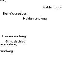
Dieser Dienst stellt für das INSPIRE-Thema Geografische Bezeichnungen aus ATKIS Basis-DLM umgesetzte Daten bereit.:Diese Layerzusammenstellung visualisiert die saarländischen Geografischen Bezeichner abgeleitet aus dem ATKIS Basis-DLM. Die Datengrundlage erfüllt die INSPIRE Datenspezifikation.
|
|
Citation proposal
. INSPIRE-WMS SL Geografische Bezeichnungen ATKIS - INSPIRE SL Geografische Bezeichnungen ATKIS Basis-DLM. LVGL https://gdk.gdi-de.org/geonetwork/srv/api/records/369151b1-fad6-b53b-90a1-dc63a7ce309a |
INSPIRE
Identification
- File identifier
- 369151b1-fad6-b53b-90a1-dc63a7ce309a XML
- Hierarchy level
- service Service
Online resource
- Protocol
- OGC:WMS-1.1.1-http-get-map
Resource identifier
Encoding
Projection
Classification of data and services
Classification of data and services
- Service Type
- view
- Coupling Type
- Loose
Coupled resource
Coupled resource
Classification of data and services
- Service Type
- view
- Coupling Type
- Loose
Coupled resource
Coupled resource
Keywords
Other keywords
- Keywords
-
- ATKIS
- WMS
- Geographical Names
- Saarland
- Geobasisdaten
- infoMapAccessService
- Geografische Bezeichnungen
- Basis-DLM
- Adv
- SL
- INSPIRE-WMS_SL_Geografische_Bezeichnungen_ATKIS_Basis-DLM
- Amtliches Topographisch-Kartographisches Informationssystem
- Digitales Basis-Landschaftsmodell
- AdV-OWS-Basisprofil
- AdV-WMS-Profil 5.0.0
- AdV-INSPIRE-Produktspezifikation (Version 2.0)
- opendata
- infoMapAccessService
- basisdaten
Geographic coverage
N
S
E
W
))
Temporal reference
Temporal extent
Temporal extent
- Date ( Revision )
- 2025-11-19
Quality and validity
Conformity
Conformity
Conformity
Conformity
Conformity
Conformity
- Explanation
- No explanation available
- Explanation
- No explanation available
- Explanation
- No explanation available
- Explanation
- No explanation available
- Explanation
- No explanation available
- Explanation
- No explanation available
- Explanation
- No explanation available
- Explanation
- No explanation available
Restrictions on access and use
Restrictions on access and use
- Access constraints
- Lizenz: dl-de-by-2.0 - Datenlizenz Deutschland Namensnennung 2.0 - https://www.govdata.de/dl-de/by-2-0 - Quellenvermerk: © GeoBasis DE/LVGL-SL (Jahr)
- Access constraints
- {"id":"dl-de-by-2.0","name":"Datenlizenz Deutschland Namensnennung 2.0","url":"https://www.govdata.de/dl-de/by-2-0","quelle":"© GeoBasis DE/LVGL-SL (Jahr)"}
Responsible organization (s)
Contact for the resource
- Organisation name
- LVGL
Responsible organization (s)
Contact for the resource
- Organisation name
- LVGL
Metadata information
Contact for the metadata
- Organisation name
- GDI-Saarland
- gdi-sl@lvgl.saarland.de
- Date stamp
- 2025-11-19
- Metadata language
- ger German
SDS
Conformance class 1: invocable
- Pass
- true
- Pass
- true
- Pass
- true
- Pass
- true
- Pass
- true
- Pass
- true
- Pass
- true
- Pass
- true
Access Point URL
Endpoint URL
Technical specification
- Date
- Explanation
- No explanation available
- Date
- Explanation
- No explanation available
- Date
- Explanation
- No explanation available
- Date
- Explanation
- No explanation available
- Date
- Explanation
- No explanation available
- Date
- Explanation
- No explanation available
- Date
- Explanation
- No explanation available
- Date
- Explanation
- No explanation available
Conformance class 2: interoperable
Coordinate reference system
Quality of Service
Access constraints
- Access constraints
- Other restrictions
Limitation
Use constraints
Limitation
- string
- Lizenz: dl-de-by-2.0 - Datenlizenz Deutschland Namensnennung 2.0 - https://www.govdata.de/dl-de/by-2-0 - Quellenvermerk: © GeoBasis DE/LVGL-SL (Jahr)
- string
- {"id":"dl-de-by-2.0","name":"Datenlizenz Deutschland Namensnennung 2.0","url":"https://www.govdata.de/dl-de/by-2-0","quelle":"© GeoBasis DE/LVGL-SL (Jahr)"}
Responsible custodian
Contact for the resource
Conformance class 3: harmonized
Contains Operations
- Operation Name
- GetCapabilities
- Distributed Computing Platforms
- Web services
Overviews
Thumbnail
Provided by

Views
369151b1-fad6-b53b-90a1-dc63a7ce309a
Access to the portal
Read here the full details and access to the data.
Associated resources
Not available