 www.geodatenkatalog.de (S3L)
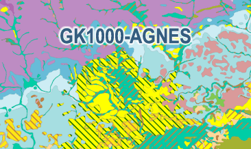
Geological Map of Germany 1:1,000,000 – AGNES (GK1000-AGNES)
This new version of the Geological Map of the Federal Republic of Germany 1:1,000,000 (GK1000-AGNES) was compiled as part of the BGR project ‘AGNES’ (Automated generalisation / Derivation of geological spatial data). With the help of the modified FME-based AutoGen workflow - developed at the State Office for Geology, Raw Materials and Mining in Baden-Württemberg (LGRB) - new GK1000 surface data were derived semi-automatically from the current GÜK250 areal data. The GK1000-AGNES comprises the three layers lithostratigraphy, petrography and geogenesis including the respective legend. It should be noted that the current GÜK250 does not primarily consist of the latest information or areal spatial data from the State Geological Surveys (SGD). In addition, the tectonic line elements of the current GÜK250 do not have sufficient attribution for semi-automatic generalisation. In other words, there is no differentiation between main fault and secondary fault. Accordingly, a generalisation / derivation of the tectonic line elements was not performed. For the sake of completeness, the tectonic line elements and also the ice margins of the previous GK1000 were therefore integrated into the GK1000-AGNES. The inclusion of the current tectonic line elements, the current surface data and the current ice margins from the SGD is to be carried out as part of a further project.
|
|
Citation proposal
(2024) . Geological Map of Germany 1:1,000,000 – AGNES (GK1000-AGNES). https://gdk.gdi-de.org/geonetwork/srv/api/records/375b4de1-e905-4aac-9517-4eaf4c5e4188 |
INSPIRE
Identification
- File identifier
- 375b4de1-e905-4aac-9517-4eaf4c5e4188 XML
- Hierarchy level
- dataset Dataset
Online resource
Resource identifier
- Metadata language
- ger German
- Spatial representation type
- Vector
Encoding
- Format
- WMS
- Version
- 1.3.0
Projection
Classification of data and services
- Topic category
-
- Geoscientific information
Classification of data and services
Coupled resource
Coupled resource
Classification of data and services
Coupled resource
Coupled resource
Keywords
- GEMET - INSPIRE themes, version 1.0 ( Theme )
-
- Geologie
- Geology
Other keywords
- Keywords ( Theme )
-
- Geogenese
- Lithostratigraphie
- Oberflächengeologie
- Petrographie
- Stratigraphie
- opendata
- GeolDG
- Keywords ( Place )
-
- Deutschland
Geographic coverage
N
S
E
W
))
Temporal reference
Temporal extent
Temporal extent
- Date ( Publication )
- 2024-07-29
Quality and validity
- Lineage
- Diese Version der Geologischen Karte der Bundesrepublik Deutschland 1:1.000.000 (GK1000-AGNES) wurde im Rahmen des BGR-Projektes „AGNES“ (Automatisierte Generalisierung / Ableitung von geologischen Flächen- und Raumdaten) erstellt.
- Denominator
- 1000000
Conformity
Conformity
Conformity
Conformity
Conformity
Conformity
- Explanation
- siehe dazu die angegebene Durchführungsbestimmung
Restrictions on access and use
- Access constraints
- Dieser Datensatz kann gemäß der "Nutzungsbestimmungen für die Bereitstellung von Geodaten des Bundes" (https://sg.geodatenzentrum.de/web_public/gdz/lizenz/geonutzv.pdf) genutzt werden.
- Access constraints
- {"id": "geoNutz/20130319", "name": "Nutzungsbestimmungen für die Bereitstellung von Geodaten des Bundes", "url": "https://sg.geodatenzentrum.de/web_public/gdz/lizenz/geonutzv.pdf", "quelle": "Bundesanstalt für Geowissenschaften und Rohstoffe (BGR)"}
Restrictions on access and use
Responsible organization (s)
Contact for the resource
- Organisation name
- Bundesanstalt für Geowissenschaften und Rohstoffe (BGR)
- geologie.daten@bgr.de
Responsible organization (s)
Contact for the resource
- Organisation name
- Bundesanstalt für Geowissenschaften und Rohstoffe (BGR)
- geologie.daten@bgr.de
Metadata information
Contact for the metadata
- Organisation name
- Bundesanstalt für Geowissenschaften und Rohstoffe (BGR)
- Date stamp
- 2024-10-08
- Metadata language
- German
- Character set
- utf8 UTF8
SDS
Conformance class 1: invocable
Access Point URL
Endpoint URL
Technical specification
Conformance class 2: interoperable
Coordinate reference system
Quality of Service
Access constraints
Limitation
Use constraints
Limitation
Responsible custodian
Contact for the resource
Conformance class 3: harmonized
Overviews
Provided by

Views
375b4de1-e905-4aac-9517-4eaf4c5e4188
Access to the portal
Read here the full details and access to the data.
Associated resources
Not available