 www.geodatenkatalog.de (S3F)
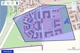
Downloadclient Gebietsauswahl für Topographische Karte 1:25 000 (TK25)
Der Download-Client bietet dem Nutzer die Möglichkeit, eigenständig den Auschhnitt für die Herstellung einer Topographischen Karte im Maßstab 1:25 000 festzulegen und zusammen mit seinen Kontaktdaten und dem Bestellwunsch an den Verkauf des GeoSN weiterzuleiten.
|
|
Citation proposal
. Downloadclient Gebietsauswahl für Topographische Karte 1:25 000 (TK25). https://gdk.gdi-de.org/geonetwork/srv/api/records/3a2f3afe-821e-47e4-a219-27906125ff7d |
INSPIRE
Identification
- File identifier
- 3a2f3afe-821e-47e4-a219-27906125ff7d XML
- Hierarchy level
- application
Online resource
Resource identifier
- Metadata language
- German
Encoding
- Format
- inapplicable
- Version
- inapplicable
Projection
Classification of data and services
- Topic category
-
- Geoscientific information
- Imagery base maps earth cover
- Planning cadastre
Classification of data and services
Coupled resource
Coupled resource
Classification of data and services
Coupled resource
Coupled resource
Keywords
- GEMET - INSPIRE themes, version 1.0
-
- Information
- Geographisch kodierte Information
- Planung
Other keywords
- Keywords
-
- Gebiet
- Gebiete
- Gebietsauswahl
- Datenabgabe
- Datenbereitstellung
- TK
- TK25
- Topographische Karte
- Digitale topographische Karte
- Verkauf
- DTK
Geographic coverage
N
S
E
W
))
Temporal reference
Temporal extent
Temporal extent
- Date ( Creation )
- 2019-04-01
Quality and validity
- Lineage
- nicht zutreffend - inapplicable
Conformity
Conformity
Conformity
Conformity
Conformity
Conformity
Restrictions on access and use
- Access constraints
- Es gelten keine Zugriffsbeschränkungen
- Access constraints
- keine Bedingungen
- Access constraints
- keine Bedingungen
Restrictions on access and use
Responsible organization (s)
Contact for the resource
- Organisation name
- Landesamt für Geobasisinformation Sachsen (GeoSN)
Responsible organization (s)
Contact for the resource
- Organisation name
- Landesamt für Geobasisinformation Sachsen (GeoSN)
Metadata information
Contact for the metadata
- Organisation name
- Landesamt für Geobasisinformation Sachsen (GeoSN)
- Date stamp
- 2023-01-03
- Metadata language
- German
- Character set
- UTF8
SDS
Conformance class 1: invocable
Access Point URL
Endpoint URL
Technical specification
Conformance class 2: interoperable
Coordinate reference system
Quality of Service
Access constraints
Limitation
Use constraints
Limitation
Responsible custodian
Contact for the resource
Conformance class 3: harmonized
Overviews
Provided by

Views
3a2f3afe-821e-47e4-a219-27906125ff7d
Access to the portal
Read here the full details and access to the data.
Associated resources
Not available