 www.geodatenkatalog.de (S2L)
ATOMFeed Saale-Orla-Kreis
Downloaddienst für Geodaten des Saale-Orla-Kreises.
|
|
Citation proposal
. ATOMFeed Saale-Orla-Kreis. https://gdk.gdi-de.org/geonetwork/srv/api/records/3abf1718-c943-4224-9bf5-b6aaabc79c0b |
INSPIRE
Identification
- File identifier
- 3abf1718-c943-4224-9bf5-b6aaabc79c0b XML
- Hierarchy level
- Service
Online resource
- Protocol
- WWW:LINK-1.0-http--rss
- Protocol
- OGC:WMS-http-get-map
Resource identifier
Encoding
- Format
- shp
- Version
- QGIS
Projection
Classification of data and services
Classification of data and services
- Service Type
- download
- Coupling Type
- Tight
Coupled resource
Coupled resource
Classification of data and services
- Service Type
- download
- Coupling Type
- Tight
Coupled resource
Coupled resource
Keywords
- GEMET - INSPIRE themes, version 1.0 ( Theme )
-
- Versorgungswirtschaft und staatliche Dienste
- VERORDNUNG (EG) Nr. 1205/2008 DER KOMMISSION zur Durchführung der Richtlinie 2007/2/EG des Europäischen Parlaments und des Rates hinsichtlich Metadaten
-
- Download-Dienste
- infoFeatureAccessService
Other keywords
- Keywords
-
- Schulstandorte
- Schule
- Grundschulen
- Regelschulen
- Gymnasien
- utilitiesCommunication
- Ver- und Entsorgung/Nachrichtenwesen
- Bildung
- Förderschulen
- opendata
- GOVE
- REGI
- SOCI
- EDUC
- Thüringen
- SOK
Geographic coverage
N
S
E
W
))
Temporal reference
Temporal extent
Temporal extent
- Date ( Revision )
- 2020-06-25
Quality and validity
Conformity
Conformity
Conformity
Conformity
Conformity
Conformity
- Explanation
- mit GDI-DE Testsuite validiert
- Explanation
- mit GDI-DE Testsuite validiert
- Explanation
- mit GDI-DE Testsuite validiert
Restrictions on access and use
Restrictions on access and use
- Access constraints
- Nutzungsbedingungen: Datenlizenz Deutschland-Namensnennung 2.0 in JSON Syntax
- Access constraints
- {"id": "dl-by-de/2.0", "name": "Datenlizenz Deutschland Namensnennung 2.0", "url": "https://www.govdata.de/dl-de/by-2-0 ", "quelle": "© GDI-Th"}
Responsible organization (s)
Contact for the resource
- Organisation name
- Landratsamt Saale-Orla-Kreis
- gis@lrasok.thueringen.de
Responsible organization (s)
Contact for the resource
- Organisation name
- Landratsamt Saale-Orla-Kreis
- gis@lrasok.thueringen.de
Metadata information
Contact for the metadata
- Organisation name
- Landratsamt Saale-Orla-Kreis
- gis@lrasok.thueringen.de
- Date stamp
- 2023-11-03T10:59:32
- Metadata language
- German
SDS
Conformance class 1: invocable
- Pass
- true
- Pass
- true
- Pass
- true
Access Point URL
Endpoint URL
Technical specification
- Date
- Explanation
- mit GDI-DE Testsuite validiert
- Date
- Explanation
- mit GDI-DE Testsuite validiert
- Date
- Explanation
- mit GDI-DE Testsuite validiert
Conformance class 2: interoperable
Coordinate reference system
Quality of Service
Access constraints
- Access constraints
- Other restrictions
Limitation
- string
- Nutzungsbedingungen: Datenlizenz Deutschland-Namensnennung 2.0 in JSON Syntax
- string
- {"id": "dl-by-de/2.0", "name": "Datenlizenz Deutschland Namensnennung 2.0", "url": "https://www.govdata.de/dl-de/by-2-0 ", "quelle": "© GDI-Th"}
Use constraints
Limitation
- string
- Nutzungsbedingungen: Datenlizenz Deutschland-Namensnennung 2.0 in JSON Syntax
- string
- {"id": "dl-by-de/2.0", "name": "Datenlizenz Deutschland Namensnennung 2.0", "url": "https://www.govdata.de/dl-de/by-2-0 ", "quelle": "© GDI-Th"}
Responsible custodian
Contact for the resource
Conformance class 3: harmonized
Contains Operations
- Operation Name
- GetCapabilities
- Distributed Computing Platforms
- XML
- Connect Point
-
Downloaddienst für Geodaten des Saale-Orla-Kreis
Downloaddienst für Geodaten des Saale-Orla-Kreis
Overviews
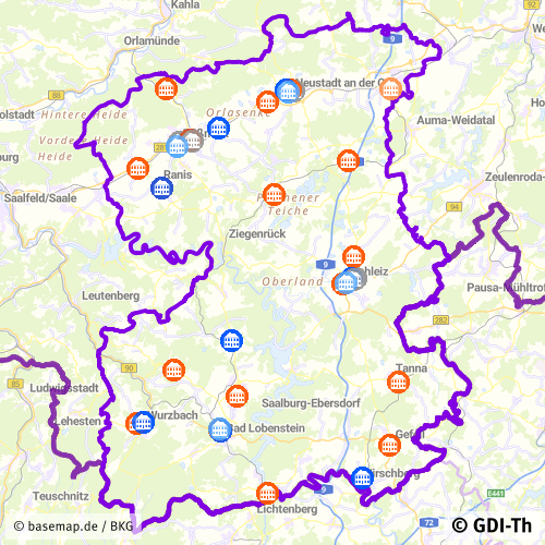
Vorschaubild
Provided by

Views
3abf1718-c943-4224-9bf5-b6aaabc79c0b
Access to the portal
Read here the full details and access to the data.
Associated resources
Not available