 www.geodatenkatalog.de (S2F)
Stadt Dortmund: WMS - Stadtbezirke
|
|
Citation proposal
. Stadt Dortmund: WMS - Stadtbezirke. https://gdk.gdi-de.org/geonetwork/srv/api/records/3af599dca14410e69ee27445d100c76369001414 |
INSPIRE
Identification
- File identifier
- 3af599dca14410e69ee27445d100c76369001414 XML
- Hierarchy level
- Service
Online resource
- Protocol
- OGC:WMS-http-get-map
Resource identifier
Encoding
- Format
- WMS
- Version
- 1.3.0
Projection
Classification of data and services
Classification of data and services
- Service Type
- OGC:WMS
- Coupling Type
- Tight
Coupled resource
Coupled resource
Classification of data and services
- Service Type
- OGC:WMS
- Coupling Type
- Tight
Coupled resource
Coupled resource
Keywords
Other keywords
- Keywords ( Theme )
-
- infoMapAccessService
- Keywords ( Theme )
-
- Stadt Dortmund
- Vermessungs- und Katasteramt
- Abteilung Geoinformation
- Geodatenmanagement
- Grenzen
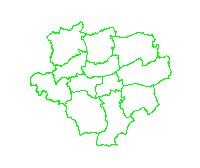
Geographic coverage
))
Temporal reference
Temporal extent
Temporal extent
- Date ( Revision )
- 2018-11-09T09:48:53
Quality and validity
- Lineage
- Eigene Erfassung
Conformity
Conformity
Conformity
Conformity
Conformity
Conformity
Restrictions on access and use
Restrictions on access and use
- Access constraints
- Datenlizenz Deutschland -Namensnennung - Version 2.0
Responsible organization (s)
Contact for the resource
- Organisation name
- Stadt Dortmund
- geodaten@dortmund.de
Responsible organization (s)
Contact for the resource
- Organisation name
- Stadt Dortmund
- geodaten@dortmund.de
Metadata information
Contact for the metadata
- Organisation name
- Stadt Dortmund
- geodaten@dortmund.de
- Date stamp
- 2018-11-09T10:35:24
- Metadata language
- German
SDS
Conformance class 1: invocable
Access Point URL
Endpoint URL
Technical specification
Conformance class 2: interoperable
Coordinate reference system
Quality of Service
Access constraints
Limitation
- string
- Datenlizenz Deutschland -Namensnennung - Version 2.0
Use constraints
Limitation
Responsible custodian
Contact for the resource
Conformance class 3: harmonized
Contains Operations
- Operation Name
- GetCapabilities
- Distributed Computing Platforms
- HTTP-GET
- Connect Point
-
Format : text/xml
Format :
text/xml
Contains Operations
- Operation Name
- GetMap
- Distributed Computing Platforms
- HTTP-GET
- Connect Point
-
Format : image/jpeg
Format :
image/jpeg
- Connect Point
-
Format : image/png
Format :
image/png
- Connect Point
-
Format : image/png; mode=16bit
Format :
image/png; mode=16bit
- Connect Point
-
Format : image/png; mode=8bit
Format :
image/png; mode=8bit
- Connect Point
-
Format : image/png; mode=1bit
Format :
image/png; mode=1bit
- Connect Point
-
Format : application/dxf
Format :
application/dxf
Contains Operations
- Operation Name
- GetFeatureInfo
- Distributed Computing Platforms
- HTTP-GET
- Connect Point
-
Format : text/plain
Format :
text/plain
- Connect Point
-
Format : text/html
Format :
text/html
- Connect Point
-
Format : text/xml
Format :
text/xml
- Connect Point
-
Format : application/vnd.ogc.gml
Format :
application/vnd.ogc.gml
- Connect Point
-
Format : application/vnd.ogc.gml/3.1.1
Format :
application/vnd.ogc.gml/3.1.1
Contains Operations
- Operation Name
- sld:GetLegendGraphic
- Distributed Computing Platforms
- HTTP-GET
- Connect Point
-
Format : image/jpeg
Format :
image/jpeg
- Connect Point
-
Format : image/png
Format :
image/png
Contains Operations
- Operation Name
- sld:DescribeLayer
- Distributed Computing Platforms
- HTTP-GET
- Connect Point
-
Format : text/xml
Format :
text/xml
Contains Operations
- Operation Name
- qgs:GetStyles
- Distributed Computing Platforms
- HTTP-GET
- Connect Point
-
Format : text/xml
Format :
text/xml
Overviews
Provided by
